
Settlements Resoutle Surface elevation 222 m Number of islands 1 | Length 8,047 m Inflow source Gee Creek Cities Restoule | |
 | ||
Primary inflows Max. depth varies in seasons from 48–53 ft (15–16 m) | ||
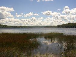
Commanda Lake (or Lake Commanda) is a lake in central Ontario, Canada. Located on the border between Patterson Township and Pringle Township, in the Almaguin Highlands region of the District of Parry Sound, it is fed by Gee Creek, Commanda Creek and Beaudry Creek and is drained by the Restoule River. The Lake is shaped like the number "3", its middle spur is called Deep Bay. The lake is home to one permanent island, located off a point in its east. This is a mud bottom lake and its water is "tea coloured." On the north shore of the lake is the community of Restoule, but cottages line many of the shore lines. Lots of crown land also surrounds the lake shore making it a very peaceful lake for people of all ages to enjoy. This lake has one public boat launch towards the southern end of the lake accessible on Commanda Lake Road. The lake is located at an altitude of 222 m (729 ft) above sea level. The lake is home to the Northern pike, Walleye, Smallmouth bass and Largemouth bass species of fish. Ice gets thick in the winter making this lake an all year round fishing lake.