
 | ||
Similar | ||
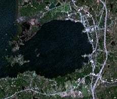
A left to right look at callander bay lake nippissing
Callander Bay is a bay at the extreme east of Lake Nipissing in Parry Sound District, Ontario, Canada. It is 3 kilometres (1.9 mi) in diameter and the main community of Callander is located on its east side.
Contents
- A left to right look at callander bay lake nippissing
- Map of Callander Bay Callander ON Canada
- Snowmobiling in callander bay ontario
- GeologyEdit
- References
Map of Callander Bay, Callander, ON, Canada
Snowmobiling in callander bay ontario
GeologyEdit
Callander Bay is an eroded Proterozoic volcanic pipe formed by the violent, supersonic eruption of a deep-origin volcano. These volcanoes originate at least three times as deep as most other volcanoes, and the resulting magma that is pushed toward the surface is high in magnesium and volatile compounds such as water and carbon dioxide. As the body of magma rises toward the surface, the volatile compounds transform to gaseous phase as pressure is reduced with decreasing depth. This sudden expansion propels the magma upward at rapid speeds, resulting in a shallow supersonic eruption.
Callander Bay contains uncommon rocks such as nepheline syenite and carbonatite and the minerals: aegirine, amphibole, analcime, apatite, barite, biotite, calcite, cancrinite, chalcopyrite, chlorite, diopside, dolomite, fluorite, garnet, hematite, kaersutite, magnetite, muscovite, nepheline, olivine, perthite, pyrite, pyroxene and pyrrhotite.