
Country Canada Time zone Eastern (EST) (UTC-5) Local time Saturday 7:43 AM | Created 1912 (1912) Postal code FSA P0J, P0K, P2N Population 32,634 (2011) | |
 | ||
Weather -7°C, Wind W at 6 km/h, 82% Humidity Points of interest Museum of Northern History, Little Claybelt Homesteaders, Cobalt Mining Museum, Haileybury Heritage Museum, Bunker Military Museum | ||
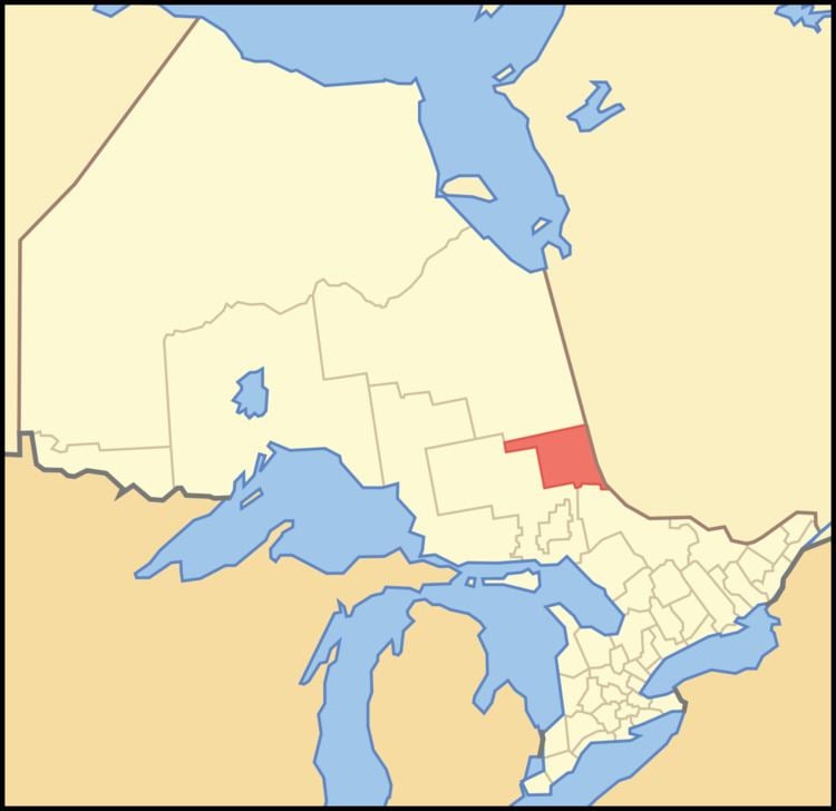
Timiskaming is a district and census division in Northeastern Ontario in the Canadian province of Ontario. The district was created in 1912 from parts of Algoma, Nipissing, and Sudbury districts. In 1921, Cochrane District was created from parts of this district and parts of Thunder Bay District.
Contents
- Map of Timiskaming District ON Canada
- History
- City
- Towns
- Townships
- Village
- First Nations reserve
- Unorganized areas
- Politics
- References
Map of Timiskaming District, ON, Canada
The division had a population of 32,634 in the Canada 2011 Census. The land area is 13,299.92 square kilometres (5,135.13 sq mi); the population density was 2.5 per square kilometre (6.5/sq mi).
History
The Coureur de bois explored and traded fur in what is now the Timiskaming District, in the 17th century.
City
Towns
Townships
Village
First Nations reserve
Unorganized areas
The following local services boards serve inhabitants of these unincorporated areas:
Politics
The district seat is in Temiskaming Shores.
Along with portions of the neighbouring district, Cochrane, Timiskaming is represented in the Legislative Assembly of Ontario by John Vanthof. In the House of Commons of Canada, the district is divided between Nipissing—Timiskaming, represented by Anthony Rota, in the south, and Timmins—James Bay, represented by Charlie Angus, in the north. A very small portion of the district also belongs to the riding of Nickel Belt.