Samiksha Jaiswal (Editor)

Route nationale 7 (Madagascar)

Updated on
Edit
Like
Comment
Share on FacebookTweet on TwitterShare on LinkedInShare on Reddit
Length
  
980 km

Major cities
  
Antananarivo, Toliara

Route nationale 7 (Madagascar)

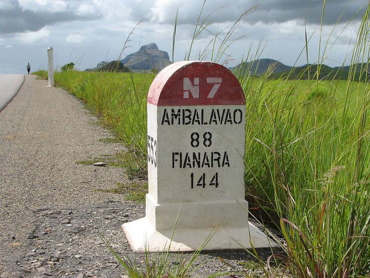
Route nationale 7 (RN7) is a primary highway in Madagascar of 980km, running from the capital Antananarivo to Tulear at the south-west coast of the country. It crosses the regions of Analamanga, Vakinankaratra, Amoron'i Mania, Haute Matsiatra, Ihorombe, and Atsimo-Andrefana.

Contents

Map of 7, Sakaraha, Madagascar

This is one of the most important roads of the country and relatively well maintained.

Selected locations on route

(north to south)

  • Antananarivo
  • Ambatolampy
  • Antsirabe - (junction with RN34 to Miandrivazo and Malaimbandy)
  • Ambositra - (junction with RN35 to Malaimbandy and Morondava)
  • Ambohimahasoa - (junction with RN25 to Mananjary)
  • Fianarantsoa - (Ranomafana National Park)
  • Ambalavao - (Andringitra National Park)
  • Zazafotsy
  • Ihosy - (junction with RN27 to Farafangana)
  • Ihosy - (junction with RN13 to Betroka and Tolanaro (Fort-Dauphin)
  • Caves of Andranomilitry - (10 km from Ihosy)
  • Ranohira - (Isalo National Park)
  • Ilakaka
  • Sakaraha - (Zombitse-Vohibasia National Park)
  • Andranovory - (junction with RN10 to Ampanihy and Ambovombe)
  • Toliara (Tulear)
  • References

    Route nationale 7 (Madagascar) Wikipedia