
Climate Af Local time Thursday 4:53 PM | Elevation 1 m | |
 | ||
Weather 28°C, Wind N at 34 km/h, 85% Humidity | ||
Farafangana is a city (commune urbaine) on the south-east coast of Madagascar and capital of the Atsimo-Atsinanana region. The population essentially consists of three ethnic groups: the Antefasy, Rabakara and Zafisoro.
Contents
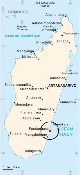
Map of Farafagana, Madagascar
Location
Farafangana is located approximately 400 kilometres south of the capital Antananarivo. It is at the southern end of the Canal des Pangalanes, with the mouth of the Manampatrana River located on the north side of the town. It is 106km south of Manakara, about 2.5 hours travel time away.
Settlements located to the north include Lokandambo, Manambotra, Ambahikarabo and Amboahangimamy, with Ambalolo to the west. To the south are Antananabo, Manambotra Atsimo and Marosondry.
Economy
There is an airport in Farafangana (Farafangana Airport). One of the main crops in the region is pepper.
Tourism
The Manombo Reserve is located at 25 km to Farafangana.