Samiksha Jaiswal (Editor)

Paschim Medinipur district

Updated on
Edit
Like
Comment
Share on FacebookTweet on TwitterShare on LinkedInShare on Reddit
Country
  
India

Headquarters
  
Midnapore

Website
  
Official website

Administrative division
  
Burdwan division

State
  
West Bengal

Average annual precipitation
  
2,111 mm

Area
  
9,345 km²

Lok sabha constituencies
  
Midnapore, Ghatal

Paschim Medinipur district httpsuploadwikimediaorgwikipediaenthumbf

Destinations
  
Jhargram, Kharagpur, Midnapore, Garbeta

Major highways
  
National Highway 6, National Highway 60

Colleges and Universities
  
Vidyasagar University, Indian Institute of Technolo, Midnapore Medical College a, Midnapore College, Belda College

Points of interest
  
Jhargram Palace, Gopegarh Eco park, Kanak‑Durga Temple, Nehru Museum, Khargeswar Temple

Paschim Medinipur district (Pron: pɔʃʧɪm med̪iːniːpur) or West Midnapore district (Pron: ˌmɪdnəˈpʊə) (also known as Midnapore West) is the districts of the state of West Bengal, India. It was formed on 1 January 2002 after the Partition of Midnapore into Paschim Medinipur and Purba Medinipur.

Contents

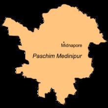
Map of West Medinipur, West Bengal

Overview

Paschim Medinipur, located in the south-western part of West Bengal, was created with the partition of the erstwhile Midnapore district, then the largest district of India, on 1 January 2002. It ranks second in terms of geographical area (9,295.28  km2) amongst the districts of the state, next to South 24-Parganas (9,960  km2). It ranks third in terms of rural population (4.58 million) following South 24-Parganas (5.82 million) and Murshidabad (5.13 million). It ranked fourth in terms of percentage of tribal population (14.87) following Jalpaiguri (18.87), Purulia (18.27) and Dakshin Dinajpur (16.12) in 2011.

Broadly speaking, there are two natural divisions of the district. NH 14 and NH 16 (old numbering NH 60) from Bankura to Balasore, cuts across the district and roughly is the dividing line between the two natural divisions. To the east of this road, the soil is fertile alluvial and the area is flat. To the west, the Chota Nagpur Plateau gradually slopes down creating an undulating area with infertile laterite rocks/ soil. The landscape changes from dense dry deciduous forests in the west to marshy wetlands in the east.

The alluvial portion may be further subdivided into two divisions. First, it is a strip of purely deltaic country nearer to the Hooghly and the Rupnarayan, intersected by numerous rivers and watercourses subject to tidal influences. Second, it is rest of the eastern half of the district. It is a monotonous rice plain with numerous waterways and tidal creeks intersecting it. The tidal creeks are lined with embankments to prevent flooding of the fields. Much of the area is water-logged.

Floods and drought

Paschim Medinipur district is subject to both floods and drought. Ghatal and parts of Kharagpur subdivision covering an area of 142,647 hectares (1,426.47 km2) are flood prone. Water logging during the rainy season affects Ghatal and the southern parts of Kharagpur subdivion and results in loss of crops in such areas as Sabang, Pingla and Narayangarh CD Blocks.335,248 hectares (3,352.48 km2) in Jhargram and Medinipur Sadar subdivisions are drought prone. The drought situation is particularly severe in Jhargram subdivision. Although the district is away from the sea, cyclones hit it frequently in October–November.

Major cities and towns

Midnapore is the district headquarters. Other important towns and cities in the district include: Kharagpur, Jhargram, Ghatal, Belda, Chandrakona, Ramjibanpur, Garbeta, Balichak, Dantan, Mohanpur, Gopiballavpur, Nayagram, Keshiari, Keshpur, Narayangarh, Sabang, Daspur.Mohanpur.

Villages

Paschim Medinipur district is home to the most villages of any district in India. The 2011 census lists Paschim Medinipur as having 8,694 villages, of which 7,600 are populated, and 1,094 are uninhabited. The district with the next highest number of villages, Mayurbhanj, in the state of Odisha, has 3,950 villages, 3,751 of which are inhabited.

Economy and politics

In 2006 the Ministry of Panchayati Raj named Paschim Medinipur one of the country's 250 most backward districts (out of a total of 640). It is one of the eleven districts in West Bengal currently receiving funds from the Backward Regions Grant Fund Programme (BRGF).

106 districts spanning 10 states across India, described as being part of Left Wing Extremism activities, constitute the Red corridor. In West Bengal the districts of Paschim Medinipur, Bankura, Purulia and Birbhum are part of the Red corridor. However, as of July 2016, there has been no reported incidents of Maoist related activities from these districts for the previous 4 years. In the period 2009-2011 LWE violence resulted in more than 500 deaths and a similar number missing in Paschim Medinipur district.

Divisions

Paschim Medinipur district is divided into the following administrative subdivisions:

Administrative subdivisions

The district comprises four subdivisions: Kharagpur, Medinipur Sadar, Ghatal and Jhargram. Kharagpur subdivision consists of Kharagpur municipality and ten community development blocks: Dantan–I, Dantan–II, Pingla, Kharagpur–I, Kharagpur–II, Sabang, Mohanpur, Narayangarh, Keshiari and Debra. Medinipur Sadar subdivision consists of Midnapore municipality and six community development blocks: Medinipur Sadar, Garhbeta–I, Garhbeta–II, Garhbeta–III, Keshpur and Shalboni. Ghatal subdivision consists of five municipalities (Ramjibanpur, Chandrakona, Khirpai, Kharar and Ghatal) and five community development blocks: Chandrakona–I, Chandrakona–II, Daspur–I, Daspur–II and Ghatal. Jhargram subdivision consists of Jhargram municipality and eight community development blocks: Binpur–I, Binpur–II, Jamboni, Jhargram, Gopiballavpur–I, Gopiballavpur–II, Nayagram and Sankrail.

Midnapore is the district headquarters. There are 28 police stations, 29 development blocks, 8 municipalities and 290 gram panchayats in this district.

Other than municipality area, each subdivision contains community development blocks which in turn are divided into rural areas and census towns. In total there are 12 urban units: 8 municipalities and 4 census towns.

Kharagpur subdivision

  • One municipality: Kharagpur.
  • Dantan I community development block consists of rural areas with 9 gram panchayats and one census town: Chaulia
  • Dantan II community development block consists of rural areas only with 7 gram panchayats.
  • Pingla community development block consists of rural areas only with 10 gram panchayats.
  • Kharagpur I community development block consists of rural areas with 7 gram panchayats and two census towns: Kharagpur Railway Settlement and Kalaikunda.
  • Kharagpur II community development block consists of rural areas only with 9 gram panchayats.
  • Sabang community development block consists of rural areas only with 13 gram panchayats.
  • Mohanpur community development block consists of rural areas only with 5 gram panchayats.
  • Narayangarh community development block consists of rural areas with 16 gram panchayats and one census town: Deuli.
  • Keshiari community development block consists of only rural areas with 9 gram panchayats.
  • Debra community development block consists of rural areas with 14 gram panchayats and one census town: Balichak.
  • Medinipur Sadar subdivision

  • One municipality: Midnapore.
  • Midnapore Sadar community development block consists of rural areas only with 9 gram panchayats.
  • Garhbeta I community development block consists of rural areas with 12 gram panchayats and two census towns: Garbeta and Amlagora
  • Garhbeta II community development block consists of rural areas only with 10 gram panchayats.
  • Garhbeta III community development block consists of rural areas with 8 gram panchayats and three census towns: Durllabhganj, Dwari Geria and Naba Kola.
  • Keshpur community development block consists of rural areas only with 15 gram panchayats.
  • Salboni community development block consists of rural areas only with 10 gram panchayats.
  • Ghatal subdivision

  • Five municipalities: Ramjibanpur, Chandrakona, Khirpai, Kharar and Ghatal.
  • Chandrakona I community development block consists of rural areas only with 6 gram panchayats.
  • Chandrakona II community development block consists of rural areas only with 6 gram panchayats.
  • Daspur I community development block consists of rural areas only with 10 gram panchayats.
  • Daspur II community development block consists of rural areas only with 14 gram panchayats.
  • Ghatal community development block consists of rural areas only with 12 gram panchayats.
  • Jhargram subdivision

  • One municipality: Jhargram.
  • Binpur I community development block consists of rural areas only with 10 gram panchayats.
  • Binpur II community development block consists of rural areas with 10 gram panchayats] and one census town: Silda.
  • Jamboni community development block consists of rural areas only with 10 gram panchayats.
  • Jhargram community development block consists of rural areas only with 13 gram panchayats.
  • Gopiballavpur I community development block consists of rural areas only with 7 gram panchayats.
  • Gopiballavpur II community development block consists of rural areas only with 7 gram panchayats.
  • Nayagram community development block consists of rural areas only with 12 gram panchayats.
  • Sankrail community development block consists of rural areas only with 10 gram panchayats.
  • Demographics

    According to the 2011 census Paschim Medinipur district has a population of 5,943,300, roughly equal to the nation of Eritrea or the US state of Missouri. This gives it a ranking of 14th in India (out of a total of 640). The district has a population density of 636 inhabitants per square kilometre (1,650/sq mi) . Its population growth rate over the decade 2001-2011 was 14.44%. Paschim Medinipur has a sex ratio of 960 females for every 1000 males, and a literacy rate of 79.04%.

    Tourism

  • Chilkigarh (Kanak Durga Temple and park)
  • Belpahari
  • Jhargram
  • Gopegarh Heritage Park
  • Hatibari forest banglow and jhilli pakhiralay
  • kankrajhore
  • Garrasini asharam,near Belpahari
  • Kaniashar pahar,near Belpahari
  • Gurguripal Heritage Park
  • Parimalkanan park,c.k.t
  • Gangani [Garhbeta]
  • Deer park[Jhargram]
  • Rameshwar Temple,near Rohini(On the bank of Subarnarekha river with nearby green forest called TAPOBAN)
  • Gourya Temple, Near Kharagpur
  • ECO Park DURGAHURI, Near SANKRAIL
  • Bisnu Temple, kultikri
  • Rashikananda Memorial, Rohini
  • Prayag Film City or Midnapore Film City or Chandrakona Film City at Chandrakona Road
  • Notable personalities

  • Sahid Kshudiram Basu (Mouboni, Anandapur PS, Keshpur Development Block)
  • Iswar Chandra Vidyasagar (Birsingha, Ghatal PS)
  • Raja Narasingha Malla Deb - (Jhargram)
  • Soumya Sankar Bose (Midnapore)
  • Universities and colleges

  • Ambigeria Government College
  • Belda College
  • Bhatter College
  • Chaipat S.P.B. Mahavidyalaya
  • Chandrakona Vidyasagar Mahavidyalaya
  • Debra Thana Sahid Kshudiram Smriti Mahavidyalaya
  • Garhbeta College
  • Ghatal Rabindra Satabarsiki Mahavidyalaya
  • Gourav Guin Memorial College
  • Hijli College
  • Indian Institute of Technology, Kharagpur
  • Institute of Science & Technology
  • Jhargram Raj College
  • K.D. College of Commerce and General Studies
  • Kharagpur College
  • Kharagpur Homeopathic Medical College and Hospital
  • Midnapore College(formerly known as Day college)
  • Midnapore Homoeopathic Medical College and Hospital
  • Midnapore Law College
  • Midnapore Medical College and Hospital
  • Narajole Raj College
  • Pingla Thana Mahavidyalaya
  • Raja Narendra Lal Khan Women's College
  • Sabang Sajani Kanta Mahavidyalaya
  • Sankrail Anil Biswas Smriti Mahavidyalaya
  • Santal Bidroha Sardha Satabarsiki Mahavidyalaya
  • Iswar Chandra Vidyasagar Polytechnic - Jhargram
  • Seva Bharati Mahavidyalaya
  • Seva Bharati Krishi Vigyan Kendra
  • Silda Chandra Sekhar College
  • Subarnarekha Mahavidyalaya
  • Sukumar Sengupta Mahavidyalaya
  • Vidyasagar Teachers' Training College
  • Vidyasagar University
  • Vivekananda Satavarshiki Mahavidyalaya. Raja Narendralal khan women's College
  • Healthcare

    The table below (all data in numbers) presents an overview of the medical facilities available and patients treated in the hospitals, health centres and sub-centres in 2014 in Paschim Medinipur district.

  • Excluding Nursing Homes
  • NGOs

  • Anjali Human Development and Research Organisation Jhargram PIN 721507
  • Science Centre, Midnapore, Pin-721101, functioning since 1987 in the field of science popularisation, building scientific temper among people especially among children, development of science teaching through innovative low cost experiments and have receive Jawahalal Nehru Prize in 2000-01 from ISCA and Meghnad Puraskar from Department of Science and Technology, Government of West Bengal for Science Popularization.
  • Belda Federation of Traders Organisation, Subhas Pally,Post- Belda- 721424,Secretary- Lakshman Ch. Sahoo.
  • Ghatal Nabadoy Welfare Society, Ghatal, Paschim Medinipur, Pin - 721212
  • Public Profit Policy Trust of India(P.P.P.T.I.),Kalkali,Sarishakhola,Keshpur,Midnapore.
  • Sarada Kalyan Bhandar
  • Vidyasagar Vidyapith
  • Sri Sri Nitya Gopal Vision Care Foundation
  • Midnapore.in - Legacy of Midnapore
  • C.F.Andrews .Memorial.Society-Jhargram
  • Barnali Sarangi Foundation - Rohini
  • Society for Positive Atmosphere and Related Support to HIV/AIDS (SPARSHA)-Medinipur Town, Goura,
  • Paschim Khirai Society for Rural & Child Development, Paschim Khirai, Pingla, Midnapore West- 721140
  • Bhelampur Saibaba Sechyasebi seba Sangha,Bhelampur, Gansarisha, Keshiary, Paschim Medinipur, Pin-721133
  • Lowada Cactus Welfare Association, Lowada, Debra, Paschim Medinipur, Pin-721136
  • Gopali Youth welfare Society, Gopali, Kharagpur
  • Gandhi Mission Trust
  • Sarbik Palli Kalyan Kendra (estb 1986),Kiageria,Chandrakona Block-II, Pin-721201
  • Dantan Science Club Dantan Paschim Medinipur pin-721426
  • Pindrui Sonali Sangha.(Estd. 1985) Pindrui. Pingla. Paschim Medinipur. 721131
  • Sonamui Rural Development & Social Welfare Society, Sonamui, P.O. Goura, Dist. Paschim Medinipur, Pin-721146
  • MALIGRAM SAHID KSHUDIRAM SOCIAL WELFARE SOCIETY, Vill & P.O. Maligram, Dist. Paschim Medinipur, Pin-721140
  • MALIGRAM AGRADUT SPORTING CLUB, Vill & P.O. Maligram, Dist. Paschim Medinipur, Pin-721140
  • References

    Paschim Medinipur district Wikipedia