
 | ||
In the heart of india s red corridor
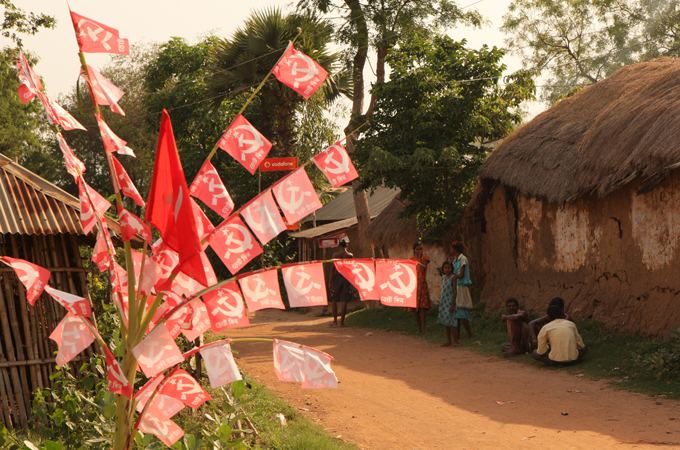
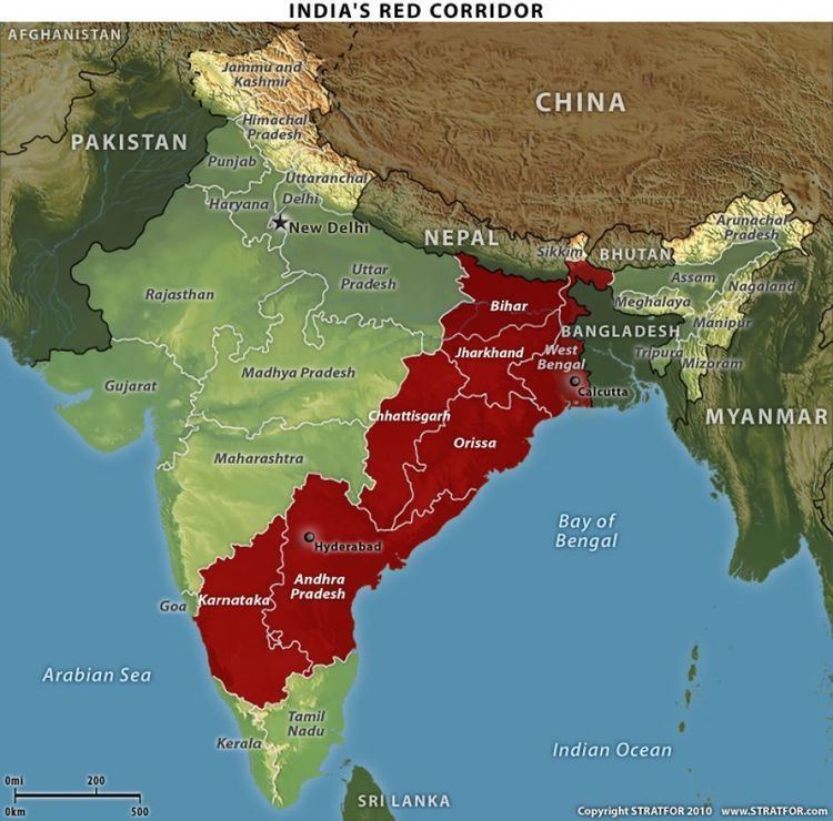
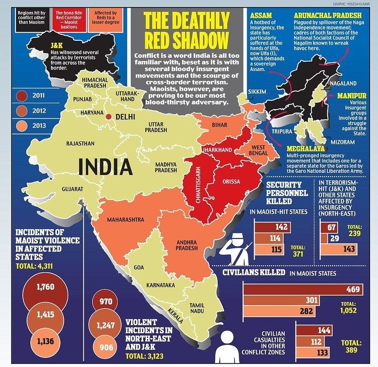
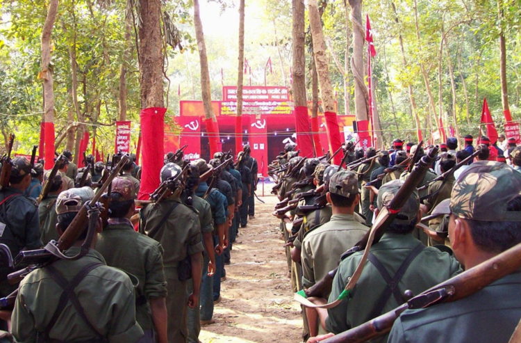
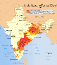
The Red Corridor is a region in the east of India that experiences considerable Naxalite–Maoist insurgency. The Naxalite group mainly consists of the armed cadres of the Communist Party of India (Maoist). These are also areas that suffer from the greatest illiteracy, poverty and overpopulation in modern India, and span parts of Andhra Pradesh, Bihar, Chhattisgarh, Jharkhand, Madhya Pradesh, Maharashtra, Odisha, Telangana, Uttar Pradesh and West Bengal states.
Contents
- In the heart of india s red corridor
- Travels in the red corridor andhra hd awaye abc radio national
- Economic situation
- Social situation
- Affected Districts
- The Odisha gap
- References
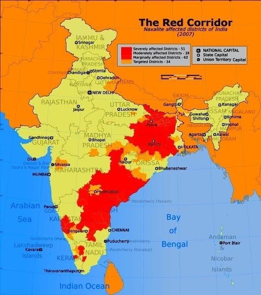
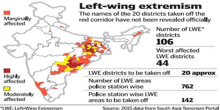
All forms of naxalite organisations have been declared as terrorist organizations under the Unlawful Activities (Prevention) Act of India (1967). According to the Government of India, as of July 2011, 83 districts (this figure includes a proposed addition of 20 districts) across 10 states are affected by left-wing extremism down from 180 districts in 2009.
Travels in the red corridor andhra hd awaye abc radio national
Economic situation
The districts that comprise the Red Corridor are among the poorest in the country. Areas such as Uttar Pradesh, Chhattisgarh and Telangana (formerly part of Andhra Pradesh), are either impoverished or have significant economic inequality, or both.
A key characteristic of this region is non-diversified economies that are solely primary sector based. Agriculture, sometimes supplemented with mining or forestry, is the mainstay of the economy, which is often unable to support rapid increases in population. The region has significant natural resources, including mineral, forestry and potential hydroelectric generation capacity. Orissa, for example, "has 60 percent of India’s bauxite reserves, 25 percent of coal, 28 percent of iron ore, 92 percent of nickel and 28 percent of manganese reserves."
Social situation
The area encompassed by the Red Corridor tends to have stratified societies, with caste and feudal divisions. Much of the area has high indigenous tribal populations (or adivasis), including Santhal and Gond. Bihar and Jharkhand have both caste and tribal divisions and violence associated with friction between these social groups. Andhra Pradesh's Telangana region similarly has deep caste divides with a strict social hierarchical arrangement. Both Chhattisgarh and Orissa have significant impoverished tribal populations.
Affected Districts
As of July 2011, 83 districts across 10 states are affected by left-wing extremism down from 180 districts in 2009. The districts affected by left-wing extremism stand at 106 in 10 states as on 12 February 2016.
The Odisha gap
The Red Corridor is almost contiguous from India's border with Nepal to the northern fringes of Tamil Nadu. There is, however, a significant gap consisting of coastal and some central areas in Odisha state, where Naxalite activity is low and indices of literacy and economic diversification are higher. However, the non-coastal districts of Odisha which fall in the Red Corridor have significantly lower indicators, and literacy throughout the region is well below the national average.