
Country State | District West Midnapore | |
 | ||
Languages spoken | ||
Khirpai aamar sib template
Khirpai also known as Kshirpai, is a town and a municipality in West Midnapore in the Indian state of West Bengal. The town is situated between Ghatal and Chandrokona Town, near the banks of river Shilabati and Kethai, and is one of the oldest municipalities in India. Khirpai is also famous for its ‘Babarsha’, a special type of sweetmeat, which is not available elsewhere.
Contents
- Khirpai aamar sib template
- History
- Geography
- Demographics
- CD Block HQ
- Economy
- Transportation
- Education
- Health
- Culture
- References
History
In the 18th and 19th century, Khirpai was a big and famous trading place. Cotton and handicrafts of this area were exported to foreign lands. In the British period, Khirpai became famous for indigo plantation. Also in the British Era, it was a famous business centre. At that time neel (indigo powder) was the main product. On the south-east side of Khirpai town, there is a lake; ruins can be found in the south east corner of this lake. Once, it was the trade-house of the European merchants. French, Dutch, Portuguese and British came here for trade before 1660, and by that time they thronged here for purchasing cotton and silk, which are of exclusive status. In 1763, French built a workshop in this place.
In the 18th century, Khirpai become famous for cotton-cloth weaving and manufacture of brush and bell metal. The weaving industry was further developed in the second half of the century by the location of an important factory of the East India Company in Khirpai. But in the 19th century the industry declined owing to the withdrawal of the company from commercial undertakings, and particularly due to the importation of British piece goods. Khirpai lost her proud status as a business centre, and the population density of Khirpai decreased gradually from that time.
Geography
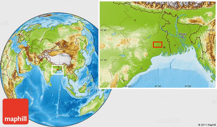
Khirpai is located at 22.7°N 87.62°E / 22.7; 87.62. It has an average elevation of 7 metres (26 feet).
Demographics
As of 2001 India census, Khirpai had a population of 14,548. Males constitute 57% of the population and females 43%. Khirpai has an average literacy rate of 77%, higher than the national average of 59.5%: male literacy is 81%, and female literacy is 62%. In Khirpai, 11% of the population is under 6 years of age. Near Khirpai there is a river named Kethia.
CD Block HQ
The headquarters of Chandrakona I Block are located at Bamaria in Kshirpai.
Economy
The main economy of this area is agriculture. Besides town area the people of the villagers basically earn their livelihood by producing crops, like paddy, potato, wheat, jute and vegetables of different kinds. A few of the people are government employees, school teachers and employed in other small private sectors. The financial status of most of the people is in middle class and lower middle class category.
Transportation
Khirpai is well connected by roads/highways with other nearby cities like Midnapore, Kharagpur, Kolkata, Howrah,Ghatal, Burdwan, Panskura, Kanthi, Tamluk, Hooghly. For local transportation bus, taxi, minibus, cycle-rikshaws are available. Panskura and chandrokona road railway stations are two nearest railway station.
State Highway 4 (West Bengal) running from Jhalda (in Purulia district) to Digha (in Purba Medinipur district) and State Highway 7 (West Bengal) running from Rajgram (in Birbhum district) to Midnapore (in Paschim Medinipur district) cross at Khirpai.
Education
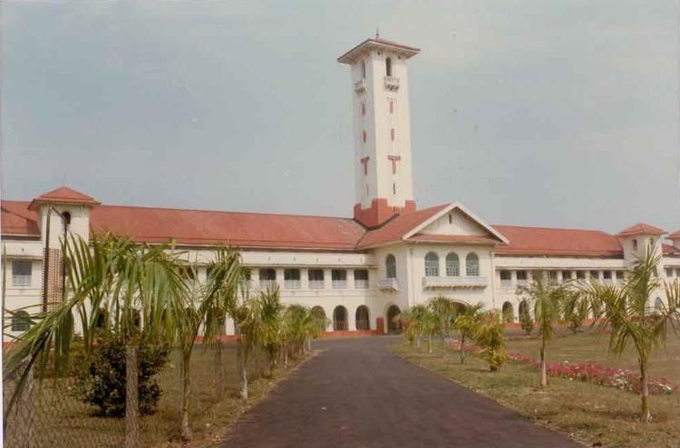
There are many no of schools and primary schools in Khirpai. There is one coeducational high school and one girls school. The name of the schools are - 1. Khirpai H.S. Multipurpose School 2. Khirpai S.K.Barman Memorial Girls High School. Ghatal Rabindra Satabarsiki Mahavidyalaya and Chandrakona Vidyasagar Mahavidyalaya are two nearest college of khirpai. Nearest Polytechnic college is Ghatal Government Polytechnic and ITI college is Ghatal Government ITI in Birsingha.
Health
There is a hospital in the Khirpai town and one Community Based primary Health Center run by Khirpai municipality. People of Khirpai and its nearest areas mainly depends on the hospital. Also There are many private chambers of doctors in the Khirpai. Health of common people is generally well.
Culture
Among many festivals of in Khirpai, 'Santoshi Mela' is the most popular. Many people from Khirpai and its nearest villages take part in the Santoshi Mela. There is also some religious places in Khirpai named Pancharatna Mandir, Parbatinath Temple, Radha Damodar Jew Temple.Radhamadhab Temple of Malpara is on Ghatal-Khirpai Road .This age old temple is ‘Pancharatna’(ratna means pinnacle) but the terracotta works still exist with glory. These works depict Krishnalila, Dasavatar and battle of Ram Ravana, even hunting scenes and floral ornamentations. It was built in 1817. Radha Damodar Jew Temple is famous for his terracota works. ‘Dalan Mandir’ in Paharipara is also notable. This temple is dedicated to Singhabahini, incarnation of Devi Durga. This was built on 1746 and probably the oldest temple of Khirpai region.The massive structure of ‘Sitalanda Tin Temple’ is situated in Hattala (Khirpai). It faces southwards and is of the atchala style. Some terracotta specimens still can be found. It is built by Pani family on 1839. There is a Shiva temple in the village Gangadaspur, Ward no.-6 of khirpai municipality which bears the age-old culture of this locality. This temple is almost 300 years old and it is the largest and highest of this area. This temple is newly renovated. It upholds the cultural heritage of this area. The regular Bengali festivals like Durga Puja, Saraswati Puja and Kali Puja are well attended. Other common pujas in the worship of Sitala, Jagaddhatri, Holi,Janmastami, Bheema Puja also takes place. A special type of sweet named Babarsa only in Bengal available here.