
Country India Telephone code 0161 Area 3,767 km² Population 3.488 million (2011) Points of interest Nehru Rose Garden | Time zone IST (UTC+5:30) Vehicle registration PB-10 Literacy 82.5% Area code 0161 | |
 | ||
Destinations Colleges and Universities Punjab Agricultural University, Guru Nanak Dev Engineeri, Christian Medical College, Dayanand Medical College, Guru Angad Dev Veterinar | ||
Ludhiana District is one of the 22 districts in the state of Punjab in North-West Republic of India. Ludhiana city which is district headquarters is the hub of industry in Punjab. The main industries are bicycle parts and hosiery. Ludhiana is the biggest city of the state. It has eight tehsils, seven sub-tehsils and twelve development blocks.
Contents
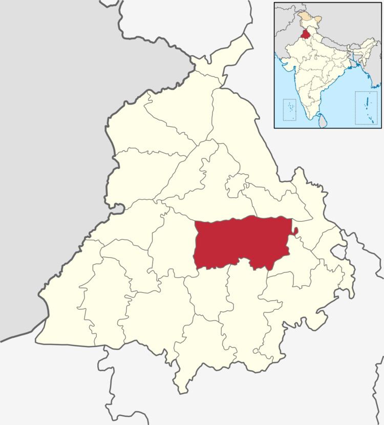
- Map of Ludhiana Punjab
- History
- Sikh Chieftains of 1860 who held great Influence and local power
- Location
- Topography
- Climate
- Rainfall
- Rivers and drains
- Ludhiana Tehsil
- Demographics
- Places of interest
- References
Map of Ludhiana, Punjab
As of 2011 census, the district population constituted 12.59 percent of the total Punjab population.
History
Ludhiana gets its name from the Lodhi Dynasty, which is believed to have founded the city in 1480. During the reign of the Mughal emperor Akbar the area formed part of the Sarkar of Sirhind. In the latter period of Mughal rule the western part of the district was leased to the Rais of Raikot. By the early eighteenth century they had become semi independent of the Mughals. The villages In Ludhiana district remained independent, and under the rule of local powerful village Sikh Chieftains, from 1707-1835. In 1747 Ahmad Shah Durrani invaded and battled the imperial army near Khanna, although the Mughals were able to stop Ahmad Shah — his subsequent invasions weakened the Mughals, which allowed the Rais to take control of Ludhiana town in 1760. Chakar, Talwandi Rai in 1478 AD, Raikot in 1648 AD and Jagraon in 1688 AD were founded by the Rai family of Raikot. Ref-Ludhiana Dist. Gazetteer 1888-89&1904. Chiefs of Punjab 1890,1909 & 1940
During the reign of Maharaja Ranjit Singh, Ludhiana became an important British cantonment. Initially, in 1805, Ranjit Singh occupied Ludhiana. However, in 1809, the British decided to curb his advance eastward and sent troops to confront him. Ranjit Singh was forced to sign the treaty of 'perpetual friendship' with the British, which confined his activities to the right bank of the Sutlej. British troops were permanently stationed in Ludhiana and the Cis-Sutlej states came under British protection.
According to the 1901 census, Hindus numbered 269,076, or 40 per cent of the total; Muslims, 235,937, or 35 per cent; and Sikhs, 164,919, or 24 per cent. In 1947 due to violence and strife between the communities, the most of the Muslim population left for Pakistan.
Sikh Chieftains of 1860, who held great Influence and local power
Location
Ludhiana is a centrally located cities of Punjab, which is on the Grand Trunk Road from Delhi to Amritsar at latitude 30.55 North and longitude 75.54 East in Northern India.
Ludhiana is the most centrally located district in the Malwa region of the state of Punjab. For administrative purposes it has been placed in the Patiala Division. It lies between north latitude 30°-34' and 31°-01' and east longitude 75°-18' and 76°-20'. It is bounded on the north by the Satluj River, which separates it from Jalandhar district. The river forms its northern boundary with Hoshiarpur district. On other sides it shares common boundaries with Rupnagar district in the east, Moga district in the west, and Barnala, Sangrur and Patiala districts in the south and southeast, respectively.
Topography
The topography of the district is typical representative of an alluvial plain. It owes its origin to the aggravation work of the Satluj River. The alluvium deposited by the river has been worked over by the wind, which gave rise to a number of small dunes and sand mounds. Most of these dunes have been leveled by farmers of the district.
The district can be divided into the flood plain of the Satluj and the upland plain.
Climate
The climate of the district is characterized by dryness except a brief spell of monsoon season, a very hot summer and a bracing winter. The cold season is from mid-November to the early part of March. The succeeding period until the end of June is the hot season. July, August and half of September constitute the southwest monsoon. The period of mid-September to about the middle of November may be termed as post-monsoon or transitional period. June is generally the hottest month. Hot and scorching dust-laden winds blow during summer season. December and January are the coldest months.
Rainfall
The rainfall in the district increases from the southwest toward the northeast. About 70% of the rainfall is received during the period of July through September. The rainfall between December and March accounts for 16% of the rainfall the remaining 14% rainfall is received in the other months of the year.
Rivers and drains
The Sutlej and its tributary, the Buddha Nala, constitute the chief hydrographic features of the district. A brief description of these is as follows.
Ludhiana Tehsil
Ludhiana West Tehsil is a Tehsil in Ludhiana district it has 125 villages.
Ludhiana East Tehsil is a Tehsil in Ludhiana district it has 181 villages.
Demographics
According to the 2011 census Ludhiana district has a population of 3,487,882, roughly equal to the nation of Panama or the US state of Connecticut. This gives it a ranking of 87th in India (out of a total of 640). The district has a population density of 975 inhabitants per square kilometre (2,530/sq mi). Its population growth rate over the decade 2001-2011 was 15 percent. Ludhiana has a sex ratio of 869 females for every 1,000 males, and a literacy rate of 82.5 percent.