
Tehsils 50 Area 15,379 km² Elevation 379 m | Vehicle registration AP-04 Literacy 67.9% | |
 | ||
Colleges and Universities Yogi Vemana University, JNTUA College of Engineering, Pulivendula, Lepakshi Degree College Points of interest Pushpagiri Temple Complex, Bhagwan Mahavir Governm, Talakona, Kodandarama Temple - Vontimitta, Ameen Peer Dargah Destinations | ||
Kadapa district tour
Kadapa district is said to be the heart of the Rayalaseema as it is centrally located and well connected with the 4 districts of Rayalaseema. The District has a glorious history and a rich cultural heritage. Kadapa district (officially: YSR Kadapa district) is one of the 13 districts in the Indian state of Andhra Pradesh. It is also one of the four districts in the Rayalaseema region of the state. The city of Kadapa is the seat of administration for the district.
Contents
- Kadapa district tour
- Map of Kadapa Andhra Pradesh
- Rock paintings
- Prehistoric Culture
- Buddhism Jainism
- Medieval history
- Modern History
- Geography
- Economy
- Large Scale Industries
- Demographics
- Divisions
- Education
- Institutions
- Tourist locations
- Notable personalities
- Transport
- Roadways
- Railways
- Airways
- Reservoirs
- References
Map of Kadapa, Andhra Pradesh
Rock paintings
Paleolithic rock paintings found at Chintakunta caves near Muddanuru in Kadapa district are said to be the second largest group of paintings in India after Bhimbetika rock art paintings. The rock paintings with mystic figures are also found at Dappalle village near Mylavaram Dam in Jammalamadugu Taluk of the district.
Prehistoric Culture
Many Paleolithic sites were found in Kadapa district, as the surroundings of Jammalamadugu, Mailavaram Dam and Gandikota.
Some megalithic burial sites were explored near Porumamilla, Sankhavaram and at Yellatur village near Kadapa. The surroundings of Vontimitta are also noted as Megalithic cultural sites.
The section of Rayachoti consists of many documented and undocumented Megalithic sites and stone circles. A noted megalithic site is at Devandlapalli in Tsundupalle taluk of the district.
Buddhism & Jainism
Kadapa has historical importance since BC era. It was connected with Mouryans in BC era and Sathavahanas. Buddhism must have flourished here for many years along the banks of rivers Cheyyeru and Penna. Nandalur is an important Buddhist site in the district along with Tallapaka, Rajampeta, Konduru, Khazipeta in the district.
Jainism also had a place in Kadapa district history; the remnants of a buried Jain temple were found at Danavulapadu village on the banks of river Penna.
Medieval history
It was part of the area ceded to the British by Nizam. The District was formed by splitting the Ceded Districts into two in 1808 during the British rule, the other district being Bellary. The British spelt the district as Cuddapah.
The district is part of Rayalaseema, commemorating the name of Rayulu (Kings) of the Vijayanagar Empire, who ruled the area in the 16th century. Gandikota fort located on the bank of the Penna River was the citadel of Pemmasani Nayaks, commanders of Vijayanagar army and who won the battles of Raichur and Gulbarga for the Vijayanagar kings.
The old records of the district reveal that Kadapa previously called Gadapa which means in Telugu language threshold. The ancient village of Kadapa with its large tank and temple of Lord Venkateswara at Devuni Kadapa was convenient camping place for the myriads of pilgrims travelling to the holy shrine of Tirupathi. There was a belief that the pilgrims have to first visit Devuni Kadapa, before going to Tirupathi to pray to Saint Annamacharya and Saint Potuluri Veera Brahmam who foretold the future and advocated a classless society. The ancient temple at Vontimitta which inspired Pothana to compose Andhra Maha Bhagavatham is also in the district. In the olden days Kadapa was also called "Heranyanagaram".
Recent historical records reveal that in Jyothi village located in Sidhout mandal has 108 Shiva lingas on the bank of Penna river.
Modern History
After the Treaty of Seringapatam nizam acquired this district and Ceeded this district to British in the year 1800. In the year 1808 British created modern kadapa district and headquarter is situated in Sidhout. In the year 1812 district headquarters was moved to Kadapa.
Geography
Kadapa District occupies an area of 15,938 square kilometres (6,154 sq mi), comparatively equivalent to Canada's Prince Patrick Island.
The main rivers in this district are Penna, Chitravathi, Kunderu, Papagni, Sagileru, Bahuda and Cheyyeru. The forest area is 5,050 km². It is 32.87% of the district area. It is the only district in the state of Andhra Pradesh (AP) that is surrounded by AP districts on all sides. All other districts either skirt the Bay of Bengal and/or border neighbouring states.
Economy
Besides its historical importance, the district has occupied an important place in the industrial map of Andhra Pradesh with its valuable mineral resources.
Black corson soil lands are 24%, black soil 19%, sandy soil lands 4%, red soil lands 25%. The first variety lands are very fertile, sand soil lands less so. 'Korra', orange, lime and betel leaf are the special crops. They are cultivated near river beds. Starting at Sunkesula Dam on Tungabadra river K. C. Canal flows through Kadapa and Kurnool districts providing water to 40 km² of cultivable land. The main source of drinking water to this district is Galeru Nagari Sujala Sravanthi Project Canal.
This district is the repository of mineral wealth. As per the 1983 survey of geological survey of India 3 million tons of lead, 74,000,000 tons of barytes, and 27000 tons of asbestos deposits are there. It is estimated that 70 million tons of barytes deposits might be in Mangampet. There are clay deposits in Rajampet. This is used to make stone implements. Limestone is available in Yerraguntla. National Mineral Development Corporation is extracting asbestos in Brahman palli and barytes in Mangampet. Kadapa is also famous for its stone called "kadapa stone" used in building construction and for slabs especially in south India. In Tummalapalle, there are 49,000 tonnes of confirmed uranium deposits which are mined and processed locally. Apart from these minerals and industries Agriculture also forms a part district economy.
Large Scale Industries
The following are the Large scale industries located in Kadapa district.
In 2006 the Indian government named Kadapa district as one of the country's 250 most backward districts (out of a total of 640). It is one of the thirteen districts in Andhra Pradesh currently receiving funds from the Backward Regions Grant Fund Programme (BRGF).
Demographics
According to the 2011 census Kadapa District has a population of 2,884,524, Hindus are 83.7%, Muslims are 14% & Christians are 2.3% roughly equal to the nation of Jamaica or the US state of Arkansas. This gives it a ranking of 132nd in India (out of a total of 640). The district has a population density of 188 inhabitants per square kilometre (490/sq mi) . Its population growth rate over the decade 2001–2011 was 10.87%. Kadapa district has a sex ratio of 984 females for every 1000 males, and a literacy rate of 67.88%.
Divisions
Kadapa District has three Revenue Divisions viz., Kadapa, Rajampeta and Jammalamadugu divisions. The district has 50 mandals under these revenue divisions. It also has a Municipal Corporation of Kadapa and six municipalities namely, Badvel, Mydukur, Proddatur, Pulivendula, Rayachoti, Jammalamadugu and a Nagar panchayat of Rajampet.
There are a total of 51 mandals in Kadapa District.
Mandals
The mandals are listed with respect to their revenue divisions in the following table:
Assembly constituenties
Education
The primary and secondary school education is imparted by government, aided and private schools, under the School Education Department of the state. As per the school information report for the academic year 2015-16, there are a total of 4,488 schools. They include, 22 government, 3,094 mandal and zilla parishads, 1 residential, 1,181 private, 10 model, 29 Kasturba Gandhi Balika Vidyalaya (KGBV), 88 municipal and 63 other types of schools. The total number of students enrolled in primary, upper primary and high schools of the district are 401,293.
Institutions
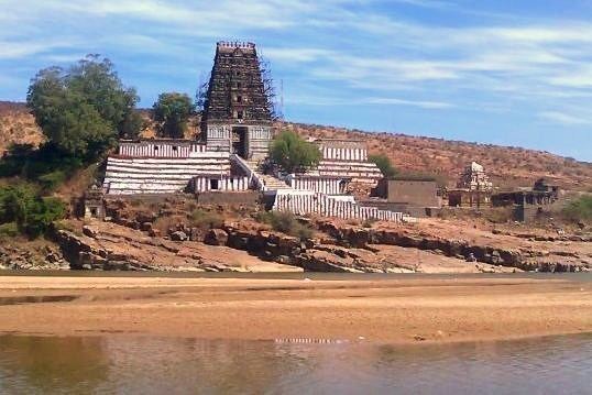
Tourist locations
The district is home to many tourist locations which include temples and forts, each with its own unique design and architecture and its own history.
Notable personalities
Transport
Kadapa district is well connected by Road , Rail and Airways with neighbouring districts of Andhra Pradesh.
Roadways
The total of core road network of the district is 1,130.906 km (702.712 mi). It includes, 714.317 km (443.856 mi) of existing and a proposed length of 416.589 km (258.856 mi).National Highway 40 (India) and National Highway 67 (India) are the national highways passing through the district.
Railways
Kadapa district has Railway network administration under Guntakal railway division. cuddapah , Yerraguntla Junction , Proddatur , Jammalamadugu are the major railway stations.
Airways
kadapa Airport is located in kadapa city.
Reservoirs
Kadapa Dist has Good number of reservoirs with in the Dist. Some of them are Brahmamsagar Reservoir, Mylavaram Dam Reservoir, Gandikota Reservoir