
Highest elevation 279 m (915 ft) Elevation 279 m | Area rank 55th Highest point unnamed Population Uninhabited Area 15,848 km² | |
 | ||
Island groups Canadian Arctic Archipelago, Queen Elizabeth Islands | ||
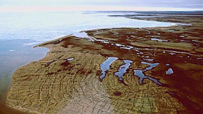
A member of the Canadian Arctic Archipelago, Prince Patrick Island is the westernmost of the Queen Elizabeth Islands in the Northwest Territories of Canada. The area of the island is 15,848 km2 (6,119 sq mi), making it the 55th largest island in the world and Canada's 14th largest island. It has historically been icebound all year, making it one of the least accessible parts of Canada.
Map of Prince Patrick Island, Inuvik, Unorganized, NT, Canada
Located at the entrance of the M'Clure Strait, Prince Patrick Island is uninhabited. A High Arctic Weather Station ("HAWS") and associated airstrip called Mould Bay were opened in 1948 as part of a joint Canada-US military effort to support a weather station network. Regular weather observations began on May 14, 1948. It had a temporary staff of between 10 and 40 people. Staff size normally increased during summer months, when the station was resupplied from the south.
During the period of US National Weather Service participation, the site was known as a Joint Arctic Weather Station ("JAWS"). Executive officers alternated between Canadians and their US counterparts. US participation ended in 1972. The station was closed in 1997, owing to budget cuts. It was replaced with an automated weather station at a new location on the airstrip, downhill from the central buildings and observatory. The last manned weather observations were taken on March 31, 1997, ending the continuous weather record of 1948-1997.
The buildings still stand, but as of 2007, most have deteriorated to an unrepairable state. The station represented the only known long-term human settlement of the Island.
The first known sighting of the island was in 1853 by George Mecham, when it was explored by him and Francis Leopold McClintock in the spring of that year during the Edward Belcher expedition. Much later, it was named for Prince Arthur William Patrick, Duke of Connaught, who was Governor General from 1911 to 1916.
The island rises to only about 279 m (915 ft), and the area is seismically active.
Prince Patrick Island is the setting for a work of fiction, the novel The Lost Ones (1961) by Ian Cameron (Donald G. Payne). It was filmed as the Walt Disney Pictures film The Island at the Top of the World in 1974. The novel tells of a lost colony of Vikings living in a lost valley in the island, which, thanks to the volcanoes on the island, is warm and habitable.