
- elevation 772 m (2,533 ft) Length 657 km | - elevation 256 m (840 ft) Basin area 13,292 km² | |
 | ||
- right Emu Creek (Condamine River), Swan Creek (Condamine River), Glengallen Creek, Dalrymple Creek, Kings Creek (Condamine River), Hodgson Creek, Oakey Creek, Myall Creek, Jimbour Creek, Cooranga Creek, Charleys Creek - location between Surat and Condamine | ||
The Condamine River, part of the Balonne catchment that is part of the Murray-Darling Basin, drains the northern portion of the Darling Downs, an area of sub-coastal southern Queensland, Australia. The river rises on Mount Superbus, South East Queensland's highest peak, on the western slopes of the Great Dividing Range, approximately 100 kilometres (62 mi) from the east coast of Queensland, and then flows north west across the Darling Downs, then west.
Contents
- Map of Condamine River Ducklo QLD Australia
- Scientists unsure cause of methane bubbling out of condamine river but it s increasing
- Course and features
- Water storage
- History
- Coal gas industry
- Methane gas
- See also
- References
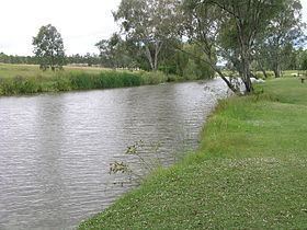
Map of Condamine River, Ducklo QLD, Australia
Scientists unsure cause of methane bubbling out of condamine river but it s increasing
Course and features
The headwaters of the river rise on the slopes of Mount Superbus, part of the Main Range, before passing through Cambanoora Gorge. The river flows through the towns of Killarney and Warwick, while the tributary Gowrie Creek drains the slopes around Toowoomba. At Surat the Condamine turns to the south-west and becomes known as the Balonne River. The Condamine descends 516 metres (1,693 ft) over its 657-kilometre (408 mi) course, with a catchment area of 13,292 square kilometres (5,132 sq mi). The water basin contains more than 1,800 wetlands.
The Balonne River forks near Dirranbandi with a western branch being called the Culgoa River which, in turn, flows into the Darling River. The eastern branch of the Balonne River in turn branches again - into the Bokhara River on the right and the Narran River on the left (eastern) side. These rivers join with the Barwon River west of Brewarrina which also flows into the Darling River. Towns the Balonne passes through include St George, Dirranbandi and Surat. In this area Bungil Creek joins the Balonne River.
Water storage
Water from the Condamine River is used for town water supply and for irrigation. Leslie Dam on Sandy Creek, a tributary of the Condamine, is the main water reservoir for Warwick. Talgai Weir is a small weir that can hold 640 megalitres (140×10^6 imp gal; 170×10^6 US gal) near Clifton. Other water storage facilities on the Condamine River include the Yarramalong Weir, Lemon Tree Weir, Loudoun Weir, Tipton Weir and the Cecil Plains Weir. The Condamine River is reduced to a series of drying ponds during droughts in Australia.
History
Parts of the water catchment were settled by the Bundjalung people. The Condamine River was named by Allan Cunningham in 1827 for Thomas de la Condamine, a former aide-de-camp to Governor Ralph Darling who became the colony's first Collector of Internal Revenue. Patrick Leslie was the first white settler in the area. He established Canning Downs in 1840, near Warwick.
Major Thomas Mitchell crossed the Balonne River on St George's Day, 23 April 1846. The next year 1847 Ludwig Leichhardt went to examine the course of the Condamine River.
In 1985, it was proposed by the Water Research Foundation of Australia to transfer water from the Clarence River to the Condamine water basin. The Condamine River and its catchment area were involved in the 2010–2011 Queensland floods. During the floods the river reached a record peak at Condamine of 15.25 metres (50.0 ft) and another peak of 14.67 metres (48.1 ft).
Coal gas industry
The Coal Seam Gas industry (often referred to as Coal Bed Methane) started exploring for unconventional gas in the Chinchilla region, through which the Condamine River flows, around 2000 when Bob Bryan formed The Queensland Gas Company (QGC). From humble beginnings supplying gas into the domestic market, the industry grew quickly with the advent of the CSG/LNG industry and building of export facilities in Gladstone.
The gas is found in coal seams attached to the coal and is trapped underground by water pressure. To extract gas from coal seams it is necessary to remove the water from the coal seams to allow the adsorbed gas to flow. Broad scale de-watering of the Walloon Coal Measures by the gas companies commenced and the impacts soon became apparent, as stock water bores drilled into the coal started to become gassy. The Walloon Coal Measures are hydraulically connected to the aquifers of the Great Artesian Basin (within the Surat Basin) and in some locations immediately underlies the Condamine Alluvium.
Methane gas
From 2012 through to early 2016 bubbles of methane gas have been observed escaping from the river. The discharges vary in intensity and are most likely linked to a fault line. The seeps have been monitored by scientists contracted by Origin Energy but, according to the gas industry, the cause remains unknown. In 2012, the Queensland Government undertook an investigation into the gas seeps. The technical study concluded that preliminary investigations indicated that the bubbling was unlikely to be caused by coal seam gas (CSG) activities in the region, but that further studies were required. In relation to the presence of methane in the river, the report concluded that “…there is no safety risk or evidence of environmental harm occurring in the immediate area from the Condamine River gas seeps."
Natural gas seeps are not all together uncommon in Queensland, the gasfield commission (a government agency) identified a range of soil gas surveys undertaken during the 1980s and 1990s which measured low levels of non-toxic methane gas ranging from less than 10 parts per million (ppm) to 240ppm naturally occurring in the subsoil at depths of up to one meter.
This Condamine River seep was brought to the forefront of media attention by New South Wales Greens MP Jeremy Buckingham, in which he allegedly set alight the methane gas bubbling from the riverbed. He also mentions "hydraulic fracturing" as likely to be contributing to the problem, but to date there is no direct link. Origin Energy, the company whom owns a majority of the coal seam gas wells in the Condamine area, refutes the claim, with a spokesperson stating that the nearest drilling projects were located several kilometers away from the river. They conceded, however, that "we are starting to see more bubbles than there used to be", which raises further questions of the gas company. The Commonwealth Scientific and Industrial Research Organisation (CSIRO) commented that "we have a pretty good idea of what’s going on, but it is hard to be completely definitive as the gas is emanating from underground", and that "the methane gas emanating from the Condamine River in Queensland poses no environmental impact."