
Population 426 (2011 census) Postcode(s) 4417 Postal code 4417 | Established 1849 Elevation 246 m Local time Saturday 4:31 PM | |
 | ||
Weather 26°C, Wind S at 18 km/h, 46% Humidity | ||
Surat /səˈræt/ is a small rural town on the Balonne River, approximately 75 kilometres (47 mi) south of Roma on the Carnarvon Highway in South West Queensland. It is 450 kilometres (280 mi) west of Brisbane. At the 2011 census, Surat had a population of 426.
Contents
Map of Surat QLD 4417, Australia
The district was first mapped by Surveyor-General Sir Thomas Mitchell in 1846. By the end of the 1840s pastoralists had penetrated the area, and in 1849 Mitchell directed a surveyor, Burrowes, to select a township site on the Balonne River. Burrowes did so and named it after the diamond-polishing city of Surat, after his former place of residence in present-day Gujarat state, then known as the Bombay Province, India.
There are oil fields further south.
Facilities
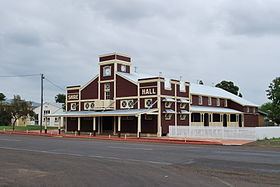
Surat has a public library, a Cobb & Co changing station, social history museum, theatre and shire hall and the Balonne gallery.
Heritage listings
Surat has a number of heritage-listed sites, including: