
Founded February 18, 1891 Congressional district 1st Website coconino.az.gov Population 136,539 (2013) Unemployment rate 5.7% (Apr 2015) | Area 48,332 km² | |
 | ||
Points of interest Meteor Crater, Walnut Canyon National, Wupatki National Monument, Lowell Observatory, Oak Creek Canyon Colleges and Universities | ||
Antelope canyon navajo nation coconino county arizona united states north america
Coconino County is a county located in the north central part of the U.S. state of Arizona. The population was 134,421 at the 2010 census. The county seat is Flagstaff. The county takes its name from Cohonino, a name applied to the Havasupai. It is the second-largest county by area in the contiguous United States, behind San Bernardino County, California, with its 18,661 square miles (48,300 km2) making it larger than each of the nine smallest states.
Contents
- Antelope canyon navajo nation coconino county arizona united states north america
- Map of Coconino County AZ USA
- History
- Geography
- Adjacent counties
- Indian reservations
- 2000 census
- 2010 census
- Cities
- Towns
- Ghost towns
- County population ranking
- Politics
- Economy
- Transportation
- References
Map of Coconino County, AZ, USA
Coconino County comprises the Flagstaff, AZ Metropolitan Statistical Area.
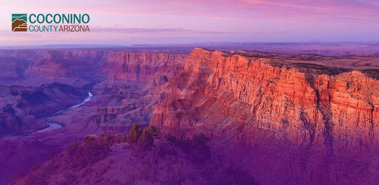
Coconino County contains Grand Canyon National Park, the Havasupai Nation, and parts of the Navajo Nation, Hualapai Nation, and Hopi Nation. It has a relatively large Native American population at nearly 30% of the county's total population, being mostly Navajo with smaller numbers of Havasupai, Hopi, and others.
The county was the setting for George Herriman's early-20th-century Krazy Kat comic strip.
History
After the building of the Atlantic & Pacific Railroad in 1883 the region of northern Yavapai County began experiencing rapid growth. The people of the northern reaches had tired of the rigors of travelling all the way to Prescott for county business. They also believed that they were a significant enough entity that they should have their own county jurisdiction. Therefore, they decided in 1887 to petition for secession from Yavapai and the creation of a new Frisco County. They remained part of Yavapai, however, until 1891 when Coconino County was formed and its seat declared to be Flagstaff.
Geography
According to the U.S. Census Bureau, the county has a total area of 18,661 square miles (48,330 km2), of which 18,619 square miles (48,220 km2) is land and 43 square miles (110 km2) (0.2%) is water. It is the largest county by area in Arizona and the second-largest county in the United States (excluding boroughs in Alaska) after San Bernardino County in California. It has more land area than each of the following U.S. states: Connecticut, Delaware, Hawaii, Maryland, Massachusetts, New Hampshire, New Jersey, Rhode Island, and Vermont.
The highest natural point in the county, as well as the entire state, is Humphreys Peak at 12,637 feet or 3,852 metres. The Barringer Meteor Crater is located in Coconino County.
Adjacent counties
Indian reservations
Coconino County has 7,142.42 square miles (18,498.8 km2) of federally designated Indian reservation, second only to Apache County. In descending order of area within the county, the reservations are the Navajo Indian Reservation, Hualapai Indian Reservation, Hopi Indian Reservation, Havasupai Indian Reservation, and the Kaibab Indian Reservation. The Havasupai Reservation is the only one that lies entirely within the county's borders.
2000 census
As of the 2000 census, there were 116,320 people, 40,448 households, and 26,938 families residing in the county. The population density was 6 people per square mile (2/km2). There were 53,443 housing units at an average density of 3 per square mile (1/km2). The racial makeup of the county was 63.09% White, 28.51% Native American, 1.04% Black or African American, 0.78% Asian, 0.09% Pacific Islander, 4.13% from other races, and 2.36% from two or more races. 10.94% of the population were Hispanic or Latino of any race. 18.59% reported speaking Navajo at home, while 6.58% speak Spanish.
There were 40,448 households out of which 34.90% had children under the age of 18 living with them, 49.70% were married couples living together, 12.20% had a female householder with no husband present, and 33.40% were non-families. 22.10% of all households were made up of individuals and 4.50% had someone living alone who was 65 years of age or older. The average household size was 2.80 and the average family size was 3.36.
In the county, the population was spread out with 28.70% under the age of 18, 14.40% from 18 to 24, 29.20% from 25 to 44, 20.70% from 45 to 64, and 7.00% who were 65 years of age or older. The median age was 30 years. For every 100 females there were 99.70 males. For every 100 females age 18 and over, there were 97.20 males.
The median income for a household in the county was $38,256, and the median income for a family was $45,873. Males had a median income of $32,226 versus $25,055 for females. The per capita income for the county was $17,139. About 13.10% of families and 18.20% of the population were below the poverty line, including 22.30% of those under age 18 and 13.30% of those age 65 or over.
2010 census
As of the 2010 United States Census, there were 134,421 people, 46,711 households, and 29,656 families residing in the county. The population density was 7.2 inhabitants per square mile (2.8/km2). There were 63,321 housing units at an average density of 3.4 per square mile (1.3/km2). The racial makeup of the county was 61.7% white, 27.3% American Indian, 1.4% Asian, 1.2% black or African American, 0.1% Pacific islander, 5.2% from other races, and 3.1% from two or more races. Those of Hispanic or Latino origin made up 13.5% of the population. In terms of ancestry, 14.5% were German, 9.9% were English, 9.6% were Irish, and 2.7% were American.
Of the 46,711 households, 33.1% had children under the age of 18 living with them, 45.0% were married couples living together, 12.7% had a female householder with no husband present, 36.5% were non-families, and 24.5% of all households were made up of individuals. The average household size was 2.69 and the average family size was 3.26. The median age was 31.0 years.
The median income for a household in the county was $49,510 and the median income for a family was $58,841. Males had a median income of $42,331 versus $31,869 for females. The per capita income for the county was $22,632. About 11.6% of families and 18.6% of the population were below the poverty line, including 22.5% of those under age 18 and 13.8% of those age 65 or over.
Cities
Towns
Ghost towns
Indian reservations
County population ranking
The population ranking of the following table is based on the 2010 census of Coconino County.
† county seat
Politics
Like many counties possessing major ski resorts, Coconino County has trended towards the Democratic Party in modern times after being a Republican stronghold between the 1950s and 1980s. It was won by every Republican Presidential nominee between 1952 and 1988; however no Republican since George Bush senior in 1988 has managed to come within six percentage points of reclaiming the county.
Economy
Grand Canyon Airlines and Air Grand Canyon are headquartered on the grounds of Grand Canyon National Park Airport in Tusayan.
Transportation
Flagstaff in Coconino County is a major highway junction, with Interstate 40 extending to the east and the west (connecting with Williams and Winslow, Arizona, for example), and with Interstate 17 extending south from Flagstaff to Phoenix and Maricopa County. U.S. Routes 89 and 180 extend north from Flagstaff and connect it with the Grand Canyon National Park.
The Grand Canyon National Park Airport is a public airport located in Tusayan, near the South Rim of the Grand Canyon.
Flagstaff Pulliam Airport is a public airport located four miles (6 km) south of the central business district of Flagstaff, it is mostly used for general aviation but is also served by two commercial airlines.
There is a Greyhound Bus Lines station in Flagstaff, with regular service east-west along Interstate 40, and also north-south service to Phoenix along Interstate 17.
AMTRAK has passenger railroad stations in Flagstaff and Williams, with daily service on the Southwest Chief to the east towards Chicago, and to the west towards Los Angeles.
The Grand Canyon Railway, a tourist railroad, links Williams with the canyon's South Rim in the Grand Canyon National Park and has service every day except Christmas.
The Mountain Line provides public transportation bus service in the Flagstaff area.