
Founded March 21, 1895 Congressional district 1st Website www.navajocountyaz.gov Population 107,322 (2013) University Northland Pioneer College | Area 25,796 km² | |
 | ||
Rivers Little Colorado River, Black River, Canyon Creek Destinations Points of interest Monument Valley, Fool Hollow Lake, Homolovi State Park, Clear Creek Reservoir, Rainbow Lake | ||
Navajo County is located in the northern part of the U.S. state of Arizona. As of the 2010 census, its population was 107,449. The county seat is Holbrook.
Contents
- Map of Navajo County AZ USA
- History
- Geography
- Adjacent counties
- Indian reservations
- National protected areas
- 2000 census
- 2010 census
- Politics
- Education
- Airports
- Cities
- Towns
- Other communities
- County population ranking
- References
Map of Navajo County, AZ, USA
Navajo County comprises the Show Low, AZ Micropolitan Statistical Area.
Navajo County contains parts of the Hopi Indian reservation, the Navajo Nation and Fort Apache Indian Reservation.
History
Navajo County was split from Apache County on March 21, 1895. The first county sheriff was legendary gunman Commodore Perry Owens, who had previously served as the sheriff of Apache County. It was the location for many of the events that played out during the Pleasant Valley War.
Geography
According to the U.S. Census Bureau, the county has a total area of 9,960 square miles (25,800 km2), of which 9,950 square miles (25,800 km2) is land and 9.3 square miles (24 km2) (0.09%) is water.
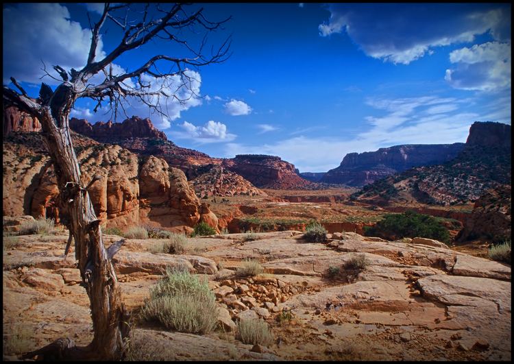
Many people think that Arizona is a vast, open desert without vegetation. However, Navajo County offers not only the Monument Valley, but Keams Canyon, part of the Petrified Forest National Park, and the largest stand of Ponderosa Pines in North America.
Adjacent counties
Indian reservations
Navajo County has 6,632.73 square miles (17,178.7 km2) of federally designated Indian reservation within its borders, the third most of any county in the United States (neighboring Apache County and Coconino County are first and second). In descending order of territory within the county, the reservations are the Navajo Indian Reservation, Hopi Indian Reservation, and Fort Apache Indian Reservation, all of which are partly located within Navajo County.
National protected areas
2000 census
As of the 2000 census, there were 97,470 people, 30,043 households, and 23,073 families residing in the county. The population density was 10 people per square mile (4/km²). There were 47,413 housing units at an average density of 5 per square mile (2/km²). The racial makeup of the county was 47.74% Native American, 45.91% White, 0.88% Black or African American, 0.33% Asian, 0.05% Pacific Islander, 3.15% from other races, and 55.94% from two or more races. 8.22% of the population were Hispanic or Latino of any race. 24.77% reported speaking Navajo at home, 5.94% other Southern Athabaskan languages, 4.71% Spanish, and 3.23% Hopi.
There were 30,043 households out of which 40.50% had children under the age of 18 living with them, 55.50% were married couples living together, 16.30% had a female householder with no husband present, and 23.20% were non-families. 19.90% of all households were made up of individuals and 7.20% had someone living alone who was 65 years of age or older. The average household size was 3.17 and the average family size was 3.68.
In the county, the population was spread out with 35.40% under the age of 18, 8.80% from 18 to 24, 25.30% from 25 to 44, 20.40% from 45 to 64, and 10.00% who were 65 years of age or older. The median age was 30 years. For every 100 females there were 98.70 males. For every 100 females age 18 and over, there were 97.20 males.
The median income for a household in the county was $28,569, and the median income for a family was $32,409. Males had a median income of $30,509 versus $21,621 for females. The per capita income for the county was $11,609. About 23.40% of families and 29.50% of the population were below the poverty line, including 36.60% of those under age 18 and 20.30% of those age 65 or over.
2010 census
As of the 2010 United States Census, there were 107,449 people, 35,658 households, and 25,923 families residing in the county. The population density was 10.8 inhabitants per square mile (4.2/km2). There were 56,938 housing units at an average density of 5.7 per square mile (2.2/km2). The racial makeup of the county was 49.3% white, 43.4% American Indian, 0.9% black or African American, 0.5% Asian, 0.1% Pacific islander, 3.4% from other races, and 2.5% from two or more races. Those of Hispanic or Latino origin made up 10.8% of the population. In terms of ancestry, 13.7% were German, 12.5% were English, 9.3% were Irish, and 2.3% were American.
Of the 35,658 households, 39.2% had children under the age of 18 living with them, 49.1% were married couples living together, 17.1% had a female householder with no husband present, 27.3% were non-families, and 23.0% of all households were made up of individuals. The average household size was 2.95 and the average family size was 3.50. The median age was 34.7 years.
The median income for a household in the county was $39,774 and the median income for a family was $45,906. Males had a median income of $41,516 versus $28,969 for females. The per capita income for the county was $16,745. About 19.1% of families and 24.4% of the population were below the poverty line, including 32.6% of those under age 18 and 12.4% of those age 65 or over.
Politics
Navajo County leans towards the Republican Party. Although its Native American population makes up nearly half of the county, a demographic that politically favors those of the Democratic Party, the county has a strong LDS presence (particularly in population centers such as Snowflake) that normally allows Republican candidates to carry the county by small margins.
Education
School districts that serve the county include:
Airports
The following public-use airports are located within the county:
Cities
Towns
Other communities
Indian reservations
County population ranking
The population ranking of the following table is based on the 2010 census of Navajo County.
† county seat