
Founded November 9, 1864 Congressional districts 1st, 4th Website www.mohavecounty.us Population 203,030 (2013) Unemployment rate 7.5% (Apr 2015) | Area 34,864 km² | |
 | ||
Colleges and Universities Mohave Community College, All Beauty College, Charles of Italy Beauty College Destinations Points of interest Hoover Dam, London Bridge, Lake Mead National Recreatio, Davis Dam, Virgin River | ||
Gun registration mohave county arizona
Mohave County is in the northwestern corner of the U.S. state of Arizona. As of the 2010 census, its population was 200,186. The county seat is Kingman, and the largest city is Lake Havasu City.
Contents
- Gun registration mohave county arizona
- Map of Mohave County AZ USA
- Mohave county arizona s beautiful mountains
- History
- Geography
- Adjacent counties
- National protected areas
- 2000 census
- 2010 census
- Politics government and infrastructure
- Education
- Unified school districts
- High school districts
- Elementary school districts
- Colleges
- Airports
- Cities
- Towns
- Unincorporated communities
- Indian reservations
- County population ranking
- References
Map of Mohave County, AZ, USA
Mohave County comprises the Lake Havasu City-Kingman, AZ Metropolitan Statistical Area, which is also included in the Las Vegas-Henderson, NV-AZ Combined Statistical Area.
Mohave County contains parts of Grand Canyon National Park and Lake Mead National Recreation Area and all of the Grand Canyon-Parashant National Monument. The Kaibab, Fort Mojave and Hualapai Indian Reservations also lie within the county.
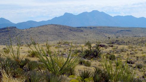
Mohave county arizona s beautiful mountains
History
Mohave County was the one of four original Arizona Counties created by the 1st Arizona Territorial Legislature. The county territory was originally defined as being west of longitude 113° 20' and north of the Bill Williams River. Pah-Ute County was created from it in 1865 and was merged back into Mohave County in 1871 when much of its territory was ceded to Nevada in 1866. The county's present boundaries were established in 1881. Mohave County has had five county seats: Mohave City (1864-1867), Hardyville (1867-1873), Cerbat (1873-1877), Mineral Park (1877-1887), and Kingman (1887–Present).
Geography
According to the U.S. Census Bureau, the county has a total area of 13,461 square miles (34,860 km2), of which 13,311 square miles (34,480 km2) is land and 150 square miles (390 km2) (1.1%) is water. It is the second-largest county by area in Arizona and the fifth-largest in the contiguous United States.
The county consists of two sections divided by the Grand Canyon, with no direct land communication between them. The northern section, smaller and less populated, forms the western part of the Arizona Strip, bordering Utah and Nevada. The larger southern section, borders Nevada and California across the Colorado River, which forms most of the county's western boundary. The southern section includes Kingman, the county seat, and other cities, as well as part of the Mojave Desert.
Adjacent counties
Mohave County and its adjacent counties form the largest such block of counties outside of Alaska. Their combined land area is 89,567.34 square miles (231,978.3 km2), or larger than that of the state of Idaho. They include the #1 (San Bernardino), #2 (Coconino), #5 (Mohave), and #7 (Lincoln) largest counties outside of Alaska.
National protected areas
There are 18 official wilderness areas in Mohave County that are part of the National Wilderness Preservation System. Most of these are managed by the Bureau of Land Management, but some are integral parts of the preceding protected areas, or have shared jurisdiction with the BLM. Some extend into neighboring counties (as indicated below) All wilderness areas within Grand Canyon-Parashant NM are managed by BLM, although the National Monument shares management with the National Park Service:
2000 census
As of the 2000 census, there were 155,032 people, 62,809 households, and 43,401 families residing in the county. The population density was 12 people per square mile (4/km²). There were 80,062 housing units at an average density of 6 per square mile (2/km²). The racial makeup of the county was 90.06% White, 0.54% Black or African American, 2.41% Native American, 0.77% Asian, 0.11% Pacific Islander, 4.00% from other races, and 2.13% from two or more races. 11.08% of the population were Hispanic or Latino of any race.
There were 62,809 households out of which 25.10% had children under the age of 18 living with them, 55.10% were married couples living together, 9.30% had a female householder with no husband present, and 30.90% were non-families. 24.10% of all households were made up of individuals and 11.30% had someone living alone who was 65 years of age or older. The average household size was 2.45 and the average family size was 2.87.
In the county, the population was spread out with 23.10% under the age of 18, 6.50% from 18 to 24, 23.20% from 25 to 44, 26.70% from 45 to 64, and 20.50% who were 65 years of age or older. The median age was 43 years. For every 100 females there were 98.90 males. For every 100 females age 18 and over, there were 96.80 males.
The median income for a household in the county was $31,521, and the median income for a family was $36,311. Males had a median income of $28,505 versus $20,632 for females. The per capita income for the county was $16,788. About 9.80% of families and 13.90% of the population were below the poverty line, including 20.40% of those under age 18 and 7.70% of those age 65 or over.
By 2006 Census Bureau estimates placed the population of Mohave County at 193,035. This represented a 24.5% increase in the population since 2000.
2010 census
As of the 2010 United States Census, there were 200,186 people, 82,539 households, and 54,036 families residing in the county. The population density was 15.0 inhabitants per square mile (5.8/km2). There were 110,911 housing units at an average density of 8.3 per square mile (3.2/km2). The racial makeup of the county was 86.9% white, 2.2% American Indian, 1.1% Asian, 0.9% black or African American, 0.2% Pacific islander, 6.0% from other races, and 2.7% from two or more races. Those of Hispanic or Latino origin made up 14.8% of the population. In terms of ancestry, 23.1% were German, 16.2% were Irish, 15.6% were English, 5.7% were Italian, and 4.5% were American.
Of the 82,539 households, 24.5% had children under the age of 18 living with them, 49.5% were married couples living together, 10.4% had a female householder with no husband present, 34.5% were non-families, and 26.7% of all households were made up of individuals. The average household size was 2.39 and the average family size was 2.86. The median age was 47.6 years.
The median income for a household in the county was $39,785 and the median income for a family was $47,530. Males had a median income of $36,222 versus $28,060 for females. The per capita income for the county was $21,523. About 11.6% of families and 16.1% of the population were below the poverty line, including 24.7% of those under age 18 and 7.0% of those age 65 or over.
Politics, government and infrastructure
Mohave County, in accordance with its cultural ties with conservative Mormon Utah, is powerfully Republican. No Democratic presidential nominee has carried Mohave County since Lyndon Johnson – ironically against Arizona native Barry Goldwater – did so in 1964, and even Johnson won by only 152 votes. In recent elections it has become common for Democratic nominees to receive less than thirty percent of the county’s vote, and Hillary Clinton in 2016 received less than 22 percent. Since 2008, Mohave has taken over from Graham and Yavapai as the “reddest” county in the state, and in 2016 it stood as such by twenty percentage points.
The Mohave County Administration Building is located in downtown Kingman at 700 West Beale Street. The old County Complex, which the Administration Building replaced, was located adjacent to the courthouse on Spring Street and 4th Street. The Mohave County Superior Courthouse, built in 1915, is an Art Deco/Streamline Moderne building on the National Register of Historic Places. The county jail is adjacent to the County Administration Building at 501 S. Highway 66.
Arizona State Prison - Kingman, a privately run prison of the Arizona Department of Corrections, is located in unincorporated Mohave County near Golden Valley and Kingman.
Education
The following school districts and colleges serve Mohave County
Unified school districts
High school districts
Elementary school districts
Colleges
Airports
The following public use airports are located in Mohave County:
Cities
Towns
Unincorporated communities
Indian reservations
County population ranking
The population ranking of the following table is based on the 2010 census of Mohave County.
† county seat