
- elevation 7,466 ft (2,276 m) Basin area 59,324 km² Bridges Natural Pier Bridge | - elevation 6,882 ft (2,098 m) Length 499 km | |
 | ||
Similar | ||
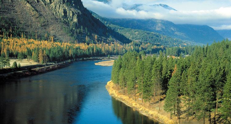
Beautiful flight to clark fork river and delta area
The Clark Fork, or the Clark Fork of the Columbia River, is a river in the U.S. states of Montana and Idaho, approximately 310 miles (500 km) long. The largest river by volume in Montana, it drains an extensive region of the Rocky Mountains in western Montana and northern Idaho in the watershed of the Columbia River. The river flows northwest through a long valley at the base of the Cabinet Mountains and empties into Lake Pend Oreille in the Idaho Panhandle. The Pend Oreille River in Idaho, Washington, and British Columbia, Canada which drains the lake to the Columbia in Washington, is sometimes included as part of the Clark Fork, giving it a total length of 479 miles (771 km), with a drainage area of 25,820 square miles (66,900 km2). In its upper 20 miles (32 km) in Montana near Butte, it is known as Silver Bow Creek. Interstate 90 follows much of the upper course of the river from Butte to northwest of Missoula. The highest point within the river's watershed is Mount Evans at 10,641 feet (3,243 m) in Deer Lodge County, Montana along the Continental Divide.
Contents
- Beautiful flight to clark fork river and delta area
- Map of Clark Fork Idaho USA
- Clark fork river whitewater rafting
- DescriptionEdit
- HistoryEdit
- ConservationEdit
- Additional readingEdit
- References
Map of Clark Fork, Idaho, USA
The Clark Fork is a Class I river for recreational purposes in Montana from Warm Springs Creek to the Idaho border.
The Clark Fork should not be confused with the Clarks Fork of the Yellowstone River, which is located in Montana and Wyoming.
Clark fork river whitewater rafting
DescriptionEdit
It rises as Silver Bow Creek in southwestern Montana, less than 5 miles (8.0 km) from the Continental Divide near downtown Butte, from the confluence of Basin and Blacktail creeks. It flows northwest and north through a valley in the mountains, passing east of Anaconda, where it changes its name to the Clark Fork at the confluence with Warm Springs Creek, then northwest to Deer Lodge. Near Deer Lodge it receives the Little Blackfoot River. From Deer Lodge it flows generally northwest across western Montana, passing south of the Garnet Range toward Missoula. Five miles east of Missoula, the river receives the Blackfoot River.
Northwest of Missoula, the river continues through a long valley along the northeast flank of the Bitterroot Range, through the Lolo National Forest. It receives the Bitterroot River from the south-southwest approximately 5.5 miles (8.9 km) west of downtown Missoula. Along the Cabinet Mountains the river receives the Flathead River from the east near Paradise. It receives the Thompson River from the north near Thompson Falls in southern Sanders County.
At Noxon, Montana, along the Cabinet Mountains and the northern end of the Bitterroots near the Idaho border, the river is impounded by the Noxon Rapids Dam to form a 20-mile-long (32 km) reservoir. It crosses into eastern Bonner County in north Idaho between the towns of Heron, Montana and the town of Cabinet, Idaho. Approximately 8 miles (13 km) west of the Idaho–Montana border, the river enters the north eastern end of Lake Pend Oreille, near the town of Clark Fork.
HistoryEdit
During the last ice age, from approximately 20,000 years ago, the Clark Fork Valley lay along the southern edge of the Cordilleran ice sheet covering western North America. The encroachment of the ice sheet formed an ice dam on the river, creating Glacial Lake Missoula which stretched through the Clark Fork Valley across central Montana. The periodic rupturing and rebuilding of the ice dam released the Missoula Floods, a series of catastrophic floods down the Clark Fork and Pend Oreille into the Columbia which sculpted many of the geographic features of eastern Washington and the Willamette Valley of Oregon.
In the 19th century the Clark Fork Valley was inhabited by the Flathead tribe of Native Americans. It was explored by Meriwether Lewis of the Lewis and Clark Expedition during the 1806 return trip from the Pacific. The river is named for William Clark. A middle segment of the river in Montana was formerly known as the Missoula River. The river was also referred to as the Deer Lodge River by Granville Stuart.
In 1809, David Thompson of the North West Company explored the region and founded several fur trading posts, including Kullyspell House at the mouth of the Clark Fork, and Saleesh House on the river near the present-day site of Thompson Falls, Montana. Thompson used the name Saleesh River for the entire Flathead-Clark Fork-Pend Oreille river system. For most of the first half of the 19th century the Clark Fork river and surrounding region was controlled by the British-Canadian North West Company and Hudson's Bay Company.
In the mid-19th Century the Clark Fork River wound through the valley where cattle had replaced bison. This was when Conrad Kohrs purchased a ranch from Johnny Grant that is now called the Grant-Kohrs Ranch, a National Historic Site and Federal Park. For a history of the river and the people, see Grant-Kohrs family and history of Clark Fork River region.
The Clark Fork and the Blackfoot River experienced a record flood in 1908.
Since the late 19th century many areas in the watershed of the river have been extensively mined for minerals, resulting in an ongoing stream pollution problem. Most pollution has come from the copper mines in Butte and the smelter in Anaconda. Many of the most polluted areas have been designated as Superfund sites. Nevertheless, the river and its tributaries are among the most popular destinations for fly fishing in the United States.
Today, the Clark Fork watershed encompasses the largest Superfund site in America. As a mega-site, it includes three major sites: Butte, Anaconda, and Milltown Dam/Clark Fork River's Milltown Reservoir Superfund Site. Each of these major sites is split up into numerous sub-sites known as Operable Units. Remediation and/or restoration of these sites is ongoing.