
Named for Edwin L. Bonner Website bonnercounty.us Founded 1907 | Largest city Sandpoint Area 4,970 km² Population 40,699 (2013) Unemployment rate 6.0% (Apr 2015) | |
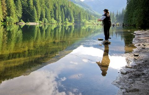 | ||
Points of interest Lake Pend Oreille, Schweitzer Mountain, 49 Degrees North Ski, Riley Creek Recreatio, Travers Park Destinations | ||
Bonner County is a county located in the northern part of the U.S. state of Idaho. As of the 2010 census, the population was 40,877. The county seat and largest city is Sandpoint. Partitioned from Kootenai County and established in 1907, it was named for Edwin L. Bonner, a ferry operator.
Contents
- Map of Bonner County ID USA
- History
- Geography
- Adjacent counties
- National protected areas
- Major highways
- 2000 census
- 2010 census
- Census designated place
- Ski area
- References
Map of Bonner County, ID, USA
Bonner County comprises the Sandpoint, ID Micropolitan Statistical Area.
History
Bonner County was formed on February 21, 1907. It was named for travel entrepreneur Edwin L. Bonner, a ferry operator.
In 1864, the Idaho Legislature created the counties of Lah-Toh and Kootenai. Kootenai County initially covered all of present-day Bonner and Boundary counties and a portion of present-day Kootenai County. It also overlapped a portion of the existing boundary of Shoshone County. Sin-na-ac-qua-teen, a trading post located in present-day Bonner County on the south shore of the Pend Oreille River near Laclede, was named county seat. The government of Kootenai failed to organize due to lack of settlement within the county boundary. In 1867, the legislature repealed the act creating the two counties and instead consolidated both into a county retaining the name of Kootenai. Rathdrum became the county seat when Kootenai County finally organized in 1881.
The tiny portion of Bonner County located south of the 48th parallel and east of Shoshone County was not located in any of Idaho's counties from 1863 to 1907, the longest time frame any non-county area existed in the State of Idaho. The Idaho panhandle north of the Clearwater River's basin was in Spokane County, Washington prior to Idaho's creation as a territory in 1863. When Idaho defined its original counties by February, 1864, it attached the former Spokane County area to Nez Perce County for judicial purposes. Legislators creating Kootenai County in December 1864 lacked knowledge of the geography of the area and failed to fully include the non-county area within the county boundaries of Kootenai or Lah-Toh. The non-county area was fully included within Bonner County when it was formed in 1907.
Boundary County was formed from Bonner County in 1915.
Geography
According to the U.S. Census Bureau, the county has a total area of 1,919 square miles (4,970 km2), of which 1,735 square miles (4,490 km2) is land and 185 square miles (480 km2) (9.6%) is water.
Adjacent counties
National protected areas
Major highways
2000 census
As of the census of 2000, there were 36,835 people, 14,693 households, and 10,270 families residing in the county. The population density was 21 people per square mile (8/km²). There were 19,646 housing units at an average density of 11 per square mile (4/km²). The racial makeup of the county was 96.58% White, 0.11% Black or African American, 0.87% Native American, 0.27% Asian, 0.05% Pacific Islander, 0.42% from other races, and 1.70% from two or more races. 1.64% of the population were Hispanic or Latino of any race. 20.9% were of German, 11.7% English, 11.7% American, 9.6% Irish and 5.3% Norwegian ancestry according to Census 2000.
There were 14,693 households out of which 30.60% had children under the age of 18 living with them, 58.60% were married couples living together, 7.50% had a female householder with no husband present, and 30.10% were non-families. 24.00% of all households were made up of individuals and 8.20% had someone living alone who was 65 years of age or older. The average household size was 2.49 and the average family size was 2.94.
In the county, the population was spread out with 25.50% under the age of 18, 6.70% from 18 to 24, 25.40% from 25 to 44, 29.30% from 45 to 64, and 13.10% who were 65 years of age or older. The median age was 41 years. For every 100 females there were 100.30 males. For every 100 females age 18 and over, there were 98.20 males.
The median income for a household in the county was $32,803, and the median income for a family was $37,930. Males had a median income of $32,504 versus $21,086 for females. The per capita income for the county was $17,263. About 11.90% of families and 15.50% of the population were below the poverty line, including 21.20% of those under age 18 and 10.20% of those age 65 or over.
2010 census
As of the 2010 United States Census, there were 40,877 people, 17,100 households, and 11,591 families residing in the county. The population density was 23.6 inhabitants per square mile (9.1/km2). There were 24,669 housing units at an average density of 14.2 per square mile (5.5/km2). The racial makeup of the county was 96.0% white, 0.8% American Indian, 0.5% Asian, 0.1% Pacific islander, 0.1% black or African American, 0.4% from other races, and 2.1% from two or more races. Those of Hispanic or Latino origin made up 2.2% of the population. In terms of ancestry, 25.4% were German, 15.3% were Irish, 15.2% were English, 6.2% were Norwegian, and 5.0% were American.
Of the 17,100 households, 27.2% had children under the age of 18 living with them, 55.3% were married couples living together, 7.9% had a female householder with no husband present, 32.2% were non-families, and 26.0% of all households were made up of individuals. The average household size was 2.37 and the average family size was 2.82. The median age was 45.8 years.
The median income for a household in the county was $41,943 and the median income for a family was $51,377. Males had a median income of $40,076 versus $30,829 for females. The per capita income for the county was $24,745. About 10.1% of families and 14.3% of the population were below the poverty line, including 22.3% of those under age 18 and 6.7% of those age 65 or over.