
Country United States Time zone Mountain (MST) (UTC-7) Elevation 779 m Zip code 59873 Local time Thursday 6:05 PM | Established 1910 FIPS code 30-73825 Area 4.48 km² Population 1,338 (2013) Area code 406 | |
 | ||
Weather 10°C, Wind NW at 6 km/h, 56% Humidity | ||
Captian carpet 406 827 4443 thompson falls montana
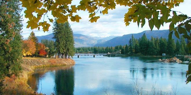
Thompson Falls is a city in and the county seat of Sanders County, Montana, United States. The population was 1,313 at the 2010 census.
Contents
- Captian carpet 406 827 4443 thompson falls montana
- Map of Thompson Falls MT 59873 USA
- History
- Geography
- Ecology
- 2010 census
- 2000 census
- Education
- References
Map of Thompson Falls, MT 59873, USA
History
Thompson Falls was named after British explorer, geographer and fur trader David Thompson, who founded a North West Company fur trading post called Saleesh House in 1809. The community is located next to natural waterfalls on the Clark Fork river. The arrival of the railroad in 1881 brought the first real activity to the area. Two years later, when the gold rush hit nearby Cœur d'Alene, the town grew to accommodate the men going over the Murray Trail to the mines. In 1885 John Russell bought 40 acres (160,000 m2) and plotted the town site.
Thompson Falls was established in 1910.
The Thompson Falls Dam, in operation since 1915, was constructed atop the original falls.
Geography
Thompson Falls is located at 47°35′48″N 115°20′37″W (47.596587, -115.343730) in the Clark Fork Valley at an elevation of 2,419 feet (737 m).
According to the United States Census Bureau, the city has a total area of 1.73 square miles (4.48 km2), all of it land.
Ecology
An amphibian, the rough-skinned newt, has a population at Thompson Falls which is noncontiguous with the remainder of the Western US population of the species.
2010 census
As of the census of 2010, there were 1,313 people, 618 households, and 362 families residing in the city. The population density was 759.0 inhabitants per square mile (293.1/km2). There were 681 housing units at an average density of 393.6 per square mile (152.0/km2). The racial makeup of the city was 94.9% White, 0.2% African American, 1.6% Native American, 0.5% Asian, 0.6% from other races, and 2.1% from two or more races. Hispanic or Latino of any race were 1.6% of the population.
There were 618 households of which 24.9% had children under the age of 18 living with them, 46.1% were married couples living together, 9.1% had a female householder with no husband present, 3.4% had a male householder with no wife present, and 41.4% were non-families. 37.4% of all households were made up of individuals and 19.4% had someone living alone who was 65 years of age or older. The average household size was 2.11 and the average family size was 2.73.
The median age in the city was 46.2 years. 21.2% of residents were under the age of 18; 5.3% were between the ages of 18 and 24; 22.1% were from 25 to 44; 28.6% were from 45 to 64; and 22.7% were 65 years of age or older. The gender makeup of the city was 48.7% male and 51.3% female.
2000 census
As of the census of 2000, there were 1,321 people, 549 households, and 357 families residing in the city. The population density was 708.5 people per square mile (274.2/km²). There were 619 housing units at an average density of 332.0 per square mile (128.5/km²). The racial makeup of the city was 96.74% White, 0.23% African American, 1.44% Native American, 0.15% Asian, 0.08% from other races, and 1.36% from two or more races. Hispanic or Latino of any race were 0.98% of the population.
There were 549 households out of which 28.1% had children under the age of 18 living with them, 53.7% were married couples living together, 9.1% had a female householder with no husband present, and 34.8% were non-families. 31.0% of all households were made up of individuals and 14.9% had someone living alone who was 65 years of age or older. The average household size was 2.36 and the average family size was 2.92.
In the city, the population was spread out with 25.1% under the age of 18, 6.4% from 18 to 24, 24.3% from 25 to 44, 27.2% from 45 to 64, and 17.0% who were 65 years of age or older. The median age was 41 years. For every 100 females there were 95.4 males. For every 100 females age 18 and over, there were 92.0 males.
The median income for a household in the city was $28,103, and the median income for a family was $31,544. Males had a median income of $28,125 versus $18,333 for females. The per capita income for the city was $13,245. About 13.6% of families and 16.1% of the population were below the poverty line, including 20.2% of those under age 18 and 18.6% of those age 65 or over.
Education
Thompson Falls is served by the Thompson Falls Public Schools School District. The district has an elementary school, middle school and high school. Students attend Thompson Falls High School, a Class B school. It offers eight sports to its students.