
Website Official website Literacy 82.1% | Major highways NH-6 Area 9,640 km² Average annual precipitation 946 | |
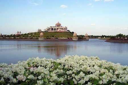 | ||
Tehsils Buldhana, Chikhli, Deulgaon Raja, Khamgaon, Shegaon, Malkapur, Motala, Nandura, Mehkar, Lonar, Sindkhed Raja, Jalgaon Jamod, Sangrampur Points of interest Lonar crater lake, Shri Balaji Temple, Daityasudan Temple Lonar, Mauli Fun N Food, Jijau Sushti Colleges and Universities Shri Sant Gajanan Maharaj, Rajarshi Shahu College o, Siddhivinayak Technical Campus | ||
Lonar crater lake information english subtitles
Buldhana district (Marathi: बुलढाणा जिल्हा) is a district in the Amravati division of Maharashtra state in western India. It is situated at the westernmost border of Vidarbha region of Maharashtra and is 500 km from the state capital, Mumbai. It is bounded by Madhya Pradesh on the north, Akola, Washim, and Amravati districts on the east, Jalna district on the south, and Jalgaon and Aurangabad districts on the west. Buldhana is religiously important as the site of the Shri Gajanan Maharaj temple, at Shegaon.
Contents
- Lonar crater lake information english subtitles
- Map of Buldhana Maharashtra
- Origin of name
- History
- Some historical events
- Talukwise Religious Population Percentage
- Languages
- Buldhana district boundaries
- Buldhana district rivers
- Economy
- Representation
- Revenue subdivisions
- Revenue talukas
- Agriculture
- Hemadpanthi temples
- Police
- Transport Office
- Electricity
- Irrigation
- Public Works Department
- Transport and travel
- Railway
- National Highway
- State highways
- Major district roads
- Dist Near Town
- Airport
- Culture
- References
Map of Buldhana, Maharashtra
Origin of name
The name of the district is derived probably from Bhil Thana (place of Bhils, a tribal group).
History
Buldhana, along with the rest of Berar Province, was part of the kingdom of Vidarbha mentioned in the Mahabharata, a Sanskrit epic poem. Berar formed part of the Maurya Empire during the reign of Ashoka (272–231 BCE). Berar came under the rule of the Satavahana dynasty (2nd century BCE–2nd century CE), the Vakataka dynasty (3rd to 6th centuries), the Chalukya dynasty (6th to 8th centuries), the Rashtrakuta Dynasty (8th to 10th centuries), the Chalukyas again (10th to 12th centuries), and finally the Yadava dynasty of Devagiri (late 12th to early 14th centuries). A period of Muslim rule began when Alauddin Khilji, Sultan of Delhi, conquered the region in the early 14th century. The region was part of the Bahmani Sultanate, which broke away from the Delhi Sultanate in the mid-14th century. The Bahmani Sultanate broke up into smaller sultanates at the end of the 15th century, and in 1572 Berar became part of the Nizam Shahi sultanate, based at Ahmednagar. The Nizam Shahis ceded Berar to the Mughal Empire in 1595. As Mughal rule started to unravel at the start of the 18th century, Asaf Jah I, Nizam of Hyderabad, seized the southern provinces of the empire (including Berar) in 1724, forming an independent state.
In 1853, the district, together with the rest of Berar, came under the administration of the British East India Company. Berar was divided into East and West Berar with Buldhana district being included in West Berar. In 1903, Berar was leased by the Nizam of Hyderabad to the British Government of India.
Some historical events
Talukwise Religious Population Percentage
According to the 2011 census Buldhana district has a population of 2,588,039, roughly equal to the nation of Kuwait or the US state of Nevada. This gives it a ranking of 159th in India (out of a total of 640). The district has a population density of 268 inhabitants per square kilometre (690/sq mi) . Its population growth rate over the decade 2001-2011 was 15.93%. Buldana has a sex ratio of 928 females for every 1000 males, and a literacy rate of 82.09%.
Languages
Apart from the commonly used Marathi language, language used in the district includes Andh, an Indo-Aryan language spoken by 100,000 people.
Buldhana district boundaries
It is bounded by Madhya Pradesh on the north, Akola, Washim, and Amravati districts on the east, Jalna district on the south, and Jalgaon and Aurangabad districts on the west. The district boundary latitudes are 19.51° to 21.17° N and longitudes are 75.57° to 76.59° E.
The district boundary has been changed many times. In 1480, as part of Berar taraf (province) of Bahamani Sultanate, Chikhli and Mehkar were part of Mahur division and Malkapur, Jalgaon, and Khamgaon were part of Gawil. During Akbar's time (1542–1605), it was part of the Sarkars (administrative unit) of Narnala, Baitalwadi, and Mehkar. In 1634 the area became known as Payanghat Subah (Lowlands Province) while Chikli and Mehkar were part of Balaghat Subah (Highlands Province), but by 1636 Berar became part of a large province called Deccan. Around that time, Malkapur, Jalgaon, Badner Bholji Pimpalgaon Raja, Jepur and Rajur were important parganas (administrative units of the Delhi Sultanate.
In 1853 the district came into existence as North Berar district with Buldhana as its headquarters. It along with South Berar district with Hingoli as its headquarters constituted Berar Province. North Berar district included the present Amravati district, the northern half of Akola, and Buldhana. After the Indian Rebellion of 1857 Hingoli, along with the neighbouring countryside, was restored to the Nizam. Berar province was reconstituted into East Berar district with headquarters at Amaravati, and West Berar district with headquarters at Akola. After 1857 Mehkar, Chikhli, and Malkapur were part of West Berar district. In 1864 these three talukas were made independent as South-West Berar district, which was renamed Mehkar district in 1865.
In 1867 Buldhana district came into existence, combining North Berar and Mehkar districts. After the amalgamation of Berar with the Central Provinces in 1903, Buldhana district became the district of Central Provinces and Berar. In August 1905 Khamgaon and Jalgaon tehsils from Akola district of Central Provinces and Berar were combined into Buldhana district.
In 1950 it became part of Madhya Pradesh with Nagpur as its capital. In 1956, along with other Marathi-speaking regions of Vidarbha, it became part of Bombay State and part of Maharashtra State in 1960.
Buldhana district rivers
The district lies in the Tapi River and Godavari River basins. Purna River is a tributary of the Tapi River while the Penganga and Kadakpurna Rivers are tributaries of Godavari River.
Here are some of the rivers in Buldhana, with their tributaries.
Economy
Cotton, sorghum and other cereals, oil seeds, soybean, sunflower, and groundnuts are the predominant crops grown in the district.
Khamgaon and Malkapur are the major cotton trading towns in the district. The district has many minor and medium size irrigation projects. The important ones are Nalganga and Vaan. There are thirteen Agriculture Produce Market Committees-Main Market, one in each tehsil, and there are twenty sub-markets in the districts.
The Indian Council for Agriculture research funded a farm science centre Krishi Vigyan Kendra, Jalgaon Jamod in the district in 1994.
The district has major industrial areas at Khamgoan and Malkapur and has smaller industrial areas at Chikhli, Buldhana, Dasarkhed, Deoulgaonraja, Mehkar, Sangrampur, and Lonar.
Representation
The district contributes one seat to the Lok Sabha (Lower House), namely Buldhana (Lok Sabha constituency). Prataprao Ganpatrao Jadhav of Shiv Sena is the current Member of Parliament from Buldhana.
Balasaheb darade is the leading educated youngstar studied in USA and return to his homtown in buldhana and presently he is leading Buldhana district on development path.
The district has seven seats in the Maharashtra State legislature assembly: Buldhana, Chikhli, Sindhkhe Raja, Mehkar, Khamgaon, and Jalgoan Jamod. The seventh seat at Malkapur is part of Raver (Lok Sabha constituency) in Jalgaon district.
Revenue subdivisions
The district has six revenue subdivisions headed by a Sub Divisional Officer (SDO): Buldhana, Mehkar, Khamgaon, Malkapur, Jalgaon-Jamod and Sindkhedraja
Revenue talukas
As of 2010, the district of Buldhana comprises thirteen talukas (tehsils): Buldhana, Chikhli, Deulgaon Raja, Malkapur, Motala, Nandura, Mehkar, Sindkhed Raja, Lonar, Khamgaon, Shegaon, Jalgaon Jamod, and Sangrampur.
Each taluka/tehsil is headed by Tahsildar and assisted by Naib-Tahsildhar, Revenue Inspector and Talathis. Some of the revenue circles are Dhad, Raipur, Mhsala, Padali, Buldhana rural, Buldhana city, Mera, Undri, Amdapur, Eklara, Hatni, Kolara, Khairao, Chikhli rural, Chikhli town, Bibi, Sultanpur, Titavi, Lonar rural, Lonar town, Jalamb, Matargaon, Pahurjira, Manasgaon, Shegaon rural, and Shegaon town.
Agriculture
The district superintending agriculture officer comes under Divisional Joint Director of Amravati Division. There are three subdivisions at Buldhana, Khamgaon, and Mehkar with a taluka agriculture officer at each taluka.
There are multiple circles under each taluka. They are Dhad, Shelapur, Dhamangaon, Motala, Shelsur, Amdapur, Chikhli, Dharangaon, Malkapur, Janephal, Mehkar, Bibi, Lonar, Sakharkherda, Sindkhed Raja, Mera Khurd, Deulgaon Mahi, Deulgaon Raja, Ganeshpur, Pimpalgaon Raja (Khamgaon), Nandura, Shegaon, Jalgaon Jamod, Warwat Khanderao, and Sangrampur.
Hemadpanthi temples
Hemadpanthi temples are located at Mehkar-Sonati, Sindhkhed Raja (Nilkantheshwar), and Sakegaon on the Chikhli-Dhad road. Three Shiva temples are located in Dhotra (Nandai), a village on Deulgaon Raja-Chikhli road. Two Shiva temples are located in Kothali (Jaipur) near Motala and also a hemadpanthi mandir in warwand of lord shiva 10 km far from buldhana on khamgaon road.
Police
The district has five police subdivisions and twenty-nine police stations.
Transport Office
One Deputy Regional Transport Office is located in Buldhana district at District Headquarters. It enforces the Motor Vehicle Act and issues vehicle registration numbers in the district with the code MH-28..
Electricity
There is no electrical generating station in the district, but there is a good electricity transmission and distribution network.
There are two 22O kV substations at Buldhana and Chikhli, with Akola-Chikhli 220 kV line, 132kV substations at Buldhana, Dusarbid, Khamgaon, Malkapur, Mehkar, Motala and Warwat Bakal. The 132 kV lines runs as Chikhli-Dusarbid, Buldhana Tap, Khamgaon-Malkapur, Khamgaon-Jalamb Relay, Khamgaon Tap, Chikhli-Mehkar, Mekhar-Malegaon (Washim), Warwat Bakal Tap. The 685 km long 400 kV Koradi-Bhusawal transmission line passes through the district at Warwat Bakal.
The distribution comes under Amravati Zone and Buldhana Circle with Buldhana, Khamgaon, and Malkapur Divisions. Each subdivision caters to more nearby talukas and has 33KV distribution substations under them.
Irrigation
The district comes under Buldhana Irrigation Project Circle along with Akola and Washim district. The circle comes under Vidarbha Irrigation Development Corporation, Nagpur. It has its Major Project division at Shegaon, Kadakpurna at Deulgaon Raja, Mun Project division at Khamgaon, and Minor Irrigation Division at Chikhli and Akola.
The completed irrigation projects are Nalganga Project in Motala and a major project in Vaan having one-fourth of the benefit accrue to Akola district. Many further irrigation projects are under way or are in the planning stages.
Public Works Department
The district comes under Amravati Public Works Region and Akola Public Works Circle. It has one Public Works division at Buldhana with subdivision at Buldhana, Chikhli, Mehkar, and Deulgaon Raja; and a second, Khamgaon division, with subdivisions at Khamgaon, Jalgaon Jamod, and Malkapur; plus the Buldhana District Mechanical Subdivision.
There are Road Project subdivisions at Buldhana and Khamgaon under the Road Project Division of Akola. There is a separate Zilla Parishad Works Division at Buldhana with subdivisions at Buldhana, Kahmgaon, Mehkar, and Malkapur. The department manages Government Rest houses at Buldhana, Khamgaon, Shegaon, Malkapur, Motala, Jalgaon Jamod, Sangrampur, Chikhli, Amdapur, Lavhala (Mehkar), Mehkar, Dongaon, Deulgaon Raja, Deulgaon Mahi, Sindkhed Raja, Lonar, and Nandura.
Transport and travel
Motor bus, jeep, two-wheeler and railway are the popular modes of transport.
There are many Maharashtra State Road Transport Corporation bus stands in all towns of the district. There are State Transport bus depots at Buldhana, Malkapur, Chikhli, Mehkar, Khamgaon, Shegaon and Jalgaon-Jamod.
Railway
Electrified double-line broad-gauge railway passes through Malkapur, Nandura, and Shegaon Tehsils. It is under the Bhusawal-Badnera Section of Bhusawal Division of the Central Railway. This main line was originally under the Great Indian Peninsula Railway and the branch line between Jalamb and Khamgaon was under the Khamgaon State Railway.
The railway stations in the district, with their codes, are Khamkhed (KMKD), Malkapur (MKU), Wadoda (WDD), Biswa Bridge (BIS), Nandura (NN), Kumgaon Burti (KJL), Jalamb Junction (JM), Khamgaon (KMN), Shegaon (SEG), and Shrikshetra Nagzari (NGZ).
A computerised railway reservation facility is available at Buldhana,Malkapur and Shegaon, while manual reservation facility is available at City Booking Office, Khamgaon, Nandura, and Jalamb Junction.
National Highway
National Highway 6 - NH6 passes through Khamgaon, Nandura, and Malkapur towns in the district.
State highways
The following state highways connect various talukas and towns in the district. Vehicles from Nagpur, Amravati and Akola pass through Khamgaon–Chikhli–Deulgaonraja while going towards Jalna–Aurangabad and Pune.
The important roads in the district are:
Major district roads
Dist Near Town
1) 10 km to Buldana -Kamgaon-Sheganon. Tempal Kameshwar in Shiva Eknath Maharaj Temple
Airport
The nearest airport is at Aurangabad which is 150 km from district headquarters.
Culture
There is a fair called Chaitra Masa Suklapaksha Navami at Shegaon on Rama Navami in Chaitra (March or April) each year.
Common folk arts are Bhajan (devotional singing), Kirtan (devotional chanting with musical instruments), and Gondhal (a complex art form involving ritual acts, dances, songs, and poems).
Residents of Buldhana are bilingual in Korku language, Hindi or Marathi language. Nihali language, a language isolate of India, is spoken by some 2,000 people (1991) in the Buldana district of Maharashtra.
Youth Hostel Buldhana is one of two youth hostels in Maharashtra and is located near Zilla Crida Sankulan with a 50-bed dormitory and five double rooms.