
Language spoken | ||
 | ||
Map of Viluppuram
Viluppuram( pronunciation )(also spelled as Villupuram and Vizhupuram) is a municipality and the administrative headquarters of Viluppuram district, the largest district in the state of Tamil Nadu, India. It is well connected by both road and rail to all the important cities in Tamil Nadu. The town serves as a major railway junction, and National Highway 45 passes through it. With agriculture as its main source of income, As of Government of India 2014 data, Viluppuram had a population of 145874 and the town's literacy rate has been recorded as 90.16% by Census 2011.
Contents
- Map of Viluppuram
- Arakandanallur Viluppuram District
- Etymology
- History
- Geography
- Demographics
- Administration
- Places of interest
- Road
- Rail
- Air
- Climate
- References
Arakandanallur- Viluppuram District
In 1919, Viluppuram was officially constituted as a municipality, which today comprises 44 wards, making it the largest city and municipality in Viluppuram district.
Etymology
Viluppuram is named after a class of people known as "Vizhupparaiyar" (விழுப்பரையர்). One of the famous Tamil poets Jayamkondar wrote a book titled "Karanai Vizhupparaiyan madal" (also known as Aadhinatha Valamadal) on the praise of Aadhinathan Vizhupparaiyan who served as a commander in the army of Kulottunga Chola I. The town came to known after the "Vizhupparaiyan" sect named after him. They are also known as "Vizhupaadharaiyar".
Viluppuram is also affectionately called as "Vizhimaa Nagaram" (விழிமா நகரம்) in Tamil. It means a town with wide-eyed people.
History
The Chola were the early rulers. Among these rulers, Karikala Chola was the most famous and powerful.
For a short period, the Cholas were overthrown by Simhavishnu Pallava and the region came under the Pallava rule for some time. Vijayalaya Chola again revived Chola rule. This was the beginning of great Chola Empire. The later Chola rulers were weak and the power passed on to the hands of Eastern Chalukyas.
Cholas regained their lost position but with the rise of Jatavarman Sundara Pandya-1 (1251 A.D), Chola supremacy came to an end. The sway of Pandyas lasted for over 50 years, followed by Muslim domination from 1334 to 1378 A.D. By 1378, the region came under the rule of Vijayanagara Empire and Nayaks were appointed as the rulers of the region.
In 1677, Shivaji took Gingee area with the assistance of Golkonda forces. Then came the Mughals. During the Mughals regime, both the English and French acquired settlements in South Arcot. During the Anglo-French rivalry, the entire district was turned into a war land. After some time, the entire area came under the control of East India Company. It remained under British authority till 1947 when India became independent.
Geography
Viluppuram is located in 11° 56' N 79° 29' E. which is in the far southeast part of India, situated 160 kilometres (99 mi) south of Chennai, 160 kilometres (99 mi) north of Trichy, 177 kilometres (110 mi) east of Salem, 40 kilometres (25 mi) west of Pondicherry shares the seashore of the Bay of Bengal.
The area contains metamorphic rocks formed by pressure and heat belonging to the granite-like gneiss family. There are also three major groups of sedimentary rocks, layers of particles that settled in different geological periods. Kalrayan Hills forest park is located 116 kilometres (72 mi) to the west and Gingee Hills forest park 50 kilometres (31 mi) to the north. The Thatagiri Murugan Temple is about 191 kilometres (119 mi) to the southeast in Senthamangalam with the Lord Siva temple in Koppampatti 153 kilometres (95 mi) southwest of the town.
Demographics
As of the 2011 census, Viluppuram municipality was divided into 44 wards for which elections are held every five years and had a population of 1,45,874 of which 72,614 were male and 73,260 female. The population of children aged 0–6 was 10,217, which was 10.61% of the total population. The female sex ratio was 1,019 against a state average of 996. The child sex ratio was around 990 compared to the Tamil Nadu state average of 943. The literacy rate of Viluppuram City was 90.16%, higher than the state average of 80.09%. In Viluppuram, male literacy was around 94.93% while female literacy rate was 85.50%. Viluppuram Municipality had total administration over 22,832 houses to which it supplies basic amenities like water and sewerage. It is also authorized to build roads within Municipality limits and impose taxes on properties coming under its jurisdiction. Scheduled Castes (SC) constituted 12.53% of the people while Scheduled Tribes (ST) were 0.29%.
Out of the total population, 33,597 were engaged in work or business activity. Of this 26,828 were males while 6,769 were females. In census survey, the worker is defined as a person who does business, job or service, and cultivator and labor activity. Of total 33597 working population, 85.69% were engaged in Main Work while 14.31% of total workers were engaged in Marginal Work.
Administration
Politically, Viluppuram is part of the Villuppuram Lok Sabha constituency and the Viluppuram State Assembly constituency. The municipality was established in 1919 and was upgraded to a second-grade municipality in 1953, the first-grade municipality in 1973, and a selection grade municipality in 1988. It has a population of 145874 (2011 census) and an area of 8.36 square kilometres (3.23 sq mi). The town is divided into 44 wards. The municipal council is composed of 44 ward councilors and is headed by a chairperson elected by voters of the town. Councilors-elect a vice-chairperson among themselves while the executive wing is headed by a commissioner, who is assisted by a team of officials including the health officer, municipal engineer, town planning officer, manager, revenue officer and other staff.
Places of interest
Road
Viluppuram is well connected by roads to major cities and to the rest of the state. Villupuram has the longest National roads of any district in Tamil Nadu. The major national highways of the town are:
Besides the above-mentioned national highways, several state highways also run through the district and town.
The town has a lot of buses frequently to major cities such as Chennai, Tiruchirapalli, Bangalore, Madurai, Salem, Pondicherry, Vellore etc. The town also serves the frequent bus services to nearby towns like Cuddalore, Thiruvannamalai, Tindivanam, Kallakurichi etc. Viluppuram is also the headquarters of the Tamil Nadu State Transport Corporation(TNSTC) – Viluppuram Division(the erstwhile Thanthai Periyar Transport Corporation [TPTC]). It is one of the six Tamil Nadu State Transport Corporation divisions serving the state. Viluppuram Bus Station is one of the largest bus terminus by area in Tamil Nadu.
Rail
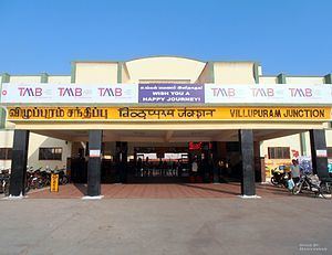
Viluppuram has a well-known railway station.It was first built under the British .The Viluppuram Railway Junction at Viluppuram serves as the distribution point of rail traffic from Chennai, the state capital of Tamil Nadu, towards the southern part of the state. It is one of the important junctions in Southern Railway. Five railway lines branch out of Viluppuram:
Viluppuram railway station has been undergone a massive infrastructure upgrade to handle this traffic.
Air
The nearest airport is Pondicherry Airport at Pondicherry, in Puducherry, approximately 40 km from Viluppuram. Pondicherry Airport is connected to Bangalore by commercial airlines.
The nearest major airport is the Chennai International Airport (MAA), approximately 147 km from the town; the next closest major airport is Tiruchirapalli Airport, approximately 160 km from the town.
Climate
Since the town is landlocked, the weather in Viluppuram is generally humid and hot. It relies on the monsoon for rain during October, November and December. Summers are very hot, and temperatures can get up to 40 °C (104 °F). Winters are moderate with temperatures ranging between 30 and 35 °C (86 and 95 °F) Viluppuram has a tropical climate. In winter, there is much less rainfall in Viluppuram than in summer. This climate is considered to be Aw according to the Köppen-Geiger climate classification.
The average annual temperature is 28.4 °C (83.1 °F) in Viluppuram with average annual rainfall of 1,046 millimetres (41.2 in). The driest month is March, with 6 millimetres (0.24 in) of rainfall. With an average of 222 millimetres (8.7 in) per annum, the most precipitation falls in October. The warmest month of the year is May, with an average temperature of 32.0 °C (89.6 °F). January has the lowest average temperature of the year at 24.6 °C (76.3 °F)
The difference in precipitation between the driest month and the wettest month is 216 millimetres (8.5 in). During the year, the average temperatures vary by 7.4 °C (45.3 °F).