
Country State | Area 1,222.7 acres Population 209,084 | |
 | ||
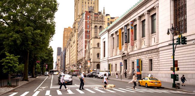
Map of Upper West Side
The Upper West Side, sometimes abbreviated UWS, is a neighborhood in the borough of Manhattan, New York City, that lies between Central Park and the Hudson River and between West 59th Street and West 110th Street. The Upper West Side is sometimes also considered by the real estate industry to include the neighborhood of Morningside Heights.
Contents
- Map of Upper West Side
- meet the owner of peacefood cafe on the upper west side in nyc
- The upper west side a charming neighborhood in nyc
- Geography
- Native American and colonial use
- Bloomingdale District
- Late 19th century development
- Subway expansion
- Enclaves
- Late 20th century urban renewal
- Demographics
- Transportation
- Community Board 7
- Police
- Organization headquarters
- Cultural
- Educational
- Religious
- Other historical sites
- Residences
- Restaurants and gourmet groceries
- Economy
- In popular culture
- Movies
- Television
- Music
- Theatre
- References
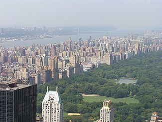
Like the Upper East Side, the Upper West Side is an affluent, primarily residential area with many of its residents working in commercial areas of Midtown and Lower Manhattan. It has the reputation of being New York City's cultural and intellectual hub, with Columbia University located at the north end of the neighborhood, and artistic workers, with Lincoln Center located at the south end. Conversely, the Upper East Side is traditionally perceived to be home to commercial and business types. The Upper West Side, along with the Upper East Side, is considered to be among New York City's wealthiest neighborhoods.
meet the owner of peacefood cafe on the upper west side in nyc
The upper west side a charming neighborhood in nyc
Geography
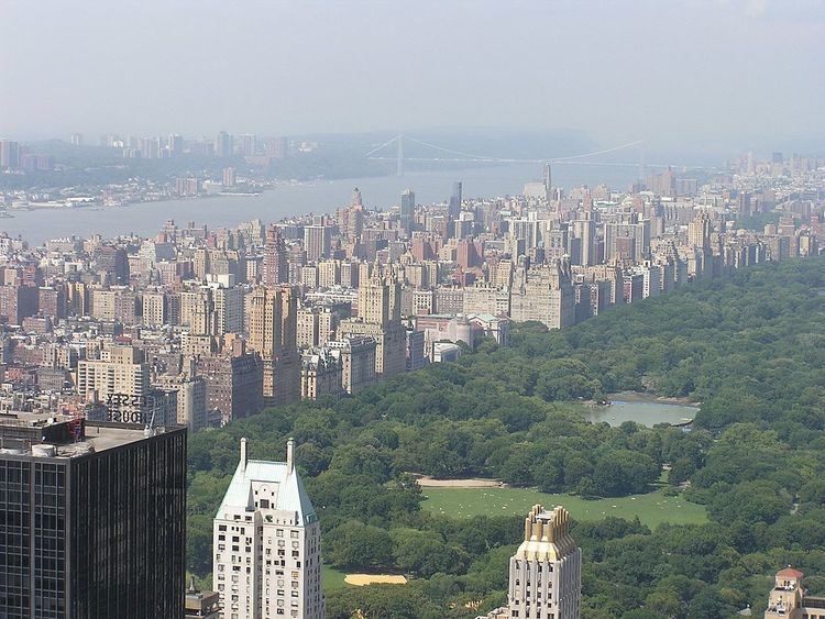
Upper West Side is bounded on the south by 59th Street, Central Park to the east, and the Hudson River to the west. Its northern boundary is somewhat less obvious. Although it has historically been cited as 110th Street, which fixes the neighborhood alongside Central Park, it is now sometimes (primarily by the real estate industry) considered to be 125th Street, encompassing Morningside Heights. The area north of West 96th Street and east of Broadway is also identified as Manhattan Valley. The overlapping area west of Amsterdam Avenue to Riverside Park was once known as the Bloomingdale District.
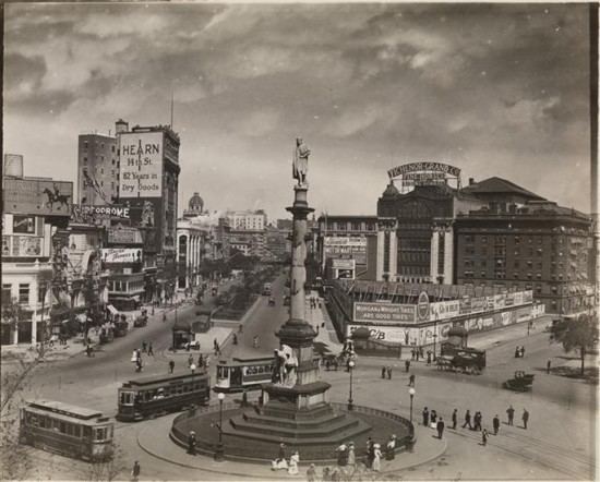
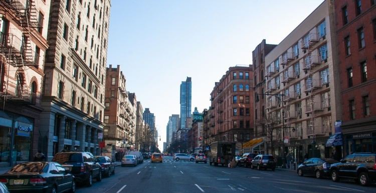
From west to east, the avenues of the Upper West Side are Riverside Drive, West End Avenue (11th Avenue), Broadway, Amsterdam Avenue (10th Avenue), Columbus Avenue (9th Avenue), and Central Park West (8th Avenue). The 66-block stretch of Broadway forms the spine of the neighborhood and runs diagonally north/south across the other avenues at the south end of the neighborhood; above 78th Street Broadway runs north parallel to the other avenues. Broadway enters the neighborhood at its juncture with Central Park West at Columbus Circle (59th Street), crosses Columbus Avenue at Lincoln Square (65th Street), Amsterdam Avenue at Verdi Square (71st Street), and then merges with West End Avenue at Straus Park (aka Bloomingdale Square, at 107th Street).
Morningside Heights, just west of Harlem, is the site of the Cathedral of Saint John the Divine, Columbia University, Barnard College, Bank Street College of Education, the National Council of Churches, Union Theological Seminary, Manhattan School of Music, Teachers College and Jewish Theological Seminary of America, as well as Grant's Tomb and Riverside Church.
Traditionally the neighborhood ranged from the former village of Harsenville, centered on the old Bloomingdale Road (now Broadway) and 65th Street, west to the railroad yards along the Hudson, then north to 110th Street, where the ground rises to Morningside Heights. With the building of Lincoln Center, its name, though perhaps not the reality, was stretched south to 58th Street. With the arrival of the corporate headquarters and expensive condos of the Time Warner Center at Columbus Circle, and the Riverside South apartment complex built by Donald Trump, the area from 58th Street to 65th Street is increasingly referred to as Lincoln Square by realtors who acknowledge a different tone and ambiance than that typically associated with the Upper West Side. This is a reversion to the neighborhood's historical name.
Native American and colonial use
The long high bluff above useful sandy coves along the North River was little used or traversed by the Lenape people. A combination of the stream valleys, such as that in which 96th Street runs, and wetlands to the northeast and east, may have protected a portion of the Upper West Side from the Lenape's controlled burns; lack of periodic ground fires results in a denser understory and more fire-intolerant trees, such as American Beech.
In the eighteenth and early nineteenth century, the Upper West Side-to-be contained some of colonial New York's most ambitious houses, spaced along Bloomingdale Road. It became increasingly infilled with smaller, more suburban villas in the first half of the nineteenth century, and in the middle of the century, parts had become decidedly lower class.
Bloomingdale District
The name "Bloomingdale District" was used to refer to a part of the Upper West Side – the present-day Manhattan Valley neighborhood – located between 96th and 110th Streets and bounded on the east by Amsterdam Avenue and on the west by Riverside Drive, Riverside Park, and the Hudson River.
Its name was a derivation of the description given to the area by Dutch settlers to New Netherland, likely from Bloemendaal, a town in the tulip region. The Dutch Anglicized the name to "Bloomingdale" or "the Bloomingdale District", to the west side of Manhattan from about 23rd Street up to the Hollow Way (modern 125th Street). It consisted of farms and villages along a road (regularized in 1703) known as the Bloomingdale Road. Bloomingdale Road was renamed The Boulevard in 1868, as the farms and villages were divided into building lots and absorbed into the city. By the 18th century it contained numerous farms and country residences of many of the city's well-off, a major parcel of which was the Apthorp Farm. The main artery of this area was the Bloomingdale Road, which began north of where Broadway and the Bowery Lane (now Fourth Avenue) join (at modern Union Square) and wended its way northward up to about modern 116th Street in Morningside Heights, where the road further north was known as the Kingsbridge Road. Within the confines of the modern-day Upper West Side, the road passed through areas known as Harsenville, Strycker's Bay, and Bloomingdale Village.
With the building of the Croton Aqueduct passing down the area between present day Amsterdam Avenue and Columbus Avenue in 1838–42, the northern reaches of the district became divided into Manhattan Valley to the east of the aqueduct and Bloomingdale to the west. Bloomingdale, in the latter half of the 19th century, was the name of a village that occupied the area just south of 110th street.
Late 19th century development
Much of the riverfront of the Upper West Side was a shipping, transportation, and manufacturing corridor. The Hudson River Railroad line right-of-way was granted in the late 1830s to connect New York City to Albany, and soon ran along the riverbank. One major non-industrial development, the creation of Central Park in the 1850s and '60s, caused many squatters to move their shacks into the Upper West Side. Parts of the neighborhood became a ragtag collection of squatters' housing, boarding houses, and rowdy taverns.
As this development occurred, the old name of Bloomingdale Road was being chopped away and the name Broadway was progressively applied further northward to include what had been lower Bloomingdale Road. In 1868, the city began straightening and grading the section of the Bloomingdale Road from Harsenville north, and it became known as "Western Boulevard" or "The Boulevard". It retained that name until the end of the century, when the name Broadway finally supplanted it.
Development of the neighborhood lagged even while Central Park was being laid out in the 1860s and '70s, then was stymied by the Panic of 1873. Things turned around with the introduction of the Ninth Avenue elevated in the 1870s along Ninth Avenue (renamed Columbus Avenue in 1890), and with Columbia University's relocation to Morningside Heights in the 1890s, using lands once held by the Bloomingdale Insane Asylum.
Riverside Park was conceived in 1866 and formally approved by the state legislature through the efforts of city parks commissioner Andrew Haswell Green. The first segment of park was acquired through condemnation in 1872, and construction soon began following a design created by the firm of Frederick Law Olmsted, who also designed the adjacent, gracefully curving Riverside Drive. In 1937, under the administration of commissioner Robert Moses, 132 acres (0.53 km2) of land were added to the park, primarily by creating a promenade that covered the tracks of the Hudson River Railroad. Moses, working with landscape architect Gilmore D. Clarke also added playgrounds, and distinctive stonework and the 79th Street Boat Basin, but also cut pedestrians off from direct access to most of the riverfront by building the Henry Hudson Parkway by the river's edge. According to Robert Caro's book on Moses, The Power Broker, Riverside Park was designed with most of the amenities located in predominantly white neighborhoods, with the neighborhoods closer to Harlem getting shorter shrift. Riverside Park, like Central Park, has undergone a revival late in the 20th century, largely through the efforts of The Riverside Park Fund, a citizen's group. Largely through their efforts and the support of the city, much of the park has been improved. The Hudson River Greenway along the river-edge of the park is a popular route for pedestrians and bicycle commuters, and offers spectacular vistas. A dramatic improvement is the $15.7 million "Riverwalk" extension to the park's greenway constructed between 83rd and 91st Streets on a promenade in the river itself, completed in May 2010.
Subway expansion
The Upper West Side experienced a building boom from 1885 to 1910, thanks in large part to the 1904 opening of the city's first subway line, which comprised, in part, what is now a portion of the IRT Broadway – Seventh Avenue Line, with subway stations at 59th, 66th, 72nd, 79th, 86th, 91st, 96th, 103rd, 110th, 116th, and 125th Streets. This followed upon the opening of the now demolished IRT Ninth Avenue Line – the city's first elevated railway – which opened in the decade following the American Civil War.
This further stimulated residential development of the area. The stately tall apartment blocks on West End Avenue and the townhouses on the streets between Amsterdam Avenue and Riverside Drive, which contribute to the character of the area, were all constructed during the pre-depression years of the twentieth century. A revolution in building techniques, the low cost of land relative to lower Manhattan, the arrival of the subway, and the democratization of the formerly expensive elevator made it possible to construct large apartment buildings for the middle classes. The large scale and style of these buildings is one reason why the neighborhood has remained largely unchanged into the twenty-first century.
The neighborhood changed from the 1930s to the 1950s. In 1932, the IND Eighth Avenue Line opened under Central Park West. In 1940, the elevated IRT Ninth Avenue Line over Columbus Avenue closed. Immigrants from Eastern Europe and the Caribbean moved in during the '50s and the '60s. The Lincoln Center for the Performing Arts opened in the 1960s.
Enclaves
In the 1900s, the area south of 67th Street was heavily populated by African-Americans and supposedly gained its nickname of "San Juan Hill" in commemoration of African-American soldiers who were a major part of the assault on Cuba's San Juan Hill in the Spanish–American War. By 1960, it was a rough neighborhood of tenement housing, the demolition of which was delayed to allow for exterior shots in the movie musical West Side Story. Thereafter, urban renewal brought the construction of the Lincoln Center for the Performing Arts and Lincoln Towers apartments during 1962–1968.
The Upper West Side is a significant Jewish neighborhood, populated with both German Jews who moved in at the turn of last century, and Jewish refugees escaping Hitler's Europe in the 1930s. Today the area between 85th Street and 100th Street is home to the largest community of young Modern Orthodox singles outside of Israel. However, the Upper West Side also features a substantial number of non-Orthodox Jews. A number of major synagogues are located in the neighborhood, including the oldest Jewish congregation in the United States, Shearith Israel; New York's second-oldest and the third-oldest Ashkenazi synagogue, B'nai Jeshurun; Rodeph Sholom; the Stephen Wise Free Synagogue; and numerous others.
Late 20th century urban renewal
From the post-WWII years until the AIDS epidemic, the neighborhood, especially below 86th Street, had a substantial gay population. As the neighborhood had deteriorated, it was affordable to working class gay men, and those just arriving in the city and looking for their first white collar jobs. Its ethnically mixed gay population, mostly Hispanic and white, with a mixture of income levels and occupations patronized the same gay bars in the neighborhood, making it markedly different from most gay enclaves elsewhere in the city. The influx of white gay men in the Fifties and Sixties is often credited with accelerating the gentrification of the Upper West Side, and by the mid and late '70s, the gay male population had become predominantly white. Another component that brought about the eventual gentrification of the neighborhood were the recent college graduates in the late '70s and early '80s who moved in, drawn to the neighborhood's relatively large apartments and cheap housing.
In a subsequent phase of urban renewal, the rail yards which had formed the Upper West Side's southwest corner were replaced by the Riverside South residential project, which included a southward extension of Riverside Park. The evolution of Riverside South had a 40-year history, often extremely bitter, beginning in 1962 when the New York Central Railroad, in partnership with the Amalgamated Lithographers Union, proposed a mixed-use development with 12,000 apartments, Litho City, to be built on platforms over the tracks. The subsequent bankruptcy of the enlarged, but short-lived Penn Central Railroad brought other proposals and prospective developers. The one generating the most opposition was Donald Trump's "Television City" concept of 1985, which would have included a 152-story office tower and six 75-story residential buildings. In 1991, a coalition of prominent civic organizations proposed a purely residential development of about half that size, and then reached a deal with Trump. As of 2008, construction is well underway, but still to be resolved is the future of the West Side Highway viaduct over the park area.
The community's links to the events of September 11, 2001 were evinced in Upper West Side resident and Pulitzer Prize winner David Halberstam's paean to the men of Ladder Co 40/Engine Co 35, just a few blocks from his home, in Firehouse.
Today, this area is the site for several long-established charitable institutions; their unbroken parcels of land have provided suitably scaled sites for Columbia University and the Cathedral of Saint John the Divine, as well as for some vanished landmarks, such as the Schwab Mansion on Riverside Drive, the most ambitious free-standing private house ever built in Manhattan.
The name Bloomingdale is still used in reference to a part of the Upper West Side, essentially the location of old Bloomingdale Village, the area from about 96th Street up to 110th Street and from Riverside Park east to Amsterdam Avenue. The triangular block bound by Broadway, West End Avenue, 106th Street and 107th Street, although generally known as Straus Park (named for Isidor Straus and his wife Ida), was officially designated Bloomingdale Square in 1907. The neighborhood also includes the Bloomingdale School of Music and Bloomingdale neighborhood branch of the New York Public Library. Adjacent to the Bloomingdale neighborhood is a more diverse and less affluent subsection of the Upper West Side called Manhattan Valley, focused on the downslope of Columbus Avenue and Manhattan Avenue from about 102nd Street up to 110th Street.
Demographics
As of 2010, Manhattan Community Board 7 has a population of 209,084, which is down from 210,993 in 1990. Of the population, 140,850 (67.4%) are White non Hispanic, 31,347 (15%) of Hispanic origin, 15,834 (7.6%) are African American, 15,988 (7.6%) Asian or Pacific Islander, 221 (0.1%) American Indian or Native Alaskan, 671 (0.3%) of some other race, 4,173 (2%) of two or more race.
Approximately 12.2% of the population benefits from public assistance as of 2012.
The land area is 1.9 square miles (4.9 km2).
Transportation
Two subway lines serve the Upper West Side. The IRT Broadway – Seventh Avenue Line (1 2 3 trains) runs along Broadway. The IND Eighth Avenue Line (A C B D trains) runs along Central Park West.
There are five different bus routes — M5, M7, M10, M11, M104 buses — that go up and down the Upper West Side, and the M57 goes up West End Avenue for 15 blocks in the neighborhood. Additionally, crosstown routes include the M66, M72, M79 SBS, M86 SBS, M96, M106. The M20 terminates at Lincoln Center.
Community Board 7
Community Board 7 (CB7) deals with land use and zoning matters, the City budget, municipal service delivery, and multiple community concerns of the Upper West Side. CB7 covers the Upper West Side from 59th/60th Streets to 110th Street. NYPD Precincts 20 and 24 are in CB7's area.
New York City's Community Boards review data collected by the 311 Customer Service Center. 3-1-1 (3-1-1) is a non-emergency telephone number, and New York City releases monthly reports on the number of requests for services to 311.
In CB7, 80% of the calls to 311 are either building complaints, noise complaints, city property damage/complaints, and lost and found property. The composition of the calls to 311 vary on a monthly basis due to weather. For instance, there were 79 total calls to 311 in October 2012 regarding damaged or dead trees in the wake of Hurricane Sandy, which reached New York City at the end of that month. In the next month, daily calls regarding trees dropped 25%, while daily calls regarding heating increased 58%. The largest number of calls to 311 in the most recent reporting month of November 2012 were referenced to the Department of Housing Preservation and Development regarding heating. The next highest was for residential noise complaints.
Police
The 20th Precinct covers the Upper West Side from 59th Street to 86th Street. This precinct area also includes Neighborhood Tabulation Areas (NTAs) for the Upper West Side (mn12) and Lincoln Square (mn14).
Recent data indicates that crime, after declining steadily for many years, bottomed in 2011. Information from the NYPD indicates total crime complaints have increased approximately 15% in the last year. Citywide crime complaints have increased 4%. This tabulation includes all types of crime complaints, from murders to petit larceny. Crime complaints increased this year in Precinct 20 for almost all of the CompStat categories, except for misdemeanor assaults. There were 2,058 crime complaints year-to-date as of November 25, 2012, up from 1,789 crime complaints in the same time period a year ago.
From 2000 to 2010 the population in precinct 20 increased by 1,674 people, up 1% annually. In comparison, but not in exactly the same time period, crime complaints decreased by 2% annually from 2001 to 2011.
The 24th Precinct covers the west side from 86th Street to 110th Street.
Organization headquarters
Cultural
Educational
Preschool to 12th grade
All public non-charter schools are operated by the New York City Department of Education.
Higher education
Religious
Other historical sites
Residences
The apartment buildings along Central Park West, facing the park, are some of the most desirable apartments in New York. The Dakota at 72nd St. has been home to numerous celebrities including John Lennon, Leonard Bernstein and Lauren Bacall. Other famous buildings on CPW include the Art Deco Century Apartments (Irwin Chanin, 1931), and The Majestic, also by Chanin. The San Remo, The Eldorado and The Beresford were all designed by Emery Roth, as was 41 West 96th Street (completed in 1926). His first commission, the Belle Époque Belleclaire, is on Broadway, while the moderne Normandie holds forth on Riverside at 86th Street. Along Broadway are several Beaux-Arts apartment houses: The Belnord (1908) – the fronting block of which was co-named in honor of longtime resident I.B. Singer, plus The Apthorp (1908), The Ansonia (1902), The Dorilton and the Manhasset . All are individually designated New York City landmarks. Curvilinear Riverside Drive also has many beautiful pre-war houses and larger buildings, including the graceful curving apartment buildings—The Paterno and The Colosseum (apartment building) by Schwartz & Gross—at 116th St and Riverside Drive. West End Avenue, a grand residential boulevard lined with pre-war Beaux-Arts apartment buildings and townhouses dating from the late-19th and early 20th centuries, is closed to commercial traffic. Columbus Avenue north of 87th Street was the spine for major post-World War II urban renewal. Broadway is lined with such architecturally notable apartment buildings as The Ansonia, The Apthorp, The Belnord, the Astor Court Building, and The Cornwall, which features an Art nouveau cornice. Newly constructed 15 Central Park West and 535 West End Avenue are known to be some of the prestigious residential addresses in Manhattan.
Restaurants and gourmet groceries
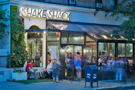
Both Broadway and Amsterdam Avenue from 67th Street up to 110th Street are lined with restaurants and bars, as is Columbus Avenue to a slightly lesser extent. The following lists a few prominent ones:
Economy
American Broadcasting Company (ABC) is headquartered on West 66 Street in the Upper West Side.
In popular culture
The Upper West Side has been a setting for many movies and television shows because of its pre-War architecture, colorful community and rich cultural life. Ever since Edward R. Murrow went "Person-to-Person" live, the length of Central Park West in the 1950s, West Siders scarcely pause to gape at on-site trailers, and jump their skateboards over coaxial cables. At one time it seemed that one or another of the various Law & Order shows took up all the available parking spaces in the neighborhood. Woody Allen's film Hannah and Her Sisters captures that quintessential Upper West Side flavor of rambling high-ceilinged apartments, bursting at the seams with books and other cultural artifacts.
Movies
In alphabetical order:
Television
In alphabetical order:
Music
In alphabetical order:
Theatre
The setting for Neil Simon's 1965 comedy The Odd Couple is Oscar Madison's eight-room apartment on Riverside Drive in "the eighties."
The action of Charles Busch's 1999 comedy/drama The Tale of the Allergist's Wife takes place in an Upper West Side apartment and deals with the intellectual pretense and angst of the characters.