
Country India भारत Assembly constituency Morwa मोरवा Local time Friday 8:36 AM Area code 06274 | Parliamentary constituency Ujiarpur उजियारपुर Time zone IST (UTC+5.30) Population 1,960 (2011) | |
 | ||
Weather 26°C, Wind E at 18 km/h, 75% Humidity | ||
Umaidpur (Hindi: उमेदपुर) is one of the villages of Morwa Dakshni Gram panchayat in Morwa (Vidhan Sabha constituency) in the Samastipur District of Bihar State, India.
Contents
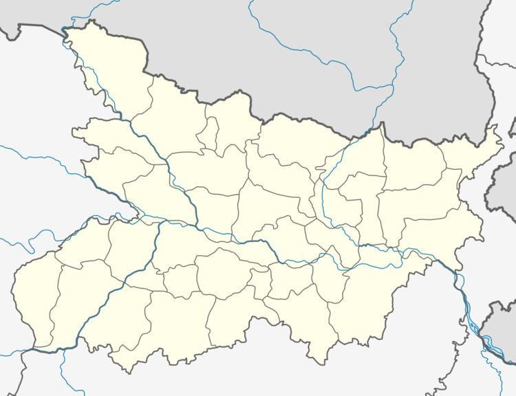
- Map of Umaidpur Bihar
- History
- Demographics
- Location
- Nearby towns villages
- Climate
- Culture
- Language
- Religion
- Cuisine
- Clothing
- Transportation
- Roads
- Railways
- Air
- Education
- Noted Persons
- Economy
- Agriculture
- Governance
- References
Map of Umaidpur, Bihar
History
It is one of the British Raj ruled rural villages. It is the home village of a former Mukhiya (1994-1996; 2001-2005) of Morwa Dakshin Gram Panchayat, Sukhdeo Roy. By British times, his father, Sukkan Roy who was married to Mundari Devi used to be a Tokedar of the Umaidpur village. At the close of the 15th century this area was part of Bengal and ruled by Afgan King prince Dyal. With the decline of Mugals 1556-1764, this region was passed under the control of Nawab of Bengal -Mir Kasim Ali. British first occupied this area through East India company in 1766. Then this village area belonged in the Monghyr district. Nathan state sub-division consisted of the districts Darbhanga, Muzzaferpur, Monghyr, Patna as a part of Monghyr district. This area became part of Bengal presidency during the British raj in 1858. In 1912 this area became part of the new province created as a Bihar.During British rule, all villages were part of estates run by independent zamindars who called themselves Raja or directly ruled by the British Raj. The unfertile land of Umaidpur village was part of the Narhan Estate and Jaintpur Estate Muzaffarpur, whereas fertile land was taken over by the British Raj. Mainly indigo, poppy, sugar cane and tobacco were cultivated by the British Raj Estate. The land revenue (malguzari) was collected with the help of Jeth Rayaits in the Umaidpur village by Tehsildar (revenue collector). Sukkan Roy was the Jeth Rayait for Narhan Estate, whereas Ram Pratap Roy was Jeth Rayait for Jaintpur Estate Muzaffarpur. Chullahai Hazari was the Brahil of the Umaidpur village, whose responsibility was to inform villagers to come at Jeth Rayat’s house to pay land revenues. Harsinghpur Kothi (2 miles east of Umaidpur) was the regional office of East India, where British officers use to stay. T.I. Pal was the East India’s Officer representative of Umaidpur and other adjacent villages. When Britishers were leaving India, they sold all their lands to Janak Kishore Prasad, including their Bungalow (Harsinghpur Kothi).
Demographics
The total land of the Umaidpur village is around 300 bighas. In Samastipur district and Patna one bigha is equivalent to 20 Kattha (1361 ft2 or 126.44 m2); one Kattha are subdivided in 20 Dhur and one Dhur is approximately 68.06 ft2 (6.321 m2). According to the 2011 Census of India, Umaidpur village (vilcode-236729) has around 329 households. The total population of the village is around 1,960 (male 1034 and female 926). More demographic information on the Umaidpur Village can be obtained here http://www.censusindia.gov.in/2011census/population. Among the Hindus,the majority of people belongs to caste – Yadav (>50 famalies), followed by Dosadhs (>15 families), and Mallahs (>10 families). Two Dhobi and one Telis families also live in this village. Among Musalmans, Shaikhs (>50 families) are the only community in this village.
Location
Umaidpur is located at 25.776563, 85.681752. This village is in the far southwest of Samastipur District, bordered to the north and east by Naua Chak village, to the south by Jitwarpur Kumhara and west by Morwa. The post office is at Bhagwatpur. The Pin code is 848135. The Telephone Std Code is 06274. Nearest Banks are State Bank of India- Tajpur Morwa (006562) and Central Bank of India - Sarairanjan (280058).
Nearby towns & villages
The nearest towns are Morwa, Sarairanjan, Tajpur, Mushrigharari, Dalsinghsarai, and Samastipur. The nearest villages are: Naua Chak, HarpurBhindi, Chako Bhindi, Nikaspur, Chak pahar, Chak Sikandar, Morwa, Jitwarpur Kumhra, Gaupur, Chandauli, Dadanpur, Gorhiari, Gaddopur, Gunai Basti, Kamtaul, Larua, Mirzapur, Nisfi, Rajwara, Rampur, Benua, Chak Dhean, Sarangpur, Songar, Waina, Bhagwatpur, Bathua, Gangapur Athar, Harlochanpur, Harpur Barheta, Sultanpur Morwa, Fatehpur Bala, Madhopur Digharua, Mathura pur, Bora Buzurg, Amritpur, Banbira, Bangora, Banwaripur urf Mahamadpur, Bazidpur Karnai, Bishunpur, Bond Dih Asli, Bond dih Dakhli, Chak Jalal, Chakbheli, Chaklal Sahi, Dharampur Asli, Dharampur Bande, Dharampur Dakhli, Halai, Hasanpur Kandh Pakar, Husainipur, Indar Wara, Jitwarpur Bhuskhara, Kaua, Kesho Naraenpur, Khanua, Kumaia, Lodipur Naraen, Mahmudpur, Maricha, Maura Khurd, Murgia Chak, Pachbhinda, Paharpur, Purkhotimpur Asli, Purkhotimpur Dakhli, Raghunathpur, Reriati urf Kutubpur, Saidpur Urf Purkhotimpur, Subhan Chak, Sarairanjan, Tikuna, Tajpur, Mushrigharari.
Climate
Latest hourly weather forecast for the Umaidpur can be found using Google Weather link https://www.google.com/#q=umaidpur+weather or at AccuWeather.com http://www.accuweather.com/en/in/umaidpur/3218713/weather-forecast/3218713 or Yahoo Weather https://weather.yahoo.com/india/bihar/umaidpur-29166694/.
Umaidpur experiences six distinct seasons ऋतु (Ritu (Indian season)): Spring वसन्त, Winter शिशिर, Summer ग्रीष्म, Monsoon वर्षा, Autumn शरद्, and Fall हेमन्त. Typical summer months are from May to July, with maximum temperatures ranging from 35 °C to 45 °C. May and June are the warmest months in Umaidpur; although summer doesn't end until July. The monsoon lasts from August to September, with moderate/high rainfall and temperatures ranging from 15 °C to 35 °C. Winter begins in mid January; the daytime temperature hovers around 28 °C (82 °F) while night temperature is below 15 °C for most of January and February.
.
Culture
The village cultural history dates back to the British Raj.
Language
The local village dialect is a mixture of Maithili and Hindi. The official spoken languages are Maithili, Hindi, and Urdu.
Religion
Historically, the residents of the village have been Hindus as well as Muslims. It has a Hanuman Mandir, a Kali Mandir, a Shailesh Mandir, a Masjid, and a Mastan Baba ka Mazar. Every year the people here celebrate Saraswati Pooja (Vasanta Panchami-वसन्त पञ्चमी), Chhath छठ पुजा, Durga Pooja, Diwali, Holi and Muharram. Chhath Puja and Muharram are the major festivals.
Cuisine
See also: Bihari Cuisine.
In general, Umaidpurian Cuisine is very similar to Maithili Cuisine with a unique flavor. The daily meal thali at an Umaidpurian home comprises – roti (wheat puffed bread or Makai ke roti), tarkaari (vegetables), daal (bean cooked in water), and bhat (boiled rice). Poultry, goat meat, Jhinga Masaledaar, Jhor Waali Machhli (fish curry) and eggs are generally cooked only on weekends or on a special occasion. Among all the varieties of food eaten by the Umaidpur people, Dal-Puri (Chanā Dāl or Moong Dāl Stuffed Pan-Fried or Deep-Fried Flat-Bread), Puā (Whole-Wheat or Flour Pancakes), Malpua (Whole-Wheat or Flour Pancakes in Simple Sugar Syrup prepared in milk), Kheer, triangular Sādā Paratha/Parauthā, round Āalu Paratha/Parauthā, Puri (Wheat-Flour Deep-Fried Puffed Bread), Kachori (Nigella Puri), Aloo Chokhā (Boiled potatod mashed with mustard oil, onion and green chili), Bajka, Baigan kā Bharta/Chokhā, Khichdi (Mix of Rice, Dal and several Vegetables), Dāl-Kaddu, Dāl-Pitthā, Buut kā Ghugni (black grams soaked either lightly/overnight in water and then sauted in mustard oil in a wok), Bhunjā generally eaten as a snack in the evening, Moori (puffed rice), Choora (puffed rice)- Dahi, Sattu - powdered baked gram, Tilkut [Makar-Sankrānti], Pirikia are the most famous cuisine. Among TARKĀRI (Sabzi, Vegetables), Bharwan karela, Ālu kā Bhunjiā (Potato Fries), Bhindi kā Bhunjiā (Okra Fries), Karelā kā Bhunjiā (Bitter Gourd Fries),Parwal kā Bhunjiā (Pointed Gourd Fries) are very popular.
Clothing
The traditional dress of Umaipurian people includes the dhoti-kurta for men and saree or Kameez-Salwar for women. Western shirts and trousers are popular among the youth male population. Modern jewelery such as rings for men and bangles for women are popular. Traditional Umaidpurian jewelaries include "Chhara", "Hansuli", "Kamarbandh",etc.
Transportation
Umaidpur is well connected by buses and rails to different towns/cities of India.
Roads
The village Umaidpur is about 5.7 kilometers west from Sarairanjan Chowk (Dadanpur-Chakpahar Road), 9 kilometers south from Tajpur, 17.3 kilometers (11 mi) southwest from Samastipur (district headquarters of this village) (Driving Duration: 29 mins; Route: NH 103 and SH 50), 18 kilometers north from Patori town, 75.76 kilometers (47.08 mi, 40.91 nmi) northeast from Patna, the State capital (Driving Duration: 1 hour 41 min; Route: NH 103), 60.4 kilometers (37.5 mi) from Hajipur (75 minutes driving distance), 56.7 kilometers (35.26 mi) from Darbhanga (65 minutes driving distance), 52.9 kilometers (32.87 mi) from Muzaffarpur (Driving Duration:59 min; Route: NH 28), 79 kilometers from Begusarai (90 minutes driving distance), 433 kilometers from Ranchi (550 minutes driving distance) and 1,038 kilometers from New Delhi (940 minutes driving distance).
Umaidpur is connected to various parts of India through national and state highways. The nearest major highways are:
Bus services are available from Samastipur to Hajipur, Patna (80 km), Muzaffarpur (56 km), Chhapra (150 km), Siwan (203 km), Motihari (156 km), Bettiah, Ranchi and other cities.
Railways
The Nearest Railway Stations are: Samastipur Junction railway station and Shahpur Patori Railway Station. One can travel from Umaidpur by bus, car or bicycle to Samastipur Junction railway station, Shahpur Patori Junction railway station or Muzaffarpur Junction railway station to board train for New Delhi, Howrah, Mumbai, Patna, Lucknow, Ranchi and other parts of India.
Air
The nearest airport, Lok Nayak Jayaprakash Narayan International Airport, Patna Airport, is 88.8 km (travel time is about 2hrs and 1 min) from Umaidpur. From Umaidpur to Patna or vice versa, you can travel though buses, taxis or train.
Education
Umaidpur village has a Primary and Upper Primary levels School. It is one of the old schools in this area. It is a co-educational school up to 8th class.
The overall literacy rate seems to be around 46.94%. Based on India Census 2011, the female literacy rate is 42.76%, whereas the male literacy rate is 51.0%. There are few people from this village who have gone to IIT Kanpur, Jawaharlal Nehru University, New Delhi and abroad for higher education. There are also few peoples of this village, who live abroad like in United States, UAE and Canada.
Noted Persons
Economy
The economy is principally agrarian. Farming is the main occupation of villagers. There are two brick chimneys in the village. The recent trend has been that many of younger generation are migrating to big cities, such as Patna, Mumbai, Surat, Ludhiana, Kolkatta, looking for employment. As a result of this, the income of individual household has gone up and living standards of individual family have become better.
Agriculture
From Imperial Gazetteer of India, Volume 11, it appears that sugar-cane, indigo and poppy were grown in the land of this and adjacent villages during and before British rule. Between 1800 and early nineteenth century, the cultivation of indigo plants (Indigofera tinctoria, also known as I. sumatrana) and poppy (a flowering plant in the subfamily Papaveroideae of the family Papaveraceae) was more prevalent. Indigo dye made in India was exported by British to the Greeks and the Romans, where it was valued as a luxury product. Maharaja of Darbhanga abandoned the cultivation of indigo around 1901, because the fall in the price of the indigo dye, due to the competition of artificial substitutes, has caused many other factories to abandon. The chief feature of the indigo industry in Umaidpur regions, as compared with the other indigo-growing tracts in North Bihar, was the large area cultivated direct by the factories themselves in the Samastipur subdivision. The plant, when cut, was fermented in masonry vats and oxidized either by beating or by currents of steam. The dye thus precipitated was boiled and dried into cakes. Due to the fall in the value of indigo dye, the factories have taken to the growing of ordinary crops, sugar kanes. The principal exports were rice, indigo, gram, pulses, linseed, mustard seed, saltpetre, tobacco, hides, and ghee; and the principal imports were rice and other food-grains, salt, kerosene oil, gunny-bags, coal and. coke, European cotton piece-goods, and raw cotton. Gram, pulses, and oilseeds are chiefly sent to Calcutta, and rice and other food-grains to Saran and Muzaffarpur. The imports of food-grains came for the most part from Bhagalpur and Nepal, coal and coke from Burdwary kerosene oil from the Twenty-four Parganas, and salt and piece-goods from Calcutta.
Most fertile part of the village, use to produce all the most valuable rabi and bhadoi crops. In the low-lying areas, the main crop grown is winter rice, though in some parts good rabi crops are also raised on the lands. Rabi and Bhadoi crops were grown from 1800 till recently (1980). Villages like Umaidpur were chiefly dependent on the Aghani (or winter) rabi and bhadoi harvests. The village land falls into two classes: Bhith (uplands) and Dhanhar (low lands where water logging occurred during rainy season). Bhith was further classified as saliferous land or usher (soils in which salinity is mainly due to accumulation of alkali salts are called alkali soils) was found in patches in the outer area between good land and low-lying land. Nunia caste from the neighbouring village, Nauachak, used to extract saltpetere in the summer after rabi crop from these lands for their living. In these lands small farmers grew mainly 'Marua, also called mandua, nachini or Ragi' or Finger Millets (Eleusine coracana), Kauni (foxtail milet) and Sama (kutaki or little milet). In Bhith land, wheat, maize, and miscellaneous food-grains which consisted chiefly of khesari, rahari, masuri, urd, mung, janera, and oats. Miscel laneous food-crops growns also included potatoes, and suthni (Dioscorea fasciculate). The chief non-food crops are oilseeds. Tobacco and Chilies are cultivated as commercial crops. Of the other non-food crops, kharhaul or thatching-grass was the most valuable, but now these lands are used for growing paddy.
Governance
Umaidpur became a part of Samastipur district, when Darbhanga district was split into three districts in 1972. Before British, the mention of this district in the Imperial Gazetteer of India (volume 11) goes back to A. D. 1400. When this area was taken over by the British in 1765, it was included in Silbah Bihar and formed with the greater part of Muzaffarpur District, the Sarkar of Tirhut. Bihar was retained as an independent revenue division, and in 1782 Tirhut (including Hajipur) was made into a Collectorate. In 1875 Tirhut was divided into the two existing Districts of Muzaffarpur and Darbhanga. The governance of the Umiadpur village is run through community development block program administered by a Morwa Block Development Officer, Morwa Dakshin Panchayat headed by Mukhiya, and a local administrative unit at the village level. The law enforcement is provided by Tajpur Police Station. The village is under the civial jurisdiction of Samastipur district. Umaidpur village is a part of Morwa (Vidhan Sabha constituency) and the current member of this constituency of Bihar Legislative Assembly is Vidya Sagar Singh Nishad of JD(U). Lok Sabha Constituency of Umaidpur village is No. 22 Ujiarpur (Lok Sabha constituency). The Lok Sabha member is Nityanand Rai, Bharatiya Janta Party.