
Country University Jai Prakash University Languages spoken Bhojpuri, Hindi | State District | |
Chhapra (also written Chapra) is a city and headquarters of the Saran district in the Indian state of Bihar. It is situated near the junction of the Ghaghara River and the Ganges River.
Contents
- Map of Chhapra
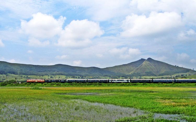
- Five killed as dibrugarh rajdhani express derailed near chhapra in bihar
- History
- Geography
- Economy
- References
Map of Chhapra
Chhapra grew in importance as a river-based market in the 18th century when the Dutch, French, Portuguese, and English established saltpeter refineries in the area. It was recognized as a municipality in 1864. The town has major rail and road connections with the rest of India.
Five killed as dibrugarh rajdhani express derailed near chhapra in bihar
History
The earliest authentic historical record concerning this district is supposedly from 898 AD. It suggests that the village of Dighwa Dubauli in Saran had supplied a copper plate issued during the reign of King Mahendra Paldeva. Maharshi Dadhichi, who donated his bones to the gods for the manufacture of arms, belongs to Saran. The cottage of Dronacharya was situated there. Gautamasthan, which is 8 km from chapra, used to be Maharshi Gautams ashram. Lord Rama gave Devi Ahiylya (wife of Maharshi Gautam) her life back after she turned to stone due to a curse. The fight of "Gaj" (Elephant) and "Grah" (Crocodile) was made at Sonepur in Saran also. Ambica Sthan or Ambika Bhawani (Ami, Dighwara) is famous for the goddess Durga temple. This place believed to be the "yagna sthal" of King Daksha, the father in law of Hindu God Lord Shiva. Annoyed with the ill behavior of her father King Daksha,Sati Lord Shivas first wife took voluntary fall into "Yagna Kund". The said "Yagna Kund" is still present with in the temple campus of the Ambika Bhawani.
Geography
chapra is located at 25.7848°N 84.7274°E? / 25.7848; 84.7274. It has an average elevation of 36 metres (118 ft).
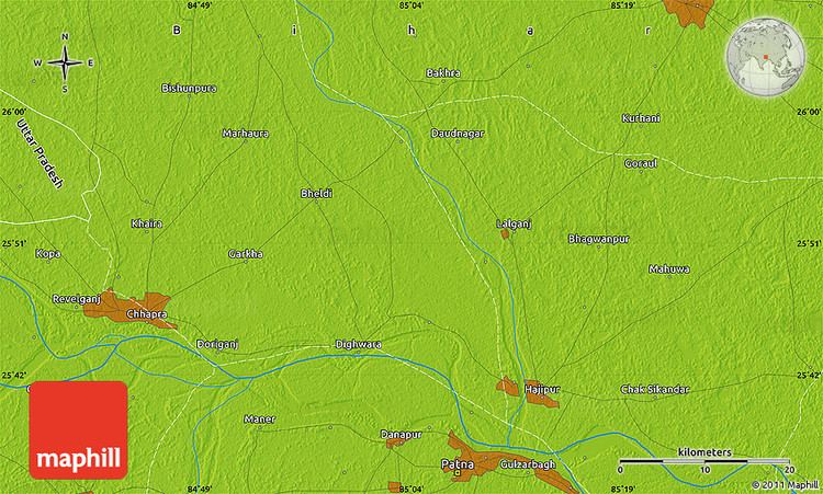
The district of Saran is situated between 25°36 and 26°13 north latitude and 84°24 and 85°15 east longitude in the southern post of the Saran Division of North Bihar. The Ganges river provides the southern boundary of the district, beyond which lie the districts of Bhojpur and Patna. To the north of Saran lie the districts of Siwan and Gopalganj. The Gandak river forms the dividing line with the Vaishali and Muzaffarpur districts in the east. To the west of Saran lie the districts of Siwan and Balia in Uttar Pradesh. The Ghaghra river forms a natural boundary between Saran and Ballia.
The district is shaped like a triangle; its apex is the confluence of the boundary of the Gopalganj district and the Gandak – Ganges river. The district is made up entirely of plains, but several depressions and marshes create three broad natural divisions:
Out of twenty blocks in the districts, six (Sonepur, Dighwara, Revelganj, chapra, Manjhi and Dariyapur) regularly flood. Six others are partially affected by floods (Parsa, Marhoura, Amnaur, Jalalpur, and Ekma). The soil of the district is alluvial. No minerals of economic value are found in the district.
Economy
The main commercial site is the municipal chowk. Hathwa market is famous for selling textiles. As of 2006 a locomotive factory was planned for the district. The Morton chocolate factory was located at Marhowrah. In addition, sugarcane, iron and cotton factories are located in Marhowrah.The Rail wheel factory, Bela are located in Dariyapur. It is the second factory in India to produce more than 1,00,000 wheels after Benglore.This factory was made by M/s Larsen and Toubro with an investment of 1400 crores rupees.