
Area 473,481 km² Peak Mount Kerinci | Highest elevation 3,805 m (12,484 ft) Pop. density 106 /km (275 /sq mi) Population 50.37 million (2010) | |
 | ||
Points of interest Lake Toba, Maimun Palace, Sipisopiso, Tjong A Fie Mansion, Lake Maninjau Destinations | ||
Sumatra how to travel indonesia mentawai islands bukit lawang medan etc
Sumatra (Indonesian: Sumatera) is a large island in western Indonesia that is part of the Sunda Islands. It is the largest island that is entirely in Indonesia (two larger islands, Borneo and New Guinea, are shared between Indonesia and other countries) and the sixth-largest island in the world at 473,481 km2 (including adjacent islands such as the Riau Islands and Bangka Belitung Islands).
Contents
- Sumatra how to travel indonesia mentawai islands bukit lawang medan etc
- Map of Sumatra Indonesia
- Local style best surf breaks in sumatra indonesia local style s2 ep7
- Etymology
- History
- Administration
- Geography
- Largest cities
- Flora and fauna
- Demographics
- Ethnic groups
- Languages
- Religion
- Rail transport
- References
Map of Sumatra, Indonesia
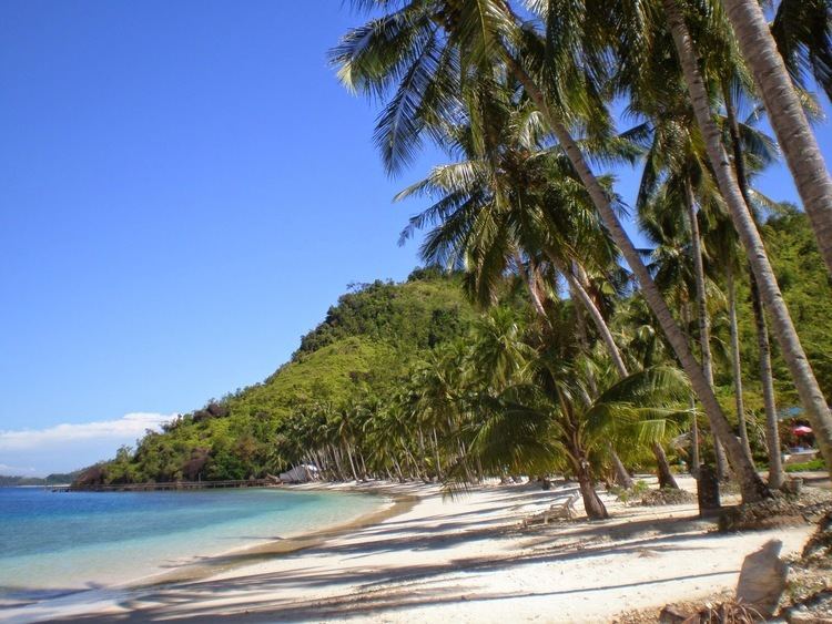
Sumatra is an elongated landmass spanning a diagonal northwest-southeast axis. The Indian Ocean borders the west, northwest, and southwest sides of Sumatra with the island chain of Simeulue, Nias and Mentawai bordering the southwestern coast. On the northeast side the narrow Strait of Malacca separates the island from the Malay Peninsula, an extension of the Eurasian continent. On the southeast the narrow Sunda Strait separates Sumatra from Java. The northern tip of Sumatra borders the Andaman Islands, while on the lower eastern side are the islands of Bangka and Belitung, Karimata Strait and the Java Sea. The Bukit Barisan mountains, which contain several active volcanoes, form the backbone of the island, while the northeast sides are outlying lowlands with swamps, mangrove and complex river systems. The equator crosses the island at its center on West Sumatra and Riau provinces. The climate of the island is tropical, hot and humid with lush tropical rain forest once dominating the landscape.
Sumatra has a wide range of plant and animal species but has lost almost 50% of its tropical rainforest in the last 35 years, and many species are critically endangered such as the Sumatran ground cuckoo, Sumatran tiger, Sumatran elephant, Sumatran rhinoceros, and Sumatran orangutan. Deforestation on the island has also resulted in serious haze over neighbouring countries, such as the 2013 Southeast Asian haze causing considerable tensions with affected countries such as Malaysia and Singapore.
Local style best surf breaks in sumatra indonesia local style s2 ep7
Etymology
Sumatra was known in ancient times by the Sanskrit names of Swarnadwīpa ("Island of Gold") and Swarnabhūmi ("Land of Gold"), because of the gold deposits of the island's highland. The first word mentioning the name of Sumatra was the name of Srivijayan Haji (king) Sumatrabhumi ("King of the land of Sumatra"), who sent an envoy to China in 1017. Arab geographers referred to the island as Lamri (Lamuri, Lambri or Ramni) in the tenth through thirteenth centuries, in reference to a kingdom near modern-day Banda Aceh which was the first landfall for traders.
Late in the 14th century the name Sumatra became popular in reference to the kingdom of Samudra Pasai, which was a rising power until it was replaced by Sultanate of Aceh. Sultan Alauddin Shah of Aceh, on letters written in 1602 addressed to Queen Elizabeth I of England, referred to himself as "king of Aceh and Samudra". The word itself is from Sanskrit "Samudra", (समुद्र), meaning "gathering together of waters, sea or ocean". Marco Polo named it Samara or Samarcha in the late 13th century, while the 14th century traveller Odoric of Pordenone used Sumoltra for Samudra, and subsequent European writers then used similar forms of the name for the island.
European writers in the 19th century found that the indigenous inhabitants did not have a name for the island.
History
The Melayu Kingdom was absorbed by Srivijaya.
Srivijaya was a Buddhist monarchy centred in what is now Palembang. Dominating the region through trade and conquest throughout the 7th to 9th centuries, the empire helped spread the Malay culture throughout Nusantara. The empire was a thalassocracy or maritime power that extended its influence from island to island. Palembang was a center for scholarly learning, and it was there the Chinese Buddhist pilgrim I Ching studied Sanskrit in 671 CE before departing for India. On his journey to China, he spent four years in Palembang translating Buddhist texts and writing two manuscripts.
Srivijayan influence waned in the 11th century after it was defeated by the Chola Empire of southern India. At the same time, Islam made its way to Sumatra through Arabs and Indian traders in the 6th and 7th centuries AD. By the late 13th century, the monarch of the Samudra kingdom had converted to Islam. Marco Polo visited the island in 1292, and Ibn Battuta visited twice during 1345–1346. Samudra was succeeded by the powerful Aceh Sultanate, which survived to the 20th century. With the coming of the Dutch, the many Sumatran princely states gradually fell under their control. Aceh, in the north, was the major obstacle, as the Dutch were involved in the long and costly Aceh War (1873–1903).
Sumatra came under the control of the Dutch East Indies and became a major producer of pepper, rubber, and oil. In the early and mid-twentieth century, Sumatran academics and leaders were important figures in Indonesia's independence movements, such as: Mohammad Hatta (the first vice-president) and Sutan Sjahrir (the first prime minister).
The Free Aceh Movement fought against Indonesian government forces in the Aceh Insurgency from 1976 to 2005. Security crackdowns in 2001 and 2002 resulted in several thousand civilian deaths.
Administration
The ten administrative Provinces (provinsi) of Sumatra – including the smaller islands nearby – are listed below with their populations at the 2000 and 2010 Censuses. Note some 4 million of these residents of Sumatra do not live on the island itself—but on nearby islands administered collectively as "Sumatra". The final two of the provinces below do not have territory on the actual island.
Geography
The longest axis of the island runs approximately 1,790 km (1,110 mi) northwest–southeast, crossing the equator near the centre. At its widest point, the island spans 435 km (270 mi). The interior of the island is dominated by two geographical regions: the Barisan Mountains in the west and swampy plains in the east. Sumatra is the closest Indonesian island to mainland Asia.
To the southeast is Java, separated by the Sunda Strait. To the north is the Malay Peninsula (located on the Asian mainland), separated by the Strait of Malacca. To the east is Borneo, across the Karimata Strait. West of the island is the Indian Ocean.
The backbone of the island is the Barisan Mountain chain, with the active volcano Mount Kerinci as the highest point at 3,805 m (12,467 ft), located at about the midpoint of the range. The volcanic activity of this region endowed the region with fertile land and beautiful sceneries, for instance around Lake Toba. It also contains deposits of coal and gold. The volcanic activity stems from Sumatra's location on the Pacific Ring of Fire—which is also the reason why Sumatra has had some of the most powerful earthquakes ever recorded: in 1797, 1833, 1861, 2004, 2005, and 2007.
The Great Sumatran fault (a strike-slip fault), and the Sunda megathrust (a subduction zone), run the entire length of the island along its west coast. On 26 December 2004, the western coast and islands of Sumatra, particularly Aceh province, were struck by a tsunami following the Indian Ocean earthquake. This was the longest earthquake recorded, lasting between 500 and 600 seconds. More than 170,000 Indonesians were killed, primarily in Aceh. Other recent earthquakes to strike Sumatra include the 2005 Nias–Simeulue earthquake and the 2010 Mentawai earthquake and tsunami.
To the east, big rivers carry silt from the mountains, forming the vast lowland interspersed by swamps. Even if mostly unsuitable for farming, the area is currently of great economic importance for Indonesia. It produces oil from both above and below the soil – palm oil and petroleum.
Sumatra is the largest producer of Indonesian coffee. Small-holders grow Arabica coffee (Coffea arabica) in the highlands, while Robusta (Coffea canephora) is found in the lowlands. Arabica coffee from the regions of Gayo, Lintong and Sidikilang is typically processed using the Giling Basah (wet hulling) technique, which gives it a heavy body and low acidity.
Most of Sumatra used to be covered by tropical rainforest, but economic development coupled with corruption and illegal logging has severely threatened its existence. Even designated conservation areas have not been spared from this destruction.
The island is the world's fifth highest island, and the third highest in the Indonesian archipelago.
Batang Hari River is the longest river in the island with its source in the Minangkabau Highlands, stretching around 800 kilometres eastward to its estuary in the Jambi lowlands.
Largest cities
The largest cities in Sumatra by population, listed by their 2010 census populations, are:
Flora and fauna
Sumatra supports a wide range of vegetation types which are home to a rich variety of species, including 17 endemic genera of plants. Unique species include the Sumatran pine which dominates the Sumatran tropical pine forests of the higher mountainsides in the north of the island and rainforest plants such as Rafflesia arnoldii (the world's largest individual flower), and the titan arum (the world's largest unbranched inflorescence).
The island is home to 201 mammal species and 580 bird species, such as the Sumatran ground cuckoo. There are 9 endemic mammal species on mainland Sumatra and 14 more endemic to the nearby Mentawai Islands. There are about 300 freshwater fish species in Sumatra.
The Sumatran tiger, Sumatran rhinoceros, Sumatran elephant, Sumatran ground cuckoo, and Sumatran orangutan are all critically endangered, indicating the highest level of threat to their survival. In October 2008, the Indonesian government announced a plan to protect Sumatra's remaining forests.
The island includes more than 10 national parks, including 3 which are listed as the Tropical Rainforest Heritage of Sumatra World Heritage Site – Gunung Leuser National Park, Kerinci Seblat National Park and Bukit Barisan Selatan National Park. The Berbak National Park is one of three national parks in Indonesia listed as a wetland of international importance under the Ramsar Convention.
Demographics
Sumatra is not particularly densely populated, with just over 100 people per km2 – more than 50 million people in total. Because of its great extent, it is nonetheless the fourth most populous island in the world. The most populous regions include most of North Sumatra and central highlands in West Sumatra, while the major urban centers are Medan and Palembang.
Ethnic groups
The people of Sumatra are multi-lingual, multi-diverse and multi-religious. Most of these groups share many similar traditions and the different tongues are closely related. Ethnic Malays dominate most of the eastern coast in the provinces of Riau, Bangka-Belitung, South Sumatra, Riau Islands, northern parts of Lampung and Bengkulu and in the easternmost parts of North Sumatra and Aceh, while people in the southern and central interior speak languages related to Malay, such as Lembak (that speak Col language), Kerinci (that speak Kerinci language) and Minangkabau people (that speak Minangkabau). The highlands of northern Sumatra is inhabited by the Bataknese, the northernmost coast is dominated by the Acehnese, while southernmost coast is dominated by Ethnic Javanese. Chinese and Tamil minorities are present in urban centres.
Languages
There are over 52 languages spoken, all of them (except Chinese and Indians) belong to the Nuclear Malayo-Polynesian sub-branch of Malayo-Polynesian which in turn is a branch of the Austronesian language family. Within Nuclear Malayo-Polynesian, they were divided into several sub-branches that is Chamic (which are represented by Acehnese in which its closest relatives are languages spoken by Ethnic Chams in Cambodia and Vietnam), Malayic (Malay, Minangkabau and other closely related languages), Northwest Sumatran (Batak languages, Gayo and others), Lampungic (includes Proper Lampung and Komering) and Bornean (represented by Rejang in which its closest linguistic relatives are Bukar Sadong and Land Dayak spoken in West Kalimantan and Sarawak (Malaysia)). Northwest Sumatran and Lampungic branches are endemic to the island. Like all parts of Indonesia, Indonesian (which was based on Riau Malay) is the official language and the main Lingua franca. Although Sumatra has its own local Lingua franca, variants of Malay like Medan Malay and Palembang Malay are popular in North and South Sumatra, especially in urban areas. Minangkabau (Padang dialect) is popular in West Sumatra, some parts of North Sumatra, Bengkulu, Jambi and Riau (especially in Pekanbaru and areas bordered with West Sumatra) while Acehnese is also used as an inter-ethnic means of communication in some parts of Aceh province.
Religion
The majority of people in Sumatra are Muslims (87%), while 10% are Christians, 2% are Buddhist and 1% are Hindu. Most central Bataks are Protestant Christians, a faith introduced by the year 2005 (German Rhenish Missionary Society).
Rail transport
Several unconnected railway networks built during Netherlands East Indies exist in Sumatra, such as the ones connecting Banda Aceh-Lhokseumawe-Besitang-Medan-Tebingtinggi-Pematang Siantar-Rantau Prapat in Northern Sumatra (the Banda Aceh-Besitang section was closed in 1971, but is currently being rebuilt). Padang-Solok-Bukittinggi in West Sumatra, and Bandar Lampung-Palembang-Lahat-Lubuk Linggau in Southern Sumatra.