
Reference no. DE: 56 Source elevation 728 m | Length 413 km Mouth Elbe | |
 | ||
Bridges Saale-Elster-Talbrücke, Beesedau Bridge Similar Elbe, Marktkirche Unser Lieben Fr, Halle Opera House, Giebichenstein Castle, Halle State Museum of Prehistory | ||
Places to see in halle saale germany
The Saale ( [ˈzaːlə]), also known as the Saxon Saale (German: Sächsische Saale) and Thuringian Saale (German: Thüringische Saale), is a river in Germany and a left-bank tributary of the Elbe. It is not to be confused with the smaller Franconian Saale, a right-bank tributary of the Main, or the Saale in Lower Saxony, a tributary of the Leine.
Contents
- Places to see in halle saale germany
- Map of Saale Germany
- CourseEdit
- GeographyEdit
- EtymologyEdit
- References
Map of Saale, Germany
CourseEdit
The Saale originates on the slope of the Großer Waldstein mountain near Zell in the Fichtelgebirge in Upper Franconia (Bavaria), at an elevation of 728 metres (2,388 ft). It pursues a winding course in a northern direction, and after passing the manufacturing town of Hof, enters Thuringia. It flows amid well-wooded low mountains of the Thuringian Forest until it reaches the valley of Saalfeld. After leaving Saalfeld the Saale reaches Rudolstadt. Here it receives the waters of the Schwarza, in whose valley lies the ruined castle of Schwarzburg, the ancestral seat of the formerly ruling House of Schwarzburg.
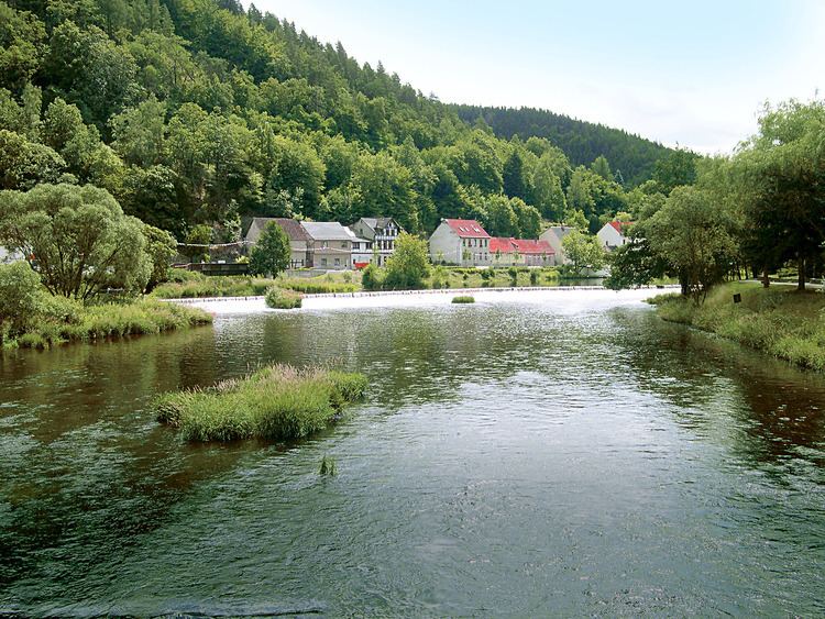
From Saalfeld the Saale enters the limestone hill region north of the Thuringian Forest, and sweeps beneath the barren, conical hills enclosing the university town of Jena. It enters Saxony-Anhalt and passes the spa of Bad Kösen, washes numerous vine-clad hills and, after receiving the deep and navigable Unstrut at Naumburg, flows past Weißenfels, Merseburg, Halle, Bernburg and Calbe. It finally joins the Elbe just above Barby, after traversing a distance of 413 kilometres (257 mi)—shortened 14 kilometres (9 mi) by a bypass from its natural length of 427 kilometres (265 mi).
The Saale is navigable from Naumburg and is also planned connected from Leuna with the White Elster near Leipzig by an unfinished canal. The soil of the lower part of its valley is exceptionally fertile, and produces, amongst other crops, large supplies of sugar beet. Among its tributaries are the White Elster, Regnitz and Orla on the right bank, and the Ilm, Unstrut, Salza, Wipper and Bode on the left. Its upper course is rapid. Its valley, down to Merseburg, contains many castles which crown the enclosing heights.
GeographyEdit
Originating in Zell, the Saale flows through – Sparneck – Weißdorf – Seulbitz – Förbau – Schwarzenbach an der Saale – Fattigau – Oberkotzau – Hof – Brunnenthal – Saalenstein – Joditz – Landesgrenze Bayern/Thüringen – Hirschberg – Sparnberg – Rudolphstein – Blankenberg – Blankenstein – Harra – Saaldorf – Saalburg – Poeritzsch – Gräfenwarth – Burgk – Walsburg – Ziegenrück – Neidenberga – Hohenwarte – Eichicht – Kaulsdorf – Fischersdorf – Weischwitz – Reschwitz – Breternitz – Saalfeld – Schwarza – Volkstedt – Rudolstadt – Catharinau – Kolkwitz – Weißen – Uhlstädt – Rückersdorf – Zeutsch – Niederkrossen – Orlamünde – Freienorla – Großeutersdorf – Kleineutersdorf – Kahla – Großpürschütz – Jägersdorf – Rothenstein – Maua – Lobeda – Jena – Zwätzen – Porstendorf – Dornburg – Dorndorf-Steudnitz – Wichmar – Camburg – Tümpling – Großheringen – Kleinheringen – Landesgrenze Thüringen/Sachsen-Anhalt – Stendorf – Saaleck – Bad Kösen – Naumburg – Schellsitz - Schönburg – Eulau – Goseck – Leißling – Lobitzsch – Uichteritz – Markweben – Weißenfels – Dehlitz – Schkortleben – Kleinkorbetha – Großkorbetha – Oebles-Schlechtewitz – Wengelsdorf – Bad Dürrenberg – Kröllwitz – Leuna – Trebnitz – Merseburg – Meuschau – Freiimfelde – Schkopau – Korbetha – Hohenweiden – Rockendorf – Holleben – Halle – Kröllwitz – Lettin – Brachwitz – Schiepzig – Salzmünde – Pfützthal – Döblitz – Zaschwitz – Wettin – Kloschwitz – Rumpin – Dobis – Friedeburg – Zickeritz – Rothenburg – Nelben – Gnölbzig – Trebnitz – Alsleben – Poplitz – Großwirschleben – Plötzkau – Gröna – Neuborna – Bernburg – Dröbel – Nienburg – Wedlitz – Damaschke Plan – Wispitz – Calbe – Trabitz – Groß Rosenburg – Werkleitz
EtymologyEdit
The name Saale comes from a Proto-Indo-European root *séles ‘marsh’, akin to Welsh hêl, heledd ‘river meadow’, Cornish heyl ‘estuary’, Greek hélos ‘marsh, meadow’, Sanskrit sáras ‘lake, pond’, Sárasvati ‘sacred river’, Old Persian Harauvati ‘Hārūt River; Arachosia’, Avestan Haraxvatī ‘id’.