
Basin size 1,043 km (403 sq mi) Source Thuringian Forest | Length 129 km | |
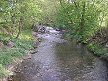 | ||
The Ilm is a river 128.7 kilometers (80.0 mi) long in Thuringia, Germany. It is a left tributary of the Saale, into which it flows in Großheringen near Bad Kösen.
Map of Ilm, Germany
Towns along the Ilm are Ilmenau, Stadtilm, Kranichfeld, Bad Berka, Weimar, Apolda and Bad Sulza.
In the valley of Ilm river runs the federal motorway 87 from Ilmenau to Leipzig and two railways: the Thuringian Railway between Großheringen and Weimar and the Ilm Railway (Ilmbahn) between Kranichfeld and Weimar. Part of the Nuremberg–Erfurt high-speed railway is also being built in the upper part of the valley near Ilmenau.
References
Ilm (Thuringia) Wikipedia(Text) CC BY-SA