Rahul Sharma (Editor)

Wettin, Saxony Anhalt

Updated on
Edit
Like
Comment
Share on FacebookTweet on TwitterShare on LinkedInShare on Reddit
Country
  
Germany

District
  
Saalekreis

Time zone
  
CET/CEST (UTC+1/+2)

Area
  
27.18 km²

Population
  
2,398 (31 Dec 2008)

Town
  
Wettin-Löbejün

State
  
Saxony-Anhalt

Elevation
  
73 m (240 ft)

Postal codes
  
06193

Postal code
  
06193

Local time
  
Saturday 4:45 PM

Dialling code
  
034607

Wettin, Saxony-Anhalt

Weather
  
23°C, Wind NE at 13 km/h, 38% Humidity

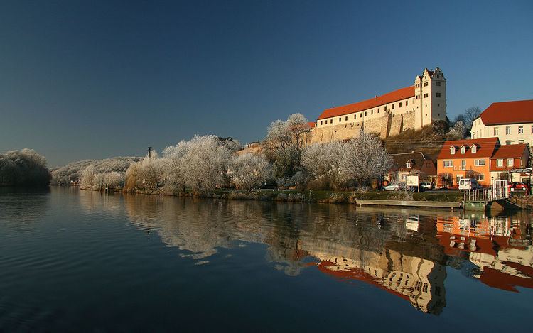
Wettin is a small town and a former municipality in the Saalekreis district of Saxony-Anhalt, Germany, situated on the River Saale north of Halle. Since 1 January 2011, it is part of the town Löbejün-Wettin. It is known for Wettin Castle, the ancestral seat of the House of Wettin, ruling dynasty of Saxony and Poland. Wettin sights include the Tower of Bismarck, the town hall, and the castle (used as the Burggymnasium).

Contents

Map of Wettin, Wettin-L%C3%B6bej%C3%BCn, Germany

History

Wettin was first documented as Vitin civitas in a 961 deed issued by German king Otto I. The settlement thereafter was a burgward within the Saxon Eastern March, held by Dietrich I von Wettin, the progenitor of the dynasty. His descendants became Margraves of Lusatia in 1032 and of Meissen in 1123. In 1288 Wettin was acquired by the Magdeburg archbishop Eric of Brandenburg.

Mücheln
The small village of Mücheln (not to be confused with the larger Mücheln near Merseburg) became part of Wettin and includes the restored old chapel of the Poor Fellow-Soldiers of Christ and of the Temple of Solomon (Knights Templar).
Lützkendorf
As bombing targets of the Oil Campaign of World War II, the Lützkendorf oil facilities 2 miles East of Mücheln included
  • a small Wintershall AG crude oil refinery (100,000 tons/yr),
  • a Bergius process hydrogenation unit (125,000 tons/yr) for blending gasolines,
  • a Fischer-Tropsch plant (80,000 tons/yr) to process heavier gasoline cuts from synthesized oil, and
  • tankage for about 75,000 metric tons.
  • The Lützkendorf Grube supplied lignite from the south end of the mine to the two interconnected plants ("Lutzkendorf" and "Lutzkendorf-Mücheln") at 51°17′N 11°52′E, and the facility also used tar for Low Temperature Carbonization.

    References

    Wettin, Saxony-Anhalt Wikipedia