
Length 527 km | Discharge 200 m³/s | |
 | ||
Basin size 27,292 km (10,538 sq mi) Bridges Eiserner Steg, Alte Mainbrücke, Alte Brücke, Holbeinsteg | ||
The Main ( [ˈmaɪn]) is a river in Germany. With a length of 527 km (327 mi) (including the White Main: 574 km (357 mi)), it is the longest right tributary of the Rhine, and the longest river lying entirely in Germany (if the Weser and the Werra are considered as two separate rivers; together they are longer). The largest cities along the Main are Frankfurt am Main and Würzburg.
Contents
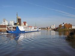
- Map of Main Germany
- GeographyEdit
- NavigationEdit
- Dams and locksEdit
- Hydroelectric power generationEdit
- TributariesEdit
- Ports and municipalitiesEdit
- Main lineEdit
- RecreationEdit
- SightsEdit
- References
Map of Main, Germany
GeographyEdit
The mainspring of the Main River flows through the German states of Bavaria, Baden-Württemberg (forming the border with Bavaria for some distance) and Hesse. Its basin competes with the Danube for water; as a result, many of its boundaries are identical with those of the European Watershed.
The Main begins near Kulmbach in Franconia at the joining of its two headstreams, the Red Main (Roter Main) and the White Main (Weißer Main). The Red Main originates in the Franconian Jura mountain range, 50 km (31 mi) in length, and runs through Creussen and Bayreuth. The White Main originates in the mountains of the Fichtelgebirge; it is 41 km (25 mi) long. In its upper and middle section it runs through the valleys of the German Highlands. Its lower section crosses the Lower Main Lowlands (Hanau-Seligenstadt Basin and northern Upper Rhine Plain) to Wiesbaden, where it discharges into the Rhine. Major tributaries of the Main are the Regnitz, the Franconian Saale, the Tauber, and the Nidda.
The name derives from the Latin Moenus or Menus, and is not related to the name of the city Mainz (Latin: Moguntiacum).
NavigationEdit
The Main is navigable for shipping from its mouth at the Rhine close to Mainz for 396 kilometres (246 mi) to Bamberg. Since 1992, the Main has been connected to the Danube via the Rhine-Main-Danube Canal and the highly regulated Altmühl river. The Main has been canalized with 34 large locks (300 m × 12 m (984 ft × 39 ft)) to allow CEMT class V (110 m × 11.45 m (360.9 ft × 37.6 ft)) vessels to navigate the total length of the river. The 16 locks in the adjacent Rhine-Main-Danube Canal and the Danube itself are of the same dimensions.
Dams and locksEdit
There are 34 dams and locks along the 380 km navigable portion of the Main, from the confluence with the Regnitz near Bamberg, to the Rhine.
Hydroelectric power generationEdit
Most of the dams along the Main also have turbines for power generation.
TributariesEdit
Tributaries from source to mouth:
Ports and municipalitiesEdit
Around Frankfurt are several large inland ports. Because the river is rather narrow on many of the upper reaches, navigation with larger vessels and push convoys requires great skill.
The largest cities along the Main are Frankfurt am Main and Würzburg. The Main also passes the following towns and cities: Burgkunstadt, Lichtenfels, Bad Staffelstein, Eltmann, Haßfurt, Schweinfurt, Volkach, Kitzingen, Marktbreit, Ochsenfurt, Karlstadt, Gemünden, Lohr, Marktheidenfeld, Wertheim, Miltenberg, Obernburg, Erlenbach/Main, Aschaffenburg, Seligenstadt, Hainburg, Hanau, Offenbach, Hattersheim, Flörsheim, and Rüsselsheim.
The river has gained enormous importance as a vital part of European "Corridor VII", the inland waterway link from the North Sea to the Black Sea.
Main lineEdit
In a historical and political sense, the Main line is referred to as the northern border of Southern Germany, with its predominantly Catholic population. The river roughly marked the southern border of the North German Federation, established in 1867 under Prussian leadership as the predecessor of the German Empire.
The river course also corresponds with the Speyer line isogloss between Central and Upper German dialects, sometimes mocked as Weißwurstäquator.
RecreationEdit
The Main-Radweg is a major German bicycle path running along the Main River. It is approximately 600 kilometres (370 mi) long and was the first long-distance bicycle path to be awarded 5 stars by the General German Bicycle Club ADFC in 2008. It starts from either Creußen or Bischofsgrün and ends in Mainz.