
- elevation 405 m (1,329 ft) Length 114 km Basin area 1,004 km² | - elevation 5 m (16 ft) Basin area 1,004 km² Country United Kingdom | |
 | ||
- right Otterburn Beck, Broughton Beck, Eastburn Beck, River Worth, Harden Beck, Bradford Beck, River Calder Bridges Leeds Bridge, Ireland Bridge | ||
Places uk water taxi granary wharf to leeds dock river aire leeds uk
The River Aire is a major river in Yorkshire, England, 148 miles (238 km) in length. In the Handbook for Leeds and Airedale (1890), it notes that the distance from Malham to Howden is 58 miles (93 km) direct, but the river's meanderings extend that to 90 miles (140 km). Part of the river below Leeds is canalised, and is known as the Aire and Calder Navigation.
Contents
- Places uk water taxi granary wharf to leeds dock river aire leeds uk
- Map of River Aire United Kingdom
- Places uk time lapse water taxi leeds dock to granary wharf river aire leeds uk
- Course
- Settlements
- Toponymy
- History
- Power stations
- Ecology
- Navigation
- References
Map of River Aire, United Kingdom
Places uk time lapse water taxi leeds dock to granary wharf river aire leeds uk
Course
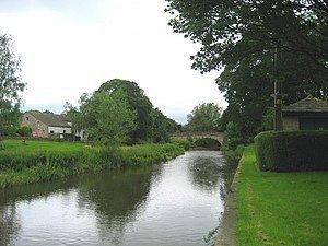
The Aire starts its journey at Malham Tarn. It becomes a subterranean stream at 'Water Sinks' about 1 mile (1.6 km) before the top of Malham Cove, it then flows underground to Aire Head, just below Malham, in North Yorkshire, and then flows through Gargrave and Skipton. After Cononley, the river enters West Yorkshire where it passes through the former industrial areas of Keighley, Bingley, Saltaire and Shipley. It then passes through Leeds and on to the villages of Swillington and Woodlesford. At Castleford is the confluence of the Aire and Calder; just downstream of the confluence was the ford where the ancient British road, used by the Romans, crossed on its way north to York. The river re-enters North Yorkshire near Knottingley and in its lower reaches forms part of the boundary between North Yorkshire and the East Riding of Yorkshire.
The River Aire empties into the River Ouse at Airmyn, 'myn' being an old English word for 'river mouth'. The name possibly derived from Common Brittonic *Isara, meaning "strong river". The Aire could have been the winwœd or winwæd written about in Old English, from the Old English elements winnan or win ("strife", "fight") and wæd ("shallow water", "ford"), however others have proposed that it is actually the Went (also called the "wynt" in Old English) or the Cock Beck (see Battle of the Winwaed). Still others have claimed that it is actually the name of the battle and not the body of water itself.
Between Malham Tarn and Airmyn, the river drops 400 metres (1,300 ft).
Tests have been conducted to authenticate the actual source of the Aire. The tarn at Malham has been dammed and then allowed to flood. Observers have noted that whilst water surged at Aire Head, it also surged at the bottom of Malham Cove. There was a significant difference of 30 minutes between the two surges with Malham Cove being slower to react to the floodwater.
The section between Malham Tarn and the confluence of the becks at Aire Head is known as Malhamdale. Thereafter the valley is known as Airedale and encompasses Bradford, (even though the river bypasses the city) and by the time it reaches Leeds, the term Airedale is rarely applied.
Settlements
from source
(Joins River Ouse)
Toponymy
The name Yr is documented in Gray's Cartularium Saxonicum in 959 AD. The river is darcy and ðarcy (with the ancient eth) in 963, in the same source. It is Eyr’ in 1135 in The Coucher Book of Selby and other sources up to 1298. Eir is given in 1175-7 in one of the Dodsworth Manuscripts in Farrer's Early Yorkshire Charters. Air from c. 1160 to 1577, Air’ in the thirteenth century.
History
The Aire was forded by a paved way by the Romans at Castleford. The Roman Road connected Doncaster with York and went north through the town near to the church. At this time, the River Don emptied into the Aire at Snaith, but the dutch engineer, Cornelius Vermuyden, changed the course of the Don in the 1630s so that it flows into the Ouse after its confluence with the Aire.
An Act of Parliament was passed in 1699 to make the river downstream of Leeds navigable (the Aire and Calder Navigation) with a further act to extend the navigable part of the river upstream to Bingley. This second act formed the basis of the Leeds and Liverpool Canal.
Between the middle part of the nineteenth century to the latter part of the twentieth, the River Aire was devoid of fish life downstream of Shipley due to its pollution. Efforts have been made to return the river to a good wildlife status and fish and other wildlife now do exist all along the course of the river.
Power stations
There are three power stations alongside the River Aire east of Castleford; Ferrybridge C, Eggborough and Drax. Drax takes its cooling water from the Ouse, but both Ferrybridge and Eggborough draw their water from the Aire. Both of these plants stopped generating in 2016, with Eggborough being a stand-by for capacity problems until March 2017.
Ecology
Due to the Aire flowing through the former industrial landscape of West Yorkshire, it had a reputation as being heavily polluted. In 2007, Yorkshire Water carried out improvements to Esholt Sewage Works at a cost of £110 million under the EU's Fresh Water Fish Directive. Whilst Trout are prevalent above Keighley, the river is host to others such as Chub, Dace, Barbel & Grayling, whilst Sea Trout have been noted as far upriver as Shipley. Work is also being undertaken to make the many weirs on the river easier to negotiate for fish. These improvements have also allowed Otters and Water Voles to return to the river as the water and food quality is far superior to that when the river was polluted.
Castleford Wastewater Treatment Works has had £16 million of investment between 2013 and 2015. The improvements to this plant, which discharges water directly into the Aire, has also vastly improved water quality downstream of the plant.
Rodley Nature Reserve, Kirkstall Valley Nature Reserve, St Aidans and Fairburn Ings RSPB reserve all lie alongside the Aire.
Navigation
The Aire is navigable as far upstream as Leeds and downstream has a navigable section into the Aire & Calder Navigation, with navigable access to other canals and waterways. Crown Point in Leeds is listed as the furthest west that can be reached by boat, though the limit is a headroom of 11 feet 11 inches (3.62 m). The weir that straddles Crown Point is a listed structure having been constructed in medieval times and first documented in 1636.
Canoeing and rowing are popular sports on the river with at least two clubs (the Bradford and Bingley Canoe Club and the Bradford Amateur Rowing Club) having landings on the river. Canoeing can be carried out on most parts of the river, with the two clubs having navigable sections protected by weirs next to their landings.