
Population 18,895 (2011 Census) Civil parish Horsforth Local time Tuesday 10:55 PM | OS grid reference SE236376 Dialling code 0113 | |
 | ||
Weather 9°C, Wind W at 18 km/h, 74% Humidity | ||
Aerial views from horsforth leeds to maltby rotherham yorkshire england 1st january 2016
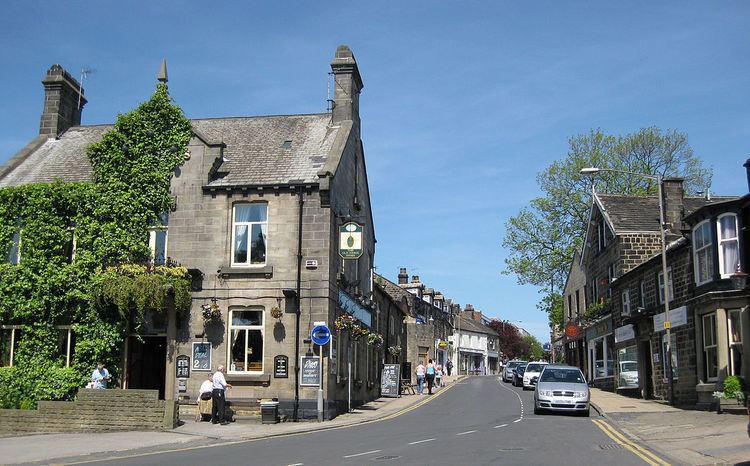
Horsforth is a town and civil parish within the City of Leeds metropolitan borough, in West Yorkshire, England, lying about five miles north west of Leeds city centre. Historically within the West Riding of Yorkshire, it has a population of 18,895 according to the 2011 Census. Horsforth was considered to have the largest population of any village in the United Kingdom during the latter part of the 19th century. It became part of the City of Leeds metropolitan borough in 1974, and became a civil parish with town council in 1999.
Contents
- Aerial views from horsforth leeds to maltby rotherham yorkshire england 1st january 2016
- Map of Horsforth Leeds UK
- Horsforth station leeds west yorkshire uk throughout 2012
- History
- Rail
- Bus
- Air
- Education
- Architecture
- Churches
- Scout and Guide hut
- Sports clubs and facilities
- Nightlife
- Notable people
- References
Map of Horsforth, Leeds, UK
Horsforth station leeds west yorkshire uk throughout 2012
History
Horsforth was recorded in the Domesday Book of 1086 as Horseford, Horseforde, Hoseforde; but late-ninth-century coins with the legend ORSNA FORD and OHSNA FORD may have come from Horsforth. The name derives from Old English hors or, to judge from the coins, *horsa ('horse') in the genitive plural form horsa/horsna + ford 'ford', thus meaning 'horses' ford'. This refers to a river crossing on the River Aire that was subsequently used to transport woollen goods to and from Pudsey, Shipley and Bradford. The original ford was situated off Calverley Lane, but was replaced by a stone footbridge at the turn of the 19th century.
The three unnamed Saxon thegns that held the land at the Conquest gave way to the king who granted it to lesser Norman nobles, but not long after most of the village came under the control of Kirkstall Abbey, a Cistercian house founded in 1152 on the bank of the River Aire downstream of Horsforth.
After the Dissolution of the Monasteries in 1539, Horsforth was partitioned and sold to five families, one of them – the Stanhopes – achieved supremacy and controlled the village for the next 300 years. The estate record of the Stanhopes is regarded as one of the most extensive and important collections of its kind, complementing the extensive medieval record associated with Kirkstall Abbey.
Until the mid 19th century, Horsforth was an agricultural community but it expanded rapidly with the growth of the nearby industrial centre of Leeds. A tannery business was founded at Woodside in about 1820 by the Watson family. It was on the eastern edge of their small farm, and memorialised by Tanhouse Hill Lane. The business became a soap manufacturer and moved to Whitehall Road in Leeds in 1861 and under the chairmanship of Joseph Watson junior, created Baron Manton in 1922, as Joseph Watson & Sons Ltd, became the largest soap supplier to the north east of England, second in size nationally only to Lever Brothers. Industrially, Horsforth has a history of producing high quality stone from its quarries. Not only did it supply Kirkstall Abbey with building materials and millstones in the medieval period, it provided the stone for Scarborough's seafront and sent sandstone from Golden Bank Quarry as far afield as Egypt. Situated on Horsforth Beck (Oil Mill Beck) were mills serving the textile trade.
Between 1861 and 1862, there was an outbreak of typhoid.
Horsforth was historically a township in the parish of Guiseley. It became a separate civil parish in 1866. In the late-19th century it achieved note as the village with the largest population in England. Railways, turnpike roads, tramways and the nearby canal made it a focus for almost all forms of public and commercial transport and it became a dormitory suburb of Leeds. The civil parish became Horsforth Urban District in 1894. The parish and urban district were abolished in 1974 and merged into the new City of Leeds metropolitan district. In 1999 Horsforth became a civil parish and a parish council was created, which exercised its right to declare Horsforth a town.
Horsforth Village Museum has collections and displays illustrating aspects of life set against the backdrop of the changing role of the village.
During World War II the £241,000 required to build the corvette HMS Aubretia was raised entirely by the people of Horsforth. In 2000 the US President Bill Clinton acknowledged Horsforth's contribution to the war effort in a letter sent to MP Paul Truswell. The letter is in the museum.
Rail
Horsforth railway station is on the Harrogate Line between Harrogate and Leeds. The station is just outside the Horsforth parish boundary, on the Cookridge side of Moseley Beck.
Newlay station, which was built by the Midland Railway, was renamed Newlay & Horsforth station in 1889. It was situated south of the River Aire and was accessible from Horsforth on Pollard Lane which connects Horsforth to Bramley. The station, which was on the Airedale Line (Leeds-Shipley-Skipton), was renamed Newlay station in 1961. It closed on 22 March 1965, along with other stations on the Airedale Line: Armley Canal Road, Kirkstall, Calverley & Rodley and Apperley Bridge.
Bus
The town is served by several bus routes:
Air
The nearest airport is Leeds Bradford International Airport, in neighbouring Yeadon.
Education
Leeds Trinity University, formerly Leeds Trinity University College, is an independent university after a period as an accredited college of the University of Leeds. The residential campus is located off Brownberrie Lane, Horsforth.
The further education college Leeds City College has a site in Horsforth called the Horsforth Campus. It was previously part of Park Lane College.
The main secondary school is Horsforth School. Horsforth's state sector primary schools are West End Lane Primary School, St Margaret's Primary School, Newlaithes Primary School, Westbrook Lane Primary School, Broadgate Lane Primary School, St Mary's Catholic Primary School and Featherbank Primary School.
Featherbank School opened in 1911 as a primary school, replacing the Grove Day School. The school's infant department was moved to the Grove Methodist Church on Stanhope Drive in 1933, but in 1960 transferred to the Featherbank School annexe. In 1972 Featherbank juniors (7–11 years) were allocated places at the newly built Newlaithes Junior School, at which point Featherbank became purely an infants' school (4–7 years). In September 2011 Featherbank reverted to a full primary school.
There is an independent primary school, The Froebelian School.
Architecture
Horsforth has a large percentage of sandstone buildings sourced from local quarries, more than any other part of Leeds. A draft design statement was produced in 2010, which summarises much of the architectural and historical character.
Churches
The main churches in Horsforth are;
Scout and Guide hut
The Scout and Guide hut on New Road Side was requisitioned during the Second World War as an emergency mortuary for the factories based around what is now Leeds Bradford Airport (Yeadon Aerodrome at the time), but it was never needed. Before being purchased by the scouts and guides, the building was used as a cafe, a popular stop off on the way out to Otley, Ilkey and the Dales.
Sports clubs and facilities
Nightlife
Given its size, Horsforth has a relatively high number of bars and pubs of varying types from traditional pubs going back to the 17th century to more modern café bars and lounges. Horsforth Town Street has the highest concentration of these with 8 bars and pubs within a short distance of each other. Other popular night life areas include Station Road and New Road Side.