
 | ||
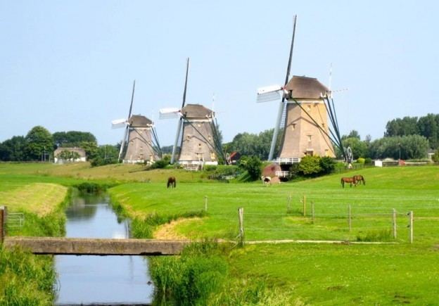
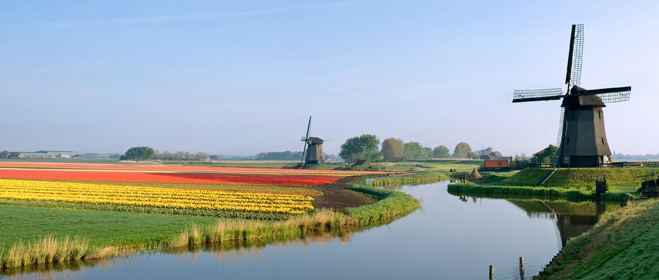
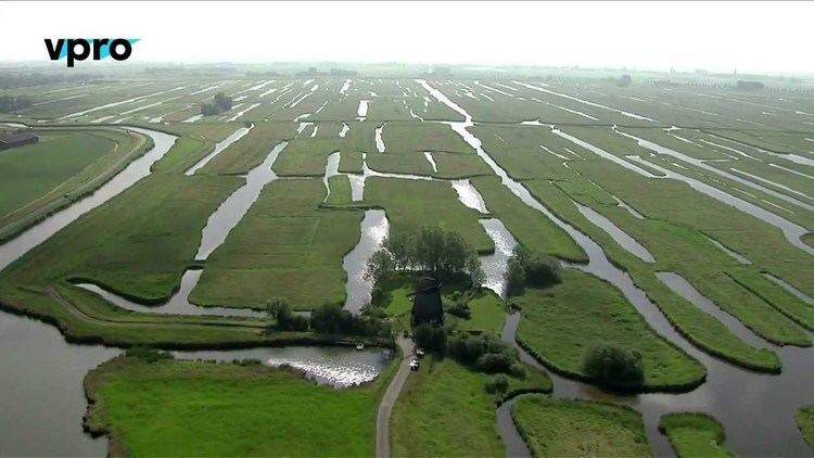
Nederland polder landscape
A polder ( [pɔldər]) is a low-lying tract of land enclosed by dikes that forms an artificial hydrological entity, meaning it has no connection with outside water other than through manually operated devices. There are three types of polder:
Contents
- Nederland polder landscape
- Flood control pumps renovation of a pumping station in the dutch polder
- Etymology
- Polders and the Netherlands
- Bangladesh
- Belgium
- Canada
- Finland
- France
- Germany
- Guyana
- India
- Ireland
- Italy
- Japan
- Lithuania
- Netherlands
- Poland
- Slovenia
- South Korea
- United Kingdom
- United States
- References
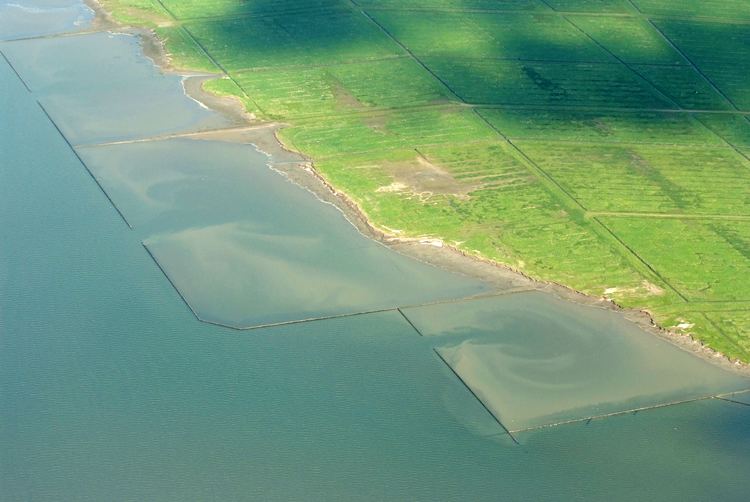
- Land reclaimed from a body of water, such as a lake or the sea bed
- Flood plains separated from the sea or river by a dike
- Marshes separated from the surrounding water by a dike and subsequently drained; these are also known as koogs especially in Germany
The ground level in drained marshes subsides over time. All polders will eventually be below the surrounding water level some or all of the time. Water enters the low-lying polder through infiltration and water pressure of ground water, or rainfall, or transport of water by rivers and canals. This usually means that the polder has an excess of water, which is pumped out or drained by opening sluices at low tide. Care must be taken not to set the internal water level too low. Polder land made up of peat (former marshland) will sink in relation to its previous level, because of peat decomposing when exposed to oxygen from the air.
Polders are at risk from flooding at all times, and care must be taken to protect the surrounding dikes. Dikes are typically built with locally available materials, and each material has its own risks: sand is prone to collapse owing to saturation by water; dry peat is lighter than water and potentially unable to retain water in very dry seasons. Some animals dig tunnels in the barrier, allowing water to infiltrate the structure; the muskrat is known for this activity and actively hunted in certain European countries because of it. Polders are most commonly, though not exclusively, found in river deltas, former fenlands and coastal areas.
Flooding of polders has also been used as a military tactic in the past. One example is the flooding of the polders along the Yser river during World War I. Opening the sluices at high tide and closing them at low tide turned the polders into an inaccessible swamp, which allowed the Allied armies to stop the German army.
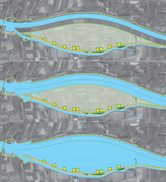
Flood control pumps renovation of a pumping station in the dutch polder
Etymology
From Dutch polder ("polder"), from Middle Dutch polre, from Old Dutch polra, ultimately from pol- "part of land, elevated above its surroundings"; with augmentative suffix -er and epenthetical -d-.
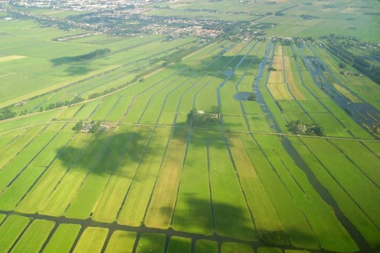
Polders and the Netherlands
The Netherlands is frequently associated with polders, as its engineers became noted for developing techniques to drain wetlands and make them usable for agriculture and other development. This is illustrated by the English saying: "God created the world but the Dutch created Holland".
The Dutch have a long history of reclamation of marshes and fenland, resulting in some 3,000 polders nationwide. About half the total surface area of polders in north-west Europe is in the Netherlands. The first embankments in Europe were constructed in Roman times. The first polders were constructed in the 11th century.
As a result of flooding disasters, water boards called waterschap (when situated more inland) or hoogheemraadschap (near the sea, mainly used in the Holland region) were set up to maintain the integrity of the water defences around polders, maintain the waterways inside a polder, and control the various water levels inside and outside the polder. Water boards hold separate elections, levy taxes, and function independently from other government bodies. Their function is basically unchanged even today. As such they are the oldest democratic institution in the country. The necessary cooperation among all ranks to maintain polder integrity gave its name to the Dutch version of third way politics—the Polder Model.
The 1953 flood disaster prompted a new approach to the design of dikes and other water-retaining structures, based on an acceptable probability of overflowing. Risk is defined as the product of probability and consequences. The potential damage in lives, property and rebuilding costs is compared to the potential cost of water defences. From these calculations follows an acceptable flood risk from the sea at one in 4,000–10,000 years, while it is one in 100–2,500 years for a river flood. The particular established policy guides the Dutch government to improve flood defences as new data on threat levels becomes available.
Some famous Dutch polders and the year they were laid dry are:
Bangladesh
Bangladesh has 123 polders, of which 49 are sea-facing. These were constructed in the 1960s to protect the coast from tidal flooding and reduce salinity incursion. They reduce long-term flooding and waterlogging following storm surges from tropical cyclones. They are also cultivated for agriculture.
Belgium
Canada
Finland
France
Germany
In Germany, land reclaimed by dyking is called a koog. The German Deichgraf system was similar to the Dutch and is widely known from Theodor Storm's novella The Rider on the White Horse.
In southern Germany, the term polder is used for retention basins recreated by opening dikes during river floodplain restoration, a meaning somewhat opposite to that in coastal context.