
Area 502,000 km² | ||
 | ||
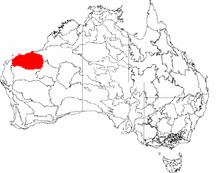
The Pilbara (/ˈpɪlbərʌ/ or /ˈpɪlbrʌ/) is a large, dry, thinly populated region in the north of Western Australia. It is known for its Aboriginal peoples, its ancient landscapes, the red earth, its vast mineral deposits, in particular iron ore and as a global biodiversity hotspot for subterranean fauna. It is one of nine regions of the Regional Development Commissions Act 1993, and is also a bioregion under the Interim Biogeographic Regionalisation for Australia (IBRA).
Contents
- 7 days in the pilbara
- Etymology
- History
- Aboriginal people
- Location and description
- Climate
- Economy
- Iron ore
- Liquified Natural Gas
- Agriculture
- Transport
- Ports
- Ecology
- References
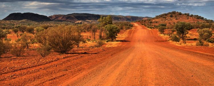
The region has an estimated population of 48,610 as of June 2010. The Pilbara covers an area of 502,000 km2, which includes some of Earth's oldest rock formations. It includes landscapes of coastal plains and mountain ranges with cliffs and gorges. The major settlements of the region are Port Hedland, Karratha and Newman.
The area is known for its petroleum, natural gas and iron ore deposits, which contribute significantly to Australia's economy. Other than mining, pastoral activities as well as fishing and tourism are the main industries.
7 days in the pilbara
Etymology
The Pilbara Aboriginal Language Centre Wangka Maya says that the name for the Pilbara region derives from the Aboriginal word bilybara, meaning 'dry' in the Nyamal and Banyjima languages.
Alternatively, The Western Australia Gas Industry claims that the region takes its name from pilbarra, an Aboriginal word for the mullet (fish). The Pilbara Creek (originally spelt "Pilbarra") is a tributary of the Yule River, a significant river in the region. Pilbarra (Sea Mullet (Mugil cephalus)) and barramundi (Lates calcarifer) can still be caught in the Yule River today. This Pilbara Creek lent its name to the Pilbara Goldfield, discovered in 1885, after which time the name was used to refer to the region.
History
The first European to explore the area was Francis Thomas Gregory in 1861. Settlements along the coast at Cossack, Roebourne and Shellborough were established over ensuing decades as agricultural and pastoral centres. However, after c. 1900, these largely went into decline with the growth of other, more productive agricultural areas of the state. Mining in the area started in 1937 in Wittenoom Gorge, and following the discovery of iron ore in the Hamersley Ranges in the 1960s, the area became pivotal to the state's economy and towns built to accommodate mining and allied services boomed. On 3 October 1952, the British conducted their first atomic bomb tests on the Montebello Islands as part of Operation Hurricane.
Aboriginal people
The Aboriginal population of the Pilbara considerably predates, by 30-40,000 years, the European colonisation of the region. Archaeological evidence indicates that people were living in the Pilbara even during the harsh climatic conditions of the Last Glacial Maximum. The early history of the first peoples is held within an oral tradition, archeological evidence and petroglyphs. Near the town of Dampier is a peninsula known as Murujuga, which contains a large collection of world heritage listed petroglyphs, dating back thousands of years. Rock art in the Pilbara appears to have been primarily etched into the hard rock surfaces, compared to predominantly paintings on the softer sandstone in the Kimberley. This does not preclude that painting was and is not performed in the Pilbara. In 2006, it was estimated that 15% of the population of the Pilbara was of Indigenous background, approximately 6,000 people.
Working conditions in the pearling and pastoral industries for Aboriginals in the Pilbara region around 1900 have been described as slavery with no wages paid, kidnapping as well as severe and cruel punishments for misbehaviour and absconding all common practices. The first strike by Indigenous people in Australia took place in 1946 in the Pilbara, when Aboriginal pastoral workers walked off the stations in protest at low pay and bad working conditions, a strike that lasted for over three years.
Family clans in the Pilbara who were supported by mining prospector, Don McLeod, developed skills for mining and the concentration of rare metals. For a short period money accumulated, which according to Aboriginal law was to be used for traditional ways. Eventually the funds were used to establish an independent Aboriginal-controlled school. The concept has expanded into a movement with around 20 similar schools established in northern Western Australia by the mid 1990s.
Many Pilbara communities struggle with the basics of a healthy life, such as housing, health, education and the many complex effects of colonisation. A 1971 survey conducted by Pat McPherson found that most of 1,000 Aboriginals contacted has one or more serious diseases. At the McClelland Royal Commission into British nuclear testing, Aboriginals from the Pilbara provided evidence regarding the explosion on the Montebello Islands.
Aboriginal communities are sited over a number of different places. Many have poor infrastructure.
Relations between police and aboriginals are very often tense.
Location and description
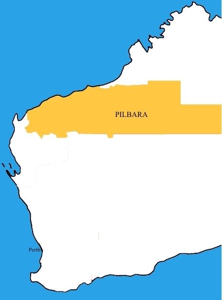
Under the Regional Development Commissions Act Pilbara is situated south of the Kimberley, and is made up of the local government areas of Ashburton, East Pilbara, Karratha and Port Hedland.
The Pilbara region covers an area of 507,896 km2 (193,826 mi2) (including offshore islands), roughly the combined land area of the US States of California and Indiana. It has a population of more than 45,000, most of whom live in the western third of the region, in towns such as Port Hedland, Karratha, Wickham, Newman and Marble Bar. A substantial number of people also work in the region on a fly-in/fly-out basis. There are approximately 10 major/medium population centres and more than 25 smaller ones
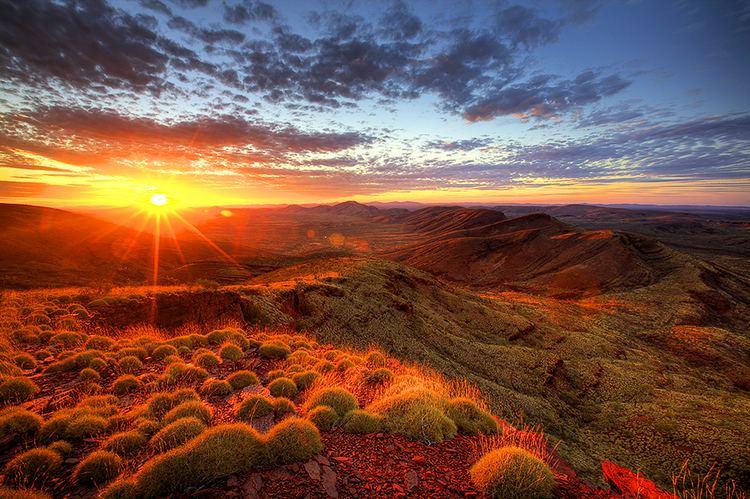
The Pilbara consists of three distinct geographic areas. The western third is the Roebourne coastal sandplain, which supports most of the region's population in towns and much of its industry and commerce. The eastern third is almost entirely desert, and is sparsely populated by a small number of Aboriginal peoples. These are separated by the inland uplands of the Pilbara Craton, including the predominant Hamersley Range which has a considerable number of mining towns, the Chichester Range and others. These uplands have a number of gorges and other natural attractions.
Pilbara contains some of the world's oldest surface rocks, including the ancient fossilised remains known as stromatolites and rocks such as granites that are more than three billion years old. In 2007, some of the oldest evidence of life on Earth was found in 3.4 billion-year-old sandstones at Strelley Pool, which preserve fossils of sulfur-processing bacteria. The mineralized spheres, which were found on an ancient beach and have a cell-like morphology, were chemically analysed, revealing that they used sulfur for fuel.
Climate
The climate of the Pilbara is arid and tropical. It experiences high temperatures and low irregular rainfall that follows the summer cyclones. During the summer months, maximum temperatures exceed 32 °C (90 °F) almost every day, and temperatures in excess of 45 °C (113 °F) are not uncommon. Winter temperatures rarely drop below 10 °C (50 °F) on the coast; however, inland temperatures as low as 0 °C (32 °F) are occasionally recorded.
The Pilbara town of Marble Bar set a world record of most consecutive days of maximum temperatures of 100 degrees Fahrenheit (37.8 degrees Celsius) or more, during a period of 160 such days from 31 October 1923 to 7 April 1924.
The average annual rainfall in the region is between 200 and 350 millimetres (7.9 and 13.8 in). Almost all of the Pilbara's rainfall occurs between December and May, usually with occasional heavy downpours in thunderstorms or tropical cyclones. The period from June to November is usually completely rainless, with warm to very hot and sunny conditions. Like most of the north coast of Australia, the coastal areas of the Pilbara experience occasional tropical cyclones. The frequency of cyclones crossing the Pilbara coast is about 7 every 10 years. Due to the low population density in the Pilbara region, cyclones rarely cause large scale destruction or loss of life.
Economy
The Pilbara's economy is dominated by mining exports and petroleum export industries.
Iron ore
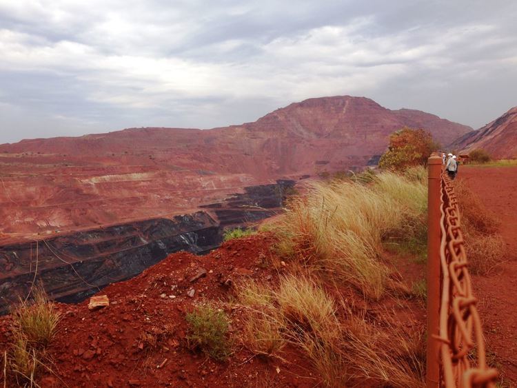
Most of Australia's iron ore is mined in the Pilbara, with mines mostly centred around Tom Price and Newman. The iron ore industry employs 9,000 people from the Pilbara area. The Pilbara also has one of the world's major manganese mines, Woodie Woodie, situated 400 kilometres (250 mi) southeast of Port Hedland.
Iron ore reserves were first discovered by Lang Hancock, and considerable portions of the Pilbara region are still claimed by his daughter Gina Rinehart and the family company Hancock Prospecting continues to gain from its interests in the region - as well as commencing its own mine workings. Blue asbestos was first mined in Wittenoom Gorge in 1943.
In the 1960s, it was reportedly called "one of the most massive ore bodies in the world" by Thomas Price, then vice president of US-based steel company Kaiser Steel. Geoscience Australia calculated that the country's "economic demonstrated resources" of iron amounted to 24 gigatonnes, or 24 billion tonnes. According to the Australian Bureau of Agricultural and Resource Economics, as of 2010, that resource is being used up at a rate of 324 million tonnes a year, with rates expected to increase over coming years. Experts Gavin Mudd (Monash University) and Jonathon Law (Commonwealth Scientific and Industrial Research Organisation) expect it to be gone within 30 to 50 years (Mudd) and 56 years (Law).
As of 2010, active iron ore mines in the Pilbara are:
Liquified Natural Gas
A significant part of Pilbara's economy is based on Liquified Natural Gas (LNG) through North-West Shelf Joint Venture and Pluto LNG Plant, both operated by Woodside.
Agriculture
The region also has a number of cattle-grazing stations, and a substantial tourist sector, with popular natural attractions including the Karijini and Millstream-Chichester national parks, the Dampier Archipelago and the Ningaloo Reef.
Transport
The first railway in the Pilbara region was the narrow-gauge Marble Bar Railway between Port Hedland and Marble Bar. The Marble Bar Railway opened in July 1911 and closed in October 1951. The Roebourne-Cossack Tramway opened in 1897 and many industrial railways have been built to serve the mines.
Currently four heavy-duty railways are associated with the various iron-ore mines, with a fifth line proposed to serve the Fortescue Metals Group Ltd. mines. The railways are all standard gauge and are built to the heaviest North American standards. Between 2008 and 2012, Rio Tinto proposes to convert to driverless trains on its railways. An additional 300 km line is planned from the Roy Hill mine to a port at Boodarie, near Port Hedland.
Ports
The ports of the Pilbara are:
Ecology
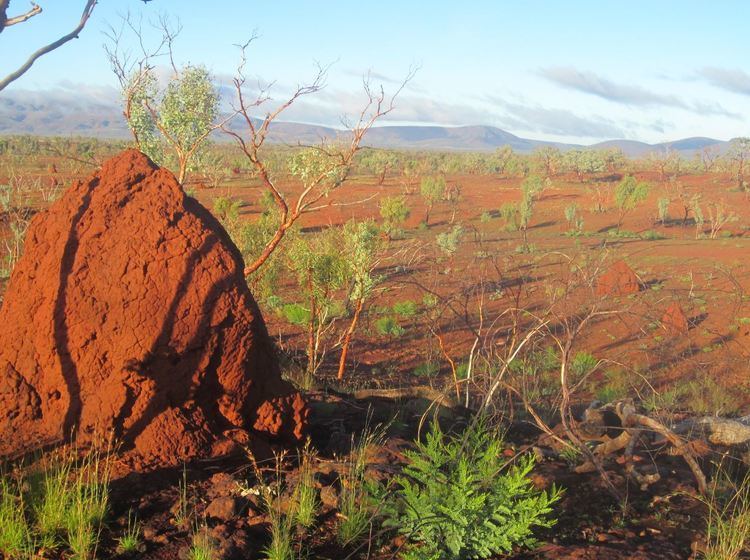
The dominant flora of the Pilbara is acacia trees and shrubs and drought-resistant Triodia spinifex grasses. Several species of acacia (wattle) trees are endemic to the Pilbara and are the focus of conservation programs along with wildflowers and other local specialities.
The Pilbara is home to a wide variety of endemic species adapted to this tough environment. There is a high diversity of invertebrates, including hundreds of species of subterranean fauna (both stygofauna and troglofauna), which are microscopic invertebrates that live underground in the caves, vugs or groundwater aquifers of the region and terrestrial fauna (see short-range endemic invertebrates). The Pilbara olive python, the western pebble-mound mouse, and the Pilbara ningaui of the Hamersley Range are among the many species of animals within the fragile ecosystems of this desert ecoregion. Birds include the Australian hobby, nankeen kestrel, spotted harrier, mulga parrot and budgerigars.
Wildlife has been damaged by the extraction of iron, natural gas and asbestos but the protection of culturally and environmentally sensitive areas of the Pilbara is now advanced by the delineation of several protected areas including the Millstream-Chichester and the Karijini National Parks.