
Population 239,438 (2011 census) | Time zone AEST (UTC+10) Area 46,762 km² | |
 | ||
LGA(s) (by population)Greater BendigoMacedon RangesCampaspeMount AlexanderCentral GoldfieldsGannawarraLoddonBuloke Federal divisions | ||
Fox hunting pictures north central victoria
North Central Victoria is a rural region in the Australian state of Victoria. The region lies to the south of the Victorian/New South Wales border as defined by the Murray River, to the southwest of the Hume region, to the west of the Great Dividing Range contained within the Central Highlands and Victorian Alps, to the north of Greater Melbourne, to the northeast of the Wimmera, and to the east of the Mallee region.
Contents
- Fox hunting pictures north central victoria
- Location
- Political representation
- Local government areas
- Environmental protection
- Climate
- Land use
- References
As at the 2011 Australian census, the North Central region had a population of 239,438, representing the aggregate population of the eight local government areas that comprise the region.
Location
Sustainability Victoria, a Victorian Government agency, defines North Central Victoria as the municipalities of Buloke, Gannawarra, Loddon, Campaspe, Central Goldfields, Mount Alexander, Macedon Ranges and the City of Greater Bendigo. A climate change study by LaTrobe University also includes the Shire of Hepburn within the region.
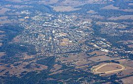
The major urban centres are Bendigo, Castlemaine, Maryborough and Rochester. Smaller localities include Kyneton, Pyramid Hill, Kerang, Donald and Creswick. In 2002 the estimated population of North Central Victoria was 200,000.
Political representation
For the purposes of Australian federal elections for the House of Representatives, the North Central region is contained within the Division of Bendigo, a southwestern portion of the Division of McEwen, the western–most portion of the Division of Murray, the northeastern–most portion of the Division of Mallee, and the northeastern–most portion of the Division of Wannon,
For the purposes of Victorian elections for the Legislative Assembly, the North Central region is contained within the electoral districts of Bendigo East, Bendigo West, Macedon, Murray Plains and Ripon.
Local government areas
For administration purposes the region is divided into eight local government areas:
Environmental protection
The North Central region contains the Greater Bendigo National Park, Gunbower National Park, Heathcote-Graytown National Park, and the Terrick Terrick National Park.
Climate
The climate is moderate with wet winters and warm, dry summers. Annual rainfall ranges from 350 millimetres (14 in) near Swan Hill in the north, to over 1,200 millimetres (47 in) in the far southeast.
Temperatures are warm in summer, typically ranging from a maximum of 31 °C (88 °F) to a minimum of 14 °C (57 °F) in Kerang in the northwest and from 27 °C (81 °F) to 11 °C (52 °F) in the south. Winters are cool with minimum temperatures of 2–4 °C (36–39 °F) across the region.
Land use
The predominant land use is agriculture, including sheep and cattle grazing and the production of cereals, grains and legumes. The gross value of agricultural output exceeds $0.8 billion a year. Forestry is also a major employer in the area surrounding the former gold rush towns of Creswick and Daylesford, with a substantial output of firewood, furniture timber and Eucalyptus oil.
Approximately 13% of the North Central catchment is public land, comprising flora reserves and state and national parks.