
Website Hume Region Area 40,381 km² | Population 300,000 (2012) | |
 | ||
LGA(s) (by population)Greater SheppartonWodongaMitchellMoiraWangarattaIndigoBenallaMurrindindiAlpineStrathbogieMansfieldTowong State electorate(s) BenambraEildonEuroaOvens ValleyShepparton | ||
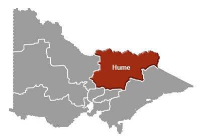
The Hume is an economic rural region located in the north-eastern part of Victoria, Australia. Comprising an area in excess of 40,000 square kilometres (15,000 sq mi) with a population that ranges from 263,000 (in 2011) to 300,000 (in 2012), the Hume region includes the local government areas of Alpine Shire, Rural City of Benalla, City of Wodonga, City of Greater Shepparton, Shire of Indigo, Shire of Mansfield, Shire of Strathbogie, Shire of Towong and the Rural City of Wangaratta, and also includes five unincorporated areas encompassing the alpine ski resorts in the region.
Contents
The Hume region is located along the two major interstate transport corridors – the Hume corridor and the Goulburn Valley corridor. The region comprises four distinct and inter-connected sub-regions or districts: Upper Hume, Central Hume, Goulburn Valley, and Lower Hume. The regional cities and centres of Wodonga, Shepparton and Wangaratta (supported by Benalla) function as a network of regional hubs that service their own distinct sub-regions. The region is bounded by the Victorian Alps in the south and east, the New South Wales border defined by the Murray River in the north, the Loddon Mallee region in the west and the Greater Melbourne northern, western, and eastern metropolitan and Gippsland regions to the south.
Political representation
For the purposes of Australian federal elections for the House of Representatives, the Hume region is contained within all or part of the electoral divisions of Bendigo, Indi, McEwen, and Murray.
For the purposes of Victorian elections for the Legislative Assembly, the Hume region is contained within all or part of the electoral districts of Benambra, Eildon, Euroa, Ovens Valley, and Shepparton.
Local government areas
The region contains twelve local government areas and five unincorporated areas of Victoria, which are:
Environmental protection
The Hume region contains the Barmah, Burrowa-Pine Mountain and Chiltern-Mt Pilot national parks.