
State Victoria Electors 45,147 (2014) | Demographic Rural Elector 45,147 (2014) | |
 | ||
Dates current 1945–1955, 1976–current Area 16,761 km (6,471.5 sq mi) Party Liberal Party of Australia | ||
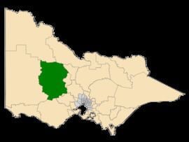
Ripon is a single member electoral district of the Victorian Legislative Assembly. It is a rural electorate based in western Victoria. In 1946 the Electoral district of Ripon was first contested but then abolished in the 1955 election after being held by Labor for seven of these years. Ripon was then re-created and has existed continuously since 1976.
Ripon has an area of 16,761 square kilometres. It includes the towns of Ararat, Avoca, Bealiba, Beaufort, Bridgewater on Loddon, Buangor, Cardigan, Carisbrook, Charlton, Clunes, Creswick, Donald, Dunolly, Eddington, Elmhurst, Glenorchy, Great Western, Inglewood, Landsborough, Lexton, Lucas, Marnoo, Maryborough, Miners Rest, Moonambel, Newbridge, Snake Valley, St Arnaud, Stawell, Stuart Mill, Talbot, Tarnagulla and Wedderburn. The main population centres are Creswick, Ararat, Maryborough, Avoca, Donald, Bridgewater, St Arnaud and Stawell. This district is known for agriculture, wine making, timber industries, manufacturing, wool production, paper milling, knitting mills and tourism.
For most of its history, Ripon has been held by the Liberal Party. However, it was held by the Australian Labor Party from 1999 to 2014.