
Length 218 km | Basin size 3,950 km (1,530 sq mi) Countries Bulgaria, Serbia | |
 | ||
Main source Bulgaria, Stara Planina mountains River mouth Južna Morava, west of Niš, Serbia Discharge Average rate:36 m/s (1,300 cu ft/s) at the mouth | ||
Kud maestro branko markovi ni ava
The Nišava or Nishava (Bulgarian and Serbian Cyrillic: Нишава, [nǐʃaʋa]) is a river in Bulgaria and Serbia, a right tributary, and with a length of 218 km also the longest one, of the South Morava.
Contents
- Kud maestro branko markovi ni ava
- Map of NiC5A1ava
- Kud diogen i de iji ansambl ni ava
- Bulgaria
- Serbia
- Characteristics and importance
- Sievo gorge
- References
Map of Ni%C5%A1ava
Kud diogen i de iji ansambl ni ava
Bulgaria
The Nišava originates in western Bulgaria, in the Stara Planina mountains (east of Kom Peak) near the village of Gintsi. Its source is close to the Serbian border. It enters Serbia after 67 km of flow through Bulgaria without receiving any major tributaries.
Because it flows through Gintsi, the upper course of the river is known as Ginska (Cyrillic: Гинска). It first flows to the south, then sharply turns west into the Godech Kettle, passing through Razboishte, after which it forms a gorge. Coming out of the gorge, it reaches Kalotina, a major border crossing on the Bulgarian-Serbian border (Kalotina-Gradina), and continues to the west into Serbia.
Serbia
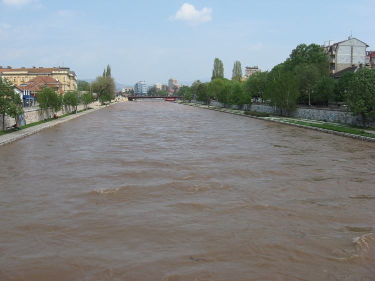
Flowing generally to the west for the remaining 151 km, it passes near Dimitrovgrad, Pirot, Bela Palanka, Niška Banja and Niš, one of the largest cities in Serbia, 10 km after which the Nišava empties into the Južna Morava. However, with the rapid growth of Niš in previous decades and its still fast growing suburbs, the banks of the Nišava are urbanized almost to its mouth.
After being divided into districts in 1992, the Nišava District (with Niš as administrative center) is named after the river.
Characteristics and importance
The river belongs to the Black Sea drainage basin. Its own drainage area covers 3,950 km2 (1,237 km2 in Bulgaria and 2,713 km2 in Serbia). The Nišava is not navigable. It is not only the longest tributary of the Južna Morava, but also the largest one in terms of discharge (36 km3/s). It has many smaller tributaries, the most important being the Temštica from the right, and the Jerma (or Sukovska reka), Crvena reka, Koritnička reka and Kutinska reka from the left.
The Nišava valley is part of a major natural route that from ancient times has connected Europe and Asia: the route follows the valleys of the Morava, Nišava and Maritsa and onwards towards Constantinople, present-day Istanbul. Both the Belgrade-Sofia-Istanbul road and the railway follow this route.
Nishava Cove in Rugged Island in the South Shetland Islands, Antarctica is named after Nishava.
Sićevo gorge
In its Serbian part, the Nišava carved a composite valley with several depressions (Dimitrovgrad, Pirot (or Basara; Cyrillic: Басара), Bela Palanka and Niš). However, the most prominent geological feature the river formed is the Sićevo gorge (Sićevačka klisura; Cyrillic: Сићевачка клисура) between Bela Palanka and Niška Banja. The river is quite powerful in the gorge, which is used for two power stations ('Sićevo' and 'Ostrovica') used for electricity production, irrigation and fishery. The gorge is 17 km long, 350–400 m deep, in some parts developing canyon like-structures (like inverse valley slopes at Gradiški kanjon; Cyrillic: Градишки кањон). The gorge itself carved through the Kunovica plateau between the southern slopes of the Mountains of Svrljig and the mountain of Suva Planina, and the surrounding areas are known for their high-quality vineyards. There is also a huge quarry in the gorge ('Ostrovica'), where six villages are located, the largest one being Sićevo that gives the name to the whole gorge.