
Peak Trem Highest point Trem Mountains Sokolov kamen, Trem | Elevation 1,810 m (5,940 ft) Country Serbia | |
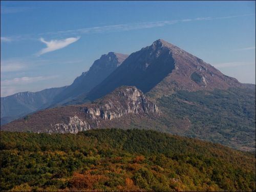 | ||
Suva Planina (Serbian Cyrillic: Сува планина, meaning "The dry mountain") is a mountain in southeastern Serbia. It lies between towns of Niška Banja on the northwest and Babušnica on the southeast, with a ridge branching towards Bela Palanka on north. Its earlier name was Kunovica.
Map of Suva Planina, Serbia
The highest peak is Trem ('porch') at 1,810 m, the second highest is Golemo Stražište at 1,714m, and there is also "Litica" at 1,683m ('cliff') southeast side of the mountain.
The name stems from the fact that there are only few springs in the whole mountain. Two biggest are Bojanine vode (under Sokolov kamen at 860 m) and Rakoš česma (at the Bela Palanka side of the mountain).
Traces of the Roman military road Via Militaris, connecting Singidunum (now Belgrade) and Constantinople (now Istanbul) are still visible across the mountain.
As of 2010, Suva planina is undergoing a process of declaration of a special nature preserve.
In last weekend in February there is a mountaineering event called “Zimski uspon na Trem” (Winter climb on Trem), that gathers over 600 mountaineers from all parts of the Balkans. It is also the biggest Balkan’s mountain winter event. It started in 1997 and it is under the organization of Mountaineering club “Železničar” from Niš.
The slopes of this mountain are popular with skiing.