
Admin. region Darmstadt Elevation 100 m (300 ft) Area 15.82 km² Local time Saturday 3:06 AM Administrative region Darmstadt | Time zone CET/CEST (UTC+1/+2) Population 25,433 (30 Jun 2009) Postal code 65795 Team FC Eddersheim | |
 | ||
Weather 8°C, Wind SW at 26 km/h, 72% Humidity | ||
Spaziergang durch hattersheim am main
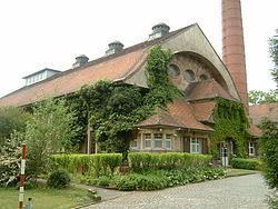
Hattersheim am Main is a town in the Main-Taunus district, Hesse (Germany) and part of the Frankfurt Rhein-Main urban area.
Contents
- Spaziergang durch hattersheim am main
- Map of Hattersheim am Main Germany
- Neighbouring towns
- Structure
- Population
- History
- Eddersheim
- Okriftel
- People born in Hattersheim
- References
Map of Hattersheim am Main, Germany
Neighbouring towns
Hattersheim borders the city of Frankfurt in the northeast, in the southeast with Kelsterbach, in the southwest with Raunheim (both are in the district of Groß-Gerau). The western neighboring towns are Flörsheim, Hofheim and Kriftel.
Structure
Hattersheim consists of three districts: Eddersheim, Hattersheim und Okriftel.
Population
(31 December)
History
In 1972 the villages of Okriftel und Eddersheim, both situated next to the river Main, have been incorporated into Hattersheim. Since then the town is called Hattersheim am Main.
Eddersheim
4944 people lived here in 2004. There is a watergate on the river Main near the village's centre. The engineer and inventor Anton Flettner was born in Eddersheim.
Okriftel
7561 people lived here in 2007. You can cross the river Main with by ferry. The next town on the other side of the river is Kelsterbach. The ferry boat operates in summer time on Sundays.