
Reference no. DE: 246 Length 131 km | Source elevation 457 m | |
 | ||
Main source near Weikersholz447 m above sea level (NN) Similar Franconia, Rhine, Regnitz, Castle Road, St James's Church - Rothenbu | ||
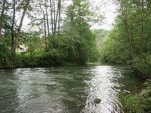
The Tauber is a river in Franconia, Germany. It is a left tributary of the Main and is 122 km in length. The name derives from the Celtic word for water (compare: Dover).
Map of Tauber, Germany
It flows through Rothenburg ob der Tauber, Creglingen, Weikersheim, Bad Mergentheim, Königshofen, Tauberbischofsheim, and flows into the river Main in Wertheim am Main.
There is a medieval bridge over the river near Rothenburg ob der Tauber.
References
Tauber Wikipedia(Text) CC BY-SA