
Founded January 15, 1818 Area 1,476 km² Unemployment rate 4.9% (Apr 2015) | Website macombcountymi.gov Population 854,769 (2013) | |
 | ||
Colleges and Universities Macomb Community College, Baker College of Clinton T, Dorsey Business Schools, Paul Mitchell the School‑Michigan, Regency Beauty Institute Points of interest Edsel and Eleanor Ford Hou, Lake St Clair Metropark, Stony Creek Metropark, Lake St Clair, River Bends Park | ||
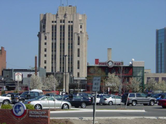
Macomb County is a county located in the eastern portion of the U.S. state of Michigan. As of the 2010 census, the population was 840,978, making it the third-most populous county in the state. Of Michigan's five largest counties, Macomb experienced the most population growth (6.7%) between 2000 and 2010. The county seat is Mt. Clemens.
Contents
- Map of Macomb County MI USA
- History
- Geography
- Adjacent counties
- Demographics
- Parks and recreation
- Government
- Elected officials
- Politics
- Air
- Major highways
- Other roads
- Villages
- ActorsActresses
- Athletes
- Musicians
- Other
- References
Map of Macomb County, MI, USA
Macomb County is part of the Detroit-Warren-Dearborn, MI Metropolitan Statistical Area. The city of Detroit is located south of 8 Mile Road, the county's southern border.
Macomb County contains 27 cities, townships and villages, including three of the top ten most populous municipalities in Michigan as of the 2010 census: Warren (#3), Sterling Heights (#4) and Clinton Township (#10). Most of this population is concentrated south of Hall Road (M-59), one of the county's main thoroughfares.
History
The Ojibwe lived in the area centuries before European contact. The first European explorers arrived in the area during the 17th century. A Moravian colony was established in the county in the late 18th century. They included French fur trappers and missionaries. In addition to the original French and English, later settlers included Germans, Belgians and others who came directly from Europe. In the 19th century the county received many American migrants from New York and New England who were attracted to the area for land and booming jobs.
Macomb County was formally organized on January 15, 1818 as the third county in the Michigan territory. At that time, it covered a much larger area than it does today. In 1819 and 1820, large portions of the county were removed to form the counties of Oakland, Lapeer, Genesee and St. Clair. The county was named in honor of Detroit-born Alexander Macomb, Jr., a highly decorated veteran of the War of 1812 and hero of the Battle of Plattsburg, who became Commanding General of the U.S. Army in 1828.
In May 2008, Macomb County voters approved the inclusion of a County Executive in a new charter to be submitted to the voters by 2010. A charter commission was elected in November 2008 for the purpose of drafting a charter for submission to Governor Granholm, which was submitted and approved and placed on the November 2009 ballot. The Charter passed with a 60.4% to 39.6% margin. Mark Hackel was voted in as Macomb's first county executive.
Geography
According to the U.S. Census Bureau, the county has a total area of 571 square miles (1,480 km2), of which 479 square miles (1,240 km2) is land and 92 square miles (240 km2) (16%) is water. The county's southeastern border with Canada is located across Lake St. Clair.
Lake St. Clair borders the county on the east.
Far northern parts of the county, such as Richmond and Armada, are often considered to be part of Michigan's Thumb region.
Adjacent counties
Demographics
As of the 2010 United States Census, there were 840,978 people residing in the county. 85.4% were White, 8.6% Black or African American, 3.0% Asian, 0.3% Native American, 0.6% of some other race and 2.1% of two or more races. 2.3% were Hispanic or Latino (of any race). 14.8% were of German, 14.3% Polish, 11.1% Italian, 6.5% Irish and 5.9% American ancestry.
In 2000, 87.6% of county residents spoke only English at home; 1.7% spoke Italian, 1.4% Polish, 1.2% Spanish, 1.1% Arabic and 1.1% Syriac.
Among Asian ethnic groups, six numbered over 1,000 people in Macomb County. The most numerous were the 5,713 Asian Indians, followed by Filipinos (4,155), Chinese (2,489), Koreans (1,853) Vietnamese (1,557), and Hmong (1,103). Pakistanis are also represented in Macomb County's population.
White ethnic groups that have settled in Macomb County include Albanians, Arabs, Chaldeans and Macedonians.
Two Native American tribes had over 1,000 residents in Macomb County in 2000. The Cherokee tribe counted 1,781 county residents, while 1,038 reported membership in the Chippewa (Ojibwa) tribe.
In 2000, there were 309,203 households out of which 31.10% had children under the age of 18 living with them, 54.30% were married couples living together, 10.10% had a female householder with no husband present, and 31.80% were non-families. 26.90% of all households were made up of individuals and 10.30% had someone living alone who was 65 years of age or older. The average household size was 2.52 and the average family size was 3.09.
In 2000, the age distribution of the county was as follows: 24.10% under the age of 18, 8.00% from 18 to 24, 31.50% from 25 to 44, 22.80% from 45 to 64, and 13.70% who were 65 years of age or older. The median age was 37 years. For every 100 females there were 96.00 males. For every 100 females age 18 and over, there were 92.90 males.
The median income for a household in the county was $52,102, and the median income for a family was $62,816. Males had a median income of $48,303 versus $30,215 for females. The per capita income for the county was $24,446. About 4.00% of families and 5.60% of the population were below the poverty line, including 7.00% of those under age 18 and 6.40% of those age 65 or over.
According to the 2006 American Community Survey the average family size was 3.15. The population of 25 and over was 571,463. 86.9% of that population had graduated from high school, and 21% of the population had a Bachelor's degree or higher. About 14.3% of that population was disabled. 12.5% of Macomb's population could speak another language at home.
Parks and recreation
Macomb County is home to more than 130 parks covering 12,000 acres (49 km2) managed by the state, regional, county, and local government. There are four major public parks in the County - Freedom Hill County Park, Macomb Orchard Trail, Metro Beach Metropark, and Stony Creek Metropark. The county also has 31 miles of shoreline and over 100 marinas.
Government
The county government operates the jail, maintains rural roads, operates the major local courts, keeps files of deeds and mortgages, maintains vital records, administers public health regulations, and participates with the state in the provision of welfare and other social services. The county board of commissioners controls the budget but has only limited authority to make laws or ordinances. In Michigan, most local government functions — police and fire, building and zoning, tax assessment, street maintenance, etc. — are the responsibility of individual cities and townships.
In May 2008, Macomb County voters approved the inclusion of a County Executive in a new charter to be submitted to the voters by 2010. A charter commission was elected in November 2008 for the purpose of drafting a charter for submission to Governor Granholm, which was submitted and approved and placed on the November 2009 ballot. The Charter passed with a 60.4% to 39.6% margin. The Macomb Intermediate School District serves all school districts based in the county.
Elected officials
Politics
Macomb County has shown Republican tendencies in statewide and federal elections, while tending to favor Democratic candidates at the local level. The county gained fame in the 1980s and '90s as a bellwether of state and national politics. Macomb's large cohort of working-class, socially conservative whites gave it one of the nation's most prominent concentrations of "Reagan Democrats". Outsider candidates with a conservative-populist bent have done well there in the past, such as Pat Buchanan in 1992 and Donald Trump in 2016. Macomb County voters were primarily responsible for the failure of the Regional Transit Authority proposal to create a public transit system in the Metropolitan Detroit region.