
Country United States Demonym(s) Lompocan Local time Sunday 1:41 AM Population 43,509 (2013) | State California Incorporated August 13, 1888 Elevation 32 m Area code 805 | |
 | ||
Named for Chumash: Lompo': "Stagnant Water" Weather 13°C, Wind NW at 11 km/h, 72% Humidity | ||
Mural in a weekend timelapse lompoc california
Lompoc (/ˈlɒmpoʊk/, LOM-poke) is a city in Santa Barbara County, California, United States. The city was incorporated on August 13, 1888. The population was 42,434 at the 2010 census, up from 41,103 at the 2000 census.
Contents
- Mural in a weekend timelapse lompoc california
- Map of Lompoc CA USA
- History
- Fire department
- Law enforcement
- Geography
- Climate
- 2010
- 2000
- Transportation
- Community College
- High schools
- Junior highmiddle schools
- Elementary schools
- Local economy
- Culture
- Lompoc Theatre
- Lompoc Pops Orchestra
- Notable people
- Sister cities
- Tourist attractions
- References
Map of Lompoc, CA, USA
Prior to the European settlements, the area around Lompoc was inhabited by the Chumash people. The name of the city is derived from a Chumashan term, "Lum Poc", that means "stagnant waters" or "lagoon." The Spanish called it "lumpoco." In 1837, the Mexican government granted the land around Lompoc as the Rancho Lompoc land grant. After the United States gained control of California in the Mexican–American War, the valley was acquired by Thomas Dibblee, Albert Dibblee and William Welles Hollister, the latter of whom sold his portion to the Lompoc Valley Land Company. It is from that portion that the present-day Lompoc was established as a temperance colony. The town was originally intended to be called New Vineland, modeled after the temperance colony in New Jersey. Lompoc then became a military town with the completion of nearby Camp Cooke (now, Vandenberg Air Force Base). The city is known as the flower seed capital of the world.
History
Prior to the Spanish conquest, the area around Lompoc was inhabited by the Chumash people. La Purisima Mission was established in 1787 near what is now the Southern edge of the city of Lompoc. The Purisimeño language was the Chumashan language spoken in the region during the mission period. After an earthquake destroyed the mission in 1812, it was relocated to its present location 1 mile (1.6 km) northeast of the present city. In 1821, the First Mexican Empire was established after independence from the Spanish Empire and subsequently secularized the California missions in 1833. Mission La Purísima gradually fell into ruins.
In 1837, the Mexican government granted the land around Lompoc as the Rancho Lompoc land grant. The United States gained control of California in the Mexican–American War, 1846-1848. The valley was acquired by Thomas Dibblee, Albert Dibblee and William Welles Hollister, the latter of whom sold his portion in 1874 to the Lompoc Valley Land Company. It is from that portion that the present-day Lompoc was established as a temperance colony. The city was incorporated on August 13, 1888 and the town was originally intended to be called New Vineland, modeled after the temperance colony in New Jersey.
The coastal branch of the Southern Pacific Railroad replaced ship transportation around 1900. In 1893 a diatomite mine opened in the southern hills in Miguilito canyon, it became and still is the largest marine diatomite mine in the world and at one time was the largest employer in the valley. Owned by Johns Manville then Allegheny corp. and now Emerys corp. In the 1940s Grefco. another diatomacious earth mine moved to lompoc, it ceased operations in 1998, Its remnants can still be seen at the northeast end of town. In 1909, the Sibyl Marston, at the time, the largest steam schooner built on the west coast sank nearby carrying 1,100,000 board feet (2,600 m3) of lumber. Many of the older Lompoc homes are built with the strewn lumber from the shipwreck. Its remnants can still be seen south of Surf Beach.
A paved road linked Lompoc to Buellton and the rest of California around 1920. In 1923 the Honda Point disaster, the largest U.S. peacetime naval accident, occurred just off the coast. Nine U.S. destroyers ran aground with the loss of 23 lives. During the Great Depression Mission La Purisima Concepcion was restored by the Civilian Conservation Corps (CCC). The W. C. Fields movie The Bank Dick (1940), was set in Lompoc (although the name was mis-pronounced as Lom' poc). During World War II, the coast west of Lompoc was the site of Camp Cooke, a United States Army training camp where large units could practice maneuvers.
Lompoc grew slowly until 1958, when the United States Air Force announced that the former Camp Cooke would be a test site for the Thor intermediate-range ballistic missile, and the first operational base for the SM-65 Atlas intercontinental-range ballistic missile. Lompoc then began to grow rapidly to provide housing for thousands of civilian and contractor workers employed at what was soon named Vandenberg Air Force Base. Vandenberg Air Force Base was the first missile base of the United States Air Force. The Space Shuttle program was slated to begin launches in the late 1980s. The city experienced a boom in restaurant and hotel construction in the mid-1980s, due to the anticipated influx of tourists coming to see shuttle launches. However, when the Challenger exploded during take-off from Cape Canaveral in 1986, the West Coast Shuttle Program was terminated, leaving Lompoc in a severe recession.
Located close to Vandenberg Air Force Base is the Federal Correctional Complex Lompoc. This is a Medium & low security facility for male inmates.
Today, the city of Lompoc is dubbed "The City of Arts and Flowers" and is also becoming known for its local wines after the movie Sideways was filmed in Lompoc (bowling alley scene), and east of Lompoc in the Santa Ynez Valley, Solvang and Buellton. In 2010, Playboy named Jasper's, a local Lompoc bar, as one of the top 10 dive bars in the country.
Fire department
The Lompoc Fire Department (LFD) is an all-risk fire protection agency, responding to over 3,800 emergency and non-emergency calls for service annually. The LFD provides automatic and mutual aid to the Santa Barbara County Fire Department as well as providing primary fire protection and emergency medical response to the United States Penitentiary. There are a combined 30 sworn and non-sworn individuals involved in delivering fire and emergency services to the jurisdiction, including: one fire chief; one administrative assistant; three battalion chiefs; one deputy fire marshal (captain rank); six fire duty captains; six fire engineers and twelve firefighters. The LFD provides a variety of services, including fire suppression, basic life support medical service, entrapment extrication, high-angle rescue, low-angle rescue, vehicle extrication, swift-water rescue, trench and collapse rescue, confined space rescue and hazardous materials mitigation.
Law enforcement
The Lompoc Police Department is the primary law enforcement agency for the City.
Geography
Lompoc is located at 34°38′46″N 120°27′37″W (34.646182, -120.460316). Most of the city is in the valley of the Santa Ynez River at an elevation of about 80–100 feet (25–30 meters); recent expansion has been to the north, on higher ground known as Vandenberg Village, with elevations of 150–300 feet (50–100 meters). Like most rivers in Southern California, the Santa Ynez River does not have a surface flow for most of the year. Underground flow in the sandy river bed recharges the aquifer beneath the city, from which 9 wells, with a tenth one planned, supply the city with water. Unlike many other cities in Southern California, Lompoc is not connected to the State Water Project.
The city was long known as the flower seed capital of the world. Flower fields have diminished in recent years, so it's debatable whether that title still stands. According to the United States Census Bureau, the city has a total area of 11.7 square miles (30 km2), 99.34% of it land and 0.66% of it water.
The Federal Correctional Complex located between Lompoc and Vandenberg AFB includes both a medium and low security Federal Correctional Institution, and two minimum security camps. A Satellite Prison Camp and a Residential Drug Treatment Camp.
Climate
Lompoc has a cool Mediterranean climate (Köppen climate classification Csb) typical of coastal California.The climate is mostly sunny refreshed by the ocean breeze. Fog is common. Snow is virtually unknown. The highest recorded temperature was 110 °F (44 °C) in 1987. The lowest recorded temperature was 15 °F (-9 °C) in 2013.
2010
The 2010 United States Census reported that Lompoc had a population of 42,434. The population density was 3,634.7 people per square mile (1,403.4/km²). The racial makeup of Lompoc was 25,950 (61.2%) White, 2,432 (5.7%) African American, 750 (1.8%) Native American, 1,615 (3.8%) Asian, 186 (0.4%) Pacific Islander, 9,020 (21.3%) from other races, and 2,481 (5.8%) from two or more races. Hispanic or Latino of any race were 21,557 persons (50.8%).
The Census reported that 38,778 people (91.4% of the population) lived in households, 99 (0.2%) lived in non-institutionalized group quarters, and 3,557 (8.4%) were institutionalized.
There were 13,355 households, out of which 5,481 (41.0%) had children under the age of 18 living in them, 6,323 (47.3%) were opposite-sex married couples living together, 2,061 (15.4%) had a female householder with no husband present, 913 (6.8%) had a male householder with no wife present. There were 949 (7.1%) unmarried opposite-sex partnerships, and 75 (0.6%) same-sex married couples or partnerships. 3,304 households (24.7%) were made up of individuals and 1,187 (8.9%) had someone living alone who was 65 years of age or older. The average household size was 2.90. There were 9,297 families (69.6% of all households); the average family size was 3.48.
The population was spread out with 11,188 people (26.4%) under the age of 18, 4,452 people (10.5%) aged 18 to 24, 12,233 people (28.8%) aged 25 to 44, 10,338 people (24.4%) aged 45 to 64, and 4,223 people (10.0%) who were 65 years of age or older. The median age was 33.9 years. For every 100 females there were 114.9 males. For every 100 females age 18 and over, there were 118.7 males.
There were 14,416 housing units at an average density of 1,234.8 per square mile (476.8/km²), of which 6,493 (48.6%) were owner-occupied, and 6,862 (51.4%) were occupied by renters. The homeowner vacancy rate was 2.2%; the rental vacancy rate was 7.1%. 18,534 people (43.7% of the population) lived in owner-occupied housing units and 20,244 people (47.7%) lived in rental housing units.
2000
As of the census of 2000, there were 43,284 people, 13,059 households, and 9,311 families residing in the city. The population density was 3,532.2 people per square mile (1,363.4/km²). There were 13,621 housing units at an average density of 1,170.5 per square mile (451.8/km²). The racial makeup of the city was 65.81% White, 7.34% African American, 1.58% Native American, 3.90% Asian, 0.32% Pacific Islander, 15.68% from other races, and 5.35% from two or more races. Hispanic or Latino of any race were 37.31% of the population.
There were 13,059 households out of which 41.1% had children under the age of 18 living with them, 51.0% were married couples living together, 14.8% had a female householder with no husband present, and 28.7% were non-families. 23.5% of all households were made up of individuals and 8.3% had someone living alone who was 65 years of age or older. The average household size was 2.88 and the average family size was 3.42.
In the city, the population was spread out with 29.9% under the age of 18, 8.9% from 18 to 24, 33.3% from 25 to 44, 18.5% from 45 to 64, and 9.4% who were 65 years of age or older. The median age was 32 years. For every 100 females there were 113.0 males. For every 100 females age 18 and over, there were 116.4 males.
The median income for a household in the city was $47,587, and the median income for a family was $62,199. Males had a median income of $35,074 versus $26,824 for females. The per capita income for the city was $15,509. About 12.6% of families and 15.4% of the population were below the poverty line, including 20.8% of those under age 18 and 6.7% of those age 65 or over.
Transportation
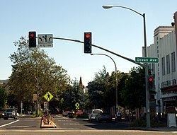
State Route 1 is the major north-south artery through Lompoc. State Route 246 heads east to Buellton and the Santa Ynez Valley.
Surf station is located to the west at Surf Beach and is served by the Pacific Surfliner line. Thruway Motorcoach buses stop in town. Lompoc is served by the City of Lompoc Transit, Clean Air Express to Santa Barbara/Goleta, and The Breeze Bus to Buellton/Solvang and Santa Maria.
Community College
High schools
Junior high/middle schools
Elementary schools
Local economy
Vandenberg Air Force Base dominates the economy, directly employing a large percentage of Lompoc's residents, and contributes $1.7 billion to the regional economy. Other mainstays of the economy include the Federal Correctional Institution, a diatomaceous earth mine, the Lompoc Oil Field and associated oil processing facilities north of town, and agriculture (especially seed flowers and vegetables). Since the end of the Cold War, many workers employed in Santa Barbara have moved to Lompoc to take advantage of lower housing costs, effectively making Lompoc a 'bedroom community' of Santa Barbara. The character of the town has changed considerably with the growth associated with this demographic shift; in addition, new housing developments are spreading into the adjacent hills on the north side of town.
Wine production and wine tourism comprise the rapidly expanding value-added agricultural sector of the Lompoc economy. Lompoc Valley is the gateway to the Sta. Rita Hills AVA wine appellation, internationally recognized for premium pinot noir and chardonnay. Thirty premium boutique wine labels are produced in Lompoc at wineries in the affectionately termed "Lompoc wine ghetto" industrial park and other locations across town. Numerous other wineries are located along California State Route 246, linking Lompoc with Buellton, and on Santa Rosa Road. Wine tasting rooms are located in the "Wine Ghetto" and other locations in Lompoc.
Culture
The Lompoc Valley Flower Festival, held the last week of June, features a parade, carnival and a craft show. In 2002, the Floral Flag was planted by the Bodger Seed Company as a tribute after the September 11, 2001 tragedy. The Floral Flag was 740 feet by 390 feet, covered 6.65 acres, and was estimated to contain more than 400,000 larkspur plants.
The Lompoc arts scene features a number of upcoming musicians and bands, ranging from singer-songwriters to psychedelic blues-rock bands. At the center of this scene is Howlin’ Byroon’s Music Exchange, a music store and frequent venue for Lompoc’s musicians. The shop was opened in May 2009, and now offers guitar lessons, consigned musical instruments and live performances.
Emily Wryn is a Lompoc songwriter who has been writing music since she was 13 years old. At age 18, one of her songs “Head on Straight” was played by DJ Nick Harcourt. Her music was also featured on NPR’s “Morning Becomes Eclectic.” Her first EP Head on Straight was released in February 2012. The album features cover art by Angelina LaPointe, who also created the cover for Saint Anne’s Place’s The Earth Shaker EP. Wryn played the Indie Week festival in Ireland in April 2014. Wryn also collaborates with the member’s of Saint Anne’s Place in a band called The Lights Electric.
Millions is the successor to the band “Le Petit Protest”, a vehicle for the songwriting of Randall Sena. Sena was dissatisfied with the live show of Le Petit Protest, causing him to disband the project. Millions is now playing gigs around the central coast. Sena is a frequent collaborator with other artists in the Lompoc music scene. Sena recorded and produced Emily Wryn’s EP Head on Straight as well as Saint Anne’s Place’s Speak Easy in his recording studio, Certain Sparks.
One of Lompoc’s most successful current artists is the rock band Saint Anne’s Place. The band was formed in 2008 and originally featured Jacob Cole, Samuel Cole, JT Wild, and Clive Hacker. The band began writing and playing music, but Hacker and Wild would eventually quit the band. Samuel and Jacob’s cousin, Joel, would join the band as bassist in April 2010, and the line-up has remained stable ever since. The band’s music has been described as “blistering yet rustic mix of blues, psychedelia, and folk rock with the chops of players twice their senior.” The members of Saint Anne’s Place grew up playing in their family’s blues bands, an influence that can still be heard in their music today. The band released their first EP, Speak Easy in 2011. The EP featured five songs, including “Lazy Fingers.”
In 2011, the band would also win The Santa Barbara Independent’s 2011 battle of the bands. After being selected through rounds of online voting, finally culminating in a set at a concert with three other finalists, voters chose Saint Anne’s Place. Saint Anne’s Place released their second EP, The Earth Shaker in December 2012. The eight song EP was critically acclaimed by local media.
Lompoc Theatre
The Lompoc Theatre at H and Ocean, constructed in 1927, was owned and operated by the Calvert family for many years. Walter Calvert and his brother-in-law, William Baker, took over the Opera House, a different establishment, in Lompoc in 1912. The Opera House did not feature much opera, but under the direction of Calvert and Baker, the Opera House became a success, offering silent films and local events to the people of Lompoc. In 1926, the Calverts purchased the building that would become the Lompoc Theatre. The theatre had its grand opening on May 27, 1927. The grand opening featured an organ solo by a blind judge, song and dance and music by an orchestra. The two comedy films, “Lost at the Front” and “Circus Daze” were shown.
Walter Calvert’s son, Earl, became involved with the management of the theatre in 1929. The theatre continued to thrive for many years. The theatre encountered financial trouble in the 1970s, due to competition from multiplexes and television. The last year a movie was shown on its screen was in 1985.
In July 2003, a non-profit group, the Lompoc Housing and Community Development Corporation announced plans to restore the theatre. The LHCDC was able to raise funds with the assistance of the City of Lompoc to purchase the theatre. By March 2008, the cost of renovating the theatre was valued at just under 10 million dollars. During its time of ownership of the theater, the LHCDC was unable to raise the money needed for renovations, and the building accumulated three liens. The building's ownership was recently passed on to the grassroots group called the “Lompoc Theatre Project,” which is working to renovate and reopen the building. The group hopes to reopen the theatre in 2017.
Lompoc Pops Orchestra
The Lompoc Pops Orchestra has been performing for 20 years and has been recognized up and down the California Central Coast. Composed of approximately 45 semi-professional musicians, under the direction of Dr. Brian Asher Alhadeff, its music includes musicals, Broadway hits, jazz pieces, big band, gospel, patriotic music, among other things. The Orchestra performs four times a year to sell-out crowds.
Notable people
Sister cities
Lompoc has five sister cities: