
Country United States County Laramie Area 63.79 km² Local time Saturday 8:06 AM | Founded 1867 Elevation 1,848 m Population 62,448 (2013) | |
 | ||
Weather 2°C, Wind W at 13 km/h, 41% Humidity | ||
Cheyenne (/ʃaɪˈæn/ shy-AN or /ʃaɪˈɛn/) is the capital and most populous city of the US state of Wyoming and the county seat of Laramie County. It is the principal city of the Cheyenne, Wyoming, Metropolitan Statistical Area which encompasses all of Laramie County. The population was 59,466 at the 2010 census. Cheyenne is the northern terminus of the extensive and fast-growing Front Range Urban Corridor that stretches from Cheyenne to Pueblo, Colorado, and has a population of 4,333,742 according to the 2010 United States Census. Cheyenne is situated on Crow Creek and Dry Creek. The Cheyenne, Wyoming Metropolitan Area had a 2010 population of 91,738, making it the 354th most populous metropolitan area in the United States.
Contents
- Map of Cheyenne WY USA
- Cheyenne wyoming authentic western culture and outdoor adventures
- History
- Geography
- Climate
- Demographics
- 2010 census
- 2000 census
- Government
- Education
- Economy
- Parks and recreation
- Professional sports
- Landmarks
- National Register of Historical Places
- Highways
- Local bus service
- Airports
- Railroads
- Cheyenne Frontier Days
- Media
- Notable people
- Sister cities
- Suburbs
- See also
- References
Map of Cheyenne, WY, USA
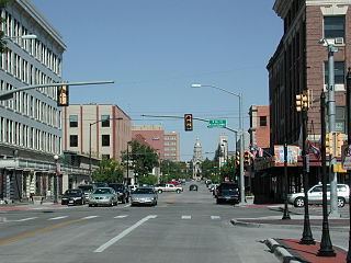
Cheyenne wyoming authentic western culture and outdoor adventures
History
On July 5, 1867, General Grenville M. Dodge and his survey crew plotted the site now known as Cheyenne in Dakota Territory (later Wyoming Territory). This site was chosen as the point at which the Union Pacific Railroad crossed Crow Creek, a tributary of the South Platte River. The city was not named by Dodge, as his memoirs state, but rather by friends who accompanied him to the area Dodge called "Crow Creek Crossing". It was named for the American Indian Cheyenne nation, one of the most famous and prominent Great Plains tribes closely allied with the Arapaho.
The construction of the Union Pacific Railroad brought hopes of prosperity to the region when it reached Cheyenne on November 13, 1867. The population at the time numbered over 4,000, and grew rapidly. This rapid growth earned the city the nickname "Magic City of the Plains".
In 1867, Fort D. A. Russell was established, three miles west of the city. The fort was later renamed Francis E. Warren Air Force Base.
The Wyoming State Capitol was constructed between 1886 and 1890, with further improvements being completed in 1917.
The Wyoming Stock Growers Association met at The Cheyenne Club, which allegedly acted as an interim government for the territory. Many of the WSGA's rules and regulations became state laws.
The Cheyenne Regional Airport was opened in 1920, initially serving as a stop for airmail. It soon developed into a civil-military airport, serving DC-3s and various military craft. During World War II, hundreds of B-17s, B-24s, and PBYs were outfitted and upgraded at the airfield. Today, it serves a number of military functions, as well as a high-altitude testbed for civilian craft.
Geography
Lying near the southeast corner of the state, Cheyenne is one of the least centrally located state capitals in the nation (together with cities such as Carson City, Nevada; Juneau, Alaska; and Topeka, Kansas).
According to the United States Census Bureau, the city has a total area of 24.63 square miles (63.79 km2), of which, 24.52 square miles (63.51 km2) is land and 0.11 square miles (0.28 km2) is water.
Climate
Cheyenne, like most of the rest of Wyoming, has a cool semi-arid climate (Köppen BSk), and is part of USDA Hardiness zone 5b, with the suburbs falling in zone 5a. Winters are cold and moderately long, but relatively dry, with a December average of 28.8 °F (−1.8 °C), highs that fail to breach freezing occur 35 days per year, and lows dip to the 0 °F or −17.8 °C mark on 9.2 mornings. However, the cold is often interrupted, with chinook winds blowing downslope from the Rockies that can bring warm conditions, bringing the high above 50 °F or 10 °C on twenty days from December to February.
Snowfall is greatest in March and April, seasonally averaging 60 inches or 1.52 metres, historically ranging from 13.1 inches (0.33 m) between July 1965 and June 1966 up to 121.5 inches (3.09 m) between July 1979 and June 1980, yet thick snow cover rarely stays. Summers are warm, with a high diurnal temperature range; July averages 69.4 °F or 20.8 °C, and highs reach 90 °F or 32.2 °C on an average twelve afternoons annually. Spring and autumn are quick transitions, with the average window for freezing temperatures being September 29 thru May 14, allowing a growing season of 106 days. Official record temperatures range from −38 °F (−38.9 °C) on January 9, 1875, up to 100 °F (37.8 °C) on June 23, 1954, the last of four occurrences; the record cold daily maximum is −21 °F (−29.4 °C) on January 11, 1963, while, conversely, the record warm daily minimum is 68 °F (20 °C) on July 31, 1960. The annual precipitation of 15.9 inches or 403.9 millimetres tends to be concentrated from May to August and is low during fall and winter; it has historically ranged from 5.04 inches (128.0 mm) in 1876 to 23.69 inches (601.7 mm) in 1942.
The city averages below 60% daily relative humidity in each month and receives an average 2,980 hours (~67% of the possible total) of sunshine annually. On July 16, 1979 an F3 tornado struck Cheyenne causing one death and 40 injuries. It was the most destructive tornado in Wyoming history.
Demographics
At the 2005–2007 American Community Survey 3-Year Estimates, the city's population was 87.2% White or European American (79.3% non-Hispanic White alone), 12.7% Hispanic or Latino (of any race), 4.5% Black or African American, 2.5% American Indian and Alaska Native, 2.1% Asian and 6.4% from some other race. 22.5% of the total population had a Bachelor's degree or higher.
2010 census
As of the census of 2010, there were 59,467 people, 25,558 households, and 15,270 families residing in the city. The population density was 2,425.2 inhabitants per square mile (936.4/km2). There were 27,284 housing units at an average density of 1,112.7 per square mile (429.6/km2). The racial makeup of the city was 77.44% European American, 2.88% African American, 0.96% Native American, 1.24% Asian, 0.20% Pacific Islander, 4.0% from other races, and 3.28% from two or more races. Hispanic or Latino of any race were 14.45% of the population.
There were 25,558 households of which 30.2% had children under the age of 18 living with them, 43.1% were married couples living together, 12.0% had a female householder with no husband present, 4.7% had a male householder with no wife present, and 40.3% were non-families. 33.5% of all households were made up of individuals and 10.6% had someone living alone who was 65 years of age or older. The average household size was 2.29 and the average family size was 2.92.
The median age in the city was 36.5 years. 24% of residents were under the age of 18; 9.5% were between the ages of 18 and 24; 26.9% were from 25 to 44; 26.2% were from 45 to 64; and 13.5% were 65 years of age or older. The gender makeup of the city was 49.3% male and 50.7% female.
2000 census
As of the census of 2000, there were 53,011 people, 22,324 households, 14,175 families residing in the city, and 81,607 people residing in the Metropolitan Statistical Area making it the largest city and metropolitan area in the state of Wyoming. The population density was 2,511.4 inhabitants per square mile (969.6/km²). There were 23,782 housing units at an average density of 1,126.7 per square mile (435.0/km²). The racial makeup of the city was 78.1% White or European American, 2.8% Black or African American, 0.8% Native American, 1.1% Asian, 0.1% Pacific Islander, 4.4% from other races, and 2.7% from two or more races. 12.5% of the population were Hispanic or Latino of any race.
There were 22,324 households out of which 30.4% had children under the age of 18 living with them, 49.2% were married couples living together, 10.6% had a female householder with no husband present, and 36.5% were non-families. 31.3% of all households were made up of individuals and 10.6% had someone living alone who was 65 years of age or older. The average household size was 2.33 and the average family size was 2.93.
The city has a wide range of ages-groups, with 24.9% under the age of 18, 8.8% from 18 to 24, 29.7% from 25 to 44, 22.8% from 45 to 64, and 13.8% 65 years of age or older. The median age was 37 years. For every 100 females there were 95.3 males. For every 100 females age 18 and over, there were 92.7 males.
The median income for a household in the city was $38,856, and the median income for a family was $46,771. Males had a median income of $32,286 versus $24,529 for females. The per capita income for the city was $19,809. About 6.3% of families and 8.8% of the population were below the poverty line, including 11.1% of those under age 18 and 5.8% of those age 65 or over.
Government
Cheyenne's government consists of a mayor and a city council. The mayor is elected in a citywide vote. The city council has nine members each of whom are elected from one of three wards. Each ward elects three members. The mayor's office is responsible for managing the various city departments which consist of Street/Alley, Police, Fire, Parks, Fleet Maintenance, Traffic, Sanitation, Downtown Historic District, Weed and Pest, Facilities Maintenance, and Cemetery. The Cheyenne Board of Public Utilities is owned by the city but is semi-autonomous.
Education
Public education in the city of Cheyenne is provided by Laramie County School District #1. The district is served by four high schools, Central High on the northwest side, East High on the east side, South High on the south side, and Triumph High, also on the south side.
Cheyenne is home to the Laramie County Community College (LCCC), as well as a branch of the Institute of Business & Medical Careers, and a branch of the University of Phoenix.
Economy
Government is the largest sector of Cheyenne's economy. The state of Wyoming operates a multitude of offices in downtown Cheyenne. Many area residents are employed by or are dependent on the U.S. Air Force, through F.E. Warren Air Force Base to the west of the city, or by the Wyoming National Guard.
Railroads also remain a major economic force for the city, with both the Burlington Northern Santa Fe and Union Pacific employing many residents.
Due much in part to work done by Cheyenne's economic development agency "Cheyenne Leads", successful steps have been taken in recent years to diversify the city's economy. Lowe's and Wal-Mart both operate distribution centers on the city's outskirts. Sierra Trading Post is headquartered in the city and also operates its distribution and fulfillment centers in the city. In addition, because of the towns cooler summers and abundant electricity supplies (both renewable and non-renewable), Cheyenne has been able to attract a number of data centers including the NCAR supercomputing center, along with a Microsoft data center, powered by bio gas and Green House Data's data centers powered by wind energy.
On 2 January 2014, Magpul Industries announced that it was moving its production, distribution and shipping operations to Cheyenne from Erie, Colorado.
Cheyenne's high elevation, coupled with its position on the continent, make it one of the windiest cities in the United States. The abundance of wind makes Cheyenne an opportune place to develop wind energy. Wind turbines are currently being placed around Laramie County. Laramie County Community College is home to a leading wind energy technician program, where students learn to maintain these turbines. The opening of a Vestas wind turbine blade assembly in nearby Weld County, Colorado, as well as other alternative energy manufacturing facilities around Colorado, are transforming the region into a center for alternative energy.
Great Lakes Airlines, Taco John's, and Green House Data are headquartered in Cheyenne.
Cheyenne has one of only three enclosed shopping malls in Wyoming, the Frontier Mall. The other two are the Eastridge Mall in Casper, and the White Mountain Mall in Rock Springs.
Parks and recreation
The Cheyenne Parks and Recreation Department operates an Ice and Events center, swimming pool, spray park, skateboard park, two golf courses, Cheyenne Botanic Gardens (including the Paul Smith Children's Village at the Gardens), paddle boat rentals in Lions Park (summers only), cemeteries, forestry operations, community house, Youth Activity Center and a miniature golf park. The Cheyenne Parks and Recreation Department also operates a 37-mile Greater Cheyenne Greenway system. The greenway connects parks and neighborhoods of greater Cheyenne. It includes many bridges and underpasses where travelers can avoid high traffic roads and travel above waterways and drainages. In 1996, as a result of the greenway, Cheyenne was named a "Trail Town USA" by the National Park service and the American Hiking Society.
Professional sports
The Cheyenne Warriors were founded as an American Professional Football League team in 2012. After playing a season in the APFL, they announced a move to the Indoor Football League. Shortly after the owner of the team died in December 2012, the Warriors announced that they were forming the new Developmental Football League. After playing several games in this new league, the team folded in May 2013.
Landmarks
National Register of Historical Places
Over fifty different locations in Cheyenne are listed on the National Register of Historical Places, including:
Several districts in the city are also listed, including:
Highways
Local bus service
Cheyenne provides local hourly bus service from 6 a.m.-7 p.m. Monday-Friday and 10 a.m.-5 p.m. on Saturday. There is no Sunday service.
Airports
Cheyenne Regional Airport features daily service from Great Lakes Airlines to Denver.
Railroads
The Union Pacific and BNSF railroads intersect in Cheyenne. The city is home to a BNSF railyard, as well as the Union Pacific's steam program. UP's 844, 3985 and 4014 reside in the steam shop.
Cheyenne Frontier Days
Cheyenne Frontier Days, which occurs during 10 days centered around the last full week in July, is the largest outdoor rodeo in the US. The events include professional bull riding, calf roping, barrel racing, steer wrestling, team roping, bronc riding, steer roping, bareback riding and many others. During this week there are many parades and other events. Additionally there is a carnival with numerous rides, games and shops.
Media
Notable people
Sister cities
Cheyenne's sister cities are:
Suburbs
1. North Cheyenne 2. South Greeley 3. Warren A.F.B 4. Ranchettes 5. Orchard Valley 6. Fox Farm-College