
Surface elevation 217 m | Area 24,514 km² Length 416 km | |
 | ||
Type Formerly part of the glacial Lake Agassiz, reservoir Primary inflows Catchment area 982,900 km (379,500 sq mi) | ||
Gigantic lake winnipeg walleye
Lake Winnipeg (French: Lac Winnipeg) is a very large, but relatively shallow 24,514-square-kilometre (9,465 sq mi) lake in central North America, in the province of Manitoba, Canada, with its southern tip about 55 kilometres (34 mi) north of the city of Winnipeg. It is the largest lake within southern Canada's borders, and it is part of the most undeveloped large watershed of southern Canada.
Contents
- Gigantic lake winnipeg walleye
- Map of Lake Winnipeg Manitoba Canada
- Hole hopping searching for fish on lake winnipeg
- Hydrography
- Tributaries
- Communities
- Environmental issues
- History
- Transportation
- Commercial fisheries
- References
Map of Lake Winnipeg, Manitoba, Canada
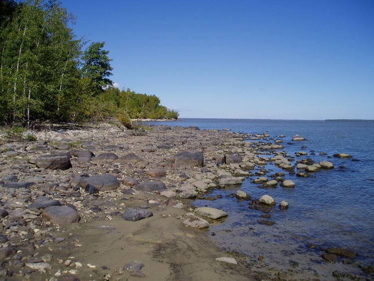
Lake Winnipeg is Canada's sixth-largest freshwater lake, and the third-largest freshwater lake contained entirely within Canada, but it is relatively shallow (mean depth of 12 m (39 ft)) excluding a narrow 36 m (118 ft) deep channel between the northern and southern basins. It is the eleventh-largest freshwater lake on Earth. The lake's east side has pristine boreal forests and rivers that are being promoted as a potential United Nations World Heritage Park. The lake is elongated and is 416 km (258 mi) from north to south, with remote sandy beaches, large limestone cliffs, and many bat caves in some areas. Manitoba Hydro uses the lake as one of the largest reservoirs in the world. There are many islands, most of them undeveloped.
Hole hopping searching for fish on lake winnipeg
Hydrography
The lake's watershed measures about 982,900 square kilometres (379,500 sq mi), and covers much of Alberta, Saskatchewan, Manitoba, northwestern Ontario, Minnesota, and North Dakota. Its drainage is about 40 times larger than its surface, a ratio bigger than any other large lake in the world. Given the massive watershed and the relatively small volume of water in the lake, it is dominated by events in its watershed. It is not surprising to find it showing the effects of materials being added to it as a result of activities in the watershed.
Lake Winnipeg drains northward into the Nelson River at an average annual rate of 2,066 cubic metres per second (72,960 cu ft/s), and forms part of the Hudson Bay watershed, which is one of the largest in the world. This watershed area was historically known as Rupert's Land when the Hudson's Bay Company was chartered in 1670.
Tributaries
The Saskatchewan River flows in from the west through Cedar Lake, the Red River (including Assiniboine River) flows in from the south and the Winnipeg River (draining Lake of the Woods, Rainy River and Rainy Lake) enters from the southeast. The Dauphin River enters from the west draining Lake Manitoba and Lake Winnipegosis.
The Bloodvein River, Berens River, Poplar River and the Manigotagan River flow in from the eastern side of the lake which is within the Canadian Shield.
Other tributaries of Lake Winnipeg (clockwise from the south end) include; Meleb Drain (drainage canal), Drunken River, Icelandic River, Washow Bay Creek, Sugar Creek, Beaver Creek, Mill Creek, Moose Creek, Fisher River, Jackhead River, Kinwow Bay Creek, Jackpine Creek, Mantagao River, Solomons Creek, Jumping Creek, Warpath River, South Two Rivers, North Two Rivers, South Twin Creek, North Twin Creek, Saskachaywiak Creek, Eating Point Creek, Woody Point Creeks, Muskwa Creek, Buffalo Creek, Fiddler Creek, Sturgeon Creek, Hungry River, Cypress Creek, William River, Bélanger River, Mukutawa River, Crane Creek, Kapawekapuk Creek, Marchand Creek, Leaf River, Pigeon River, Taskapekawe Creek, Bradbury River, Petopeko Creek, Loon Creek, Sanders Creek, Rice River, Wanipigow River, Barrie Creek, Mutch Creek, Sandy River, Black River, Sandy Creek, Catfish Creek, Jackfish Creek, Marais Creek, Brokenhead River and Devils Creek.
Communities
Communities on the lake include Grand Beach, Lester Beach, Riverton, Gimli, Winnipeg Beach, Victoria Beach, Hillside beach, Pine Falls, Manigotagan, Berens River, Bloodvein, Sandy Hook, Albert Beach, Hecla Village and Grand Rapids. A number of pleasure beaches are found on the southern end of the lake, which are popular in the summer, attracting many visitors from Winnipeg, about 80 km south.
Environmental issues
Lake Winnipeg is suffering from many environmental issues such as an explosion in the population of algae, caused by excessive amounts of phosphorus seeping into the lake, therefore not absorbing enough nitrogen. The phosphorus levels are approaching a point that could be dangerous for human health.
The Global Nature Fund has declared Lake Winnipeg as the "threatened lake of the year" for 2013.
In 2015, there was a major explosion of zebra mussels in Lake Winnipeg, the reduction of which is next to impossible due to a lack of natural predators in the lake. The mussels are devastating to the ecological opportunities of the lake.
History
Lake Winnipeg and Lake Manitoba are remnants of prehistoric Glacial Lake Agassiz, although there is evidence of a desiccated south basin of Lake Winnipeg approximately 4000 years ago. The area between the lakes is called the Interlake Region, and the whole region is called the Manitoba Lowlands.
It is believed Henry Kelsey was the first European to see the lake, in 1690. He adopted the Cree language name for the lake: wīnipēk (ᐐᓂᐯᐠ), meaning "muddy waters". La Vérendrye referred to the lake as Ouinipigon when he built the first forts in the area in the 1730s. Later, the Red River Colony to its south took the lake's name for Winnipeg, the capital of Manitoba.
Lake Winnipeg lies along one of the oldest trading routes in North America to have flown the British flag. For several centuries, furs were traded along this route between York Factory on Hudson Bay (which was the longtime headquarters for the Hudson's Bay Company) over Lake Winnipeg and the Red River Trails to the confluence of the Minnesota and Mississippi Rivers at Saint Paul, Minnesota. This was a strategic trading route for the First British Empire. With the establishment of the Second British Empire after Britain's loss of the Thirteen Colonies, a significant increase in trade occurred over Lake Winnipeg between Rupert's Land and the United States.
Transportation
Because of its length, the Lake Winnipeg water system and the lake was an important transportation route in the province before the railways reached Manitoba. It continued to be a major transportation route even after the railways reached the province. In addition to aboriginal canoes and York boats, several steamboats plied the lake, including Anson Northup, City of Selkirk, Colvile, Keenora, Premier, Princess, Winnitoba, Wolverine and most recently the diesel powered MS Lord Selkirk II passenger cruise ship.
Commercial fisheries
Lake Winnipeg has important commercial fisheries. Its catch makes up a major part of Manitoba's $30 million-a-year fishing industry. The lake was once the main source of goldeye in Canada, which is why the fish is sometimes called Winnipeg goldeye. Common carp were introduced to the lake through the Red River of the North and are firmly established. Walleye and whitefish together account for over 90 percent of its commercial fishing.