
 | ||
A lake is an area of variable size filled with water, localized in a basin, that is surrounded by land, apart from any river or other outlet that serves to feed or drain the lake. Lakes lie on land and are not part of the ocean, and therefore are distinct from lagoons, and are also larger and deeper than ponds, though there are no official or scientific definitions. Lakes can be contrasted with rivers or streams, which are usually flowing. Most lakes are fed and drained by rivers and streams.
Contents
- Etymology meaning and usage of lake
- Distribution of lakes
- Origin of natural lakes
- Tectonic lakes
- Landslide and ice dam lakes
- Salt lakes
- Oxbow lakes
- Crater lakes
- Glacial lakes
- Other lakes
- Types of lakes
- Characteristics
- Limnology
- How lakes disappear
- Extraterrestrial lakes
- Notable lakes on Earth
- Largest by continent
- References
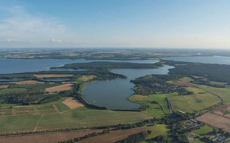
Natural lakes are generally found in mountainous areas, rift zones, and areas with ongoing glaciation. Other lakes are found in endorheic basins or along the courses of mature rivers. In some parts of the world there are many lakes because of chaotic drainage patterns left over from the last Ice Age. All lakes are temporary over geologic time scales, as they will slowly fill in with sediments or spill out of the basin containing them.
Many lakes are artificial and are constructed for industrial or agricultural use, for hydro-electric power generation or domestic water supply, or for aesthetic or recreational purposes or even for other activities.
Etymology, meaning, and usage of "lake"
The word lake comes from Middle English lake ("lake, pond, waterway"), from Old English lacu ("pond, pool, stream"), from Proto-Germanic *lakō ("pond, ditch, slow moving stream"), from the Proto-Indo-European root *leǵ- ("to leak, drain"). Cognates include Dutch laak ("lake, pond, ditch"), Middle Low German lāke ("water pooled in a riverbed, puddle") as in: de:Moorlake, de:Wolfslake, de:Butterlake, German Lache ("pool, puddle"), and Icelandic lækur ("slow flowing stream"). Also related are the English words leak and leach.
There is considerable uncertainty about defining the difference between lakes and ponds, and no current internationally accepted definition of either term across scientific disciplines or political boundaries exists. For example, limnologists have defined lakes as water bodies which are simply a larger version of a pond, which can have wave action on the shoreline or where wind-induced turbulence plays a major role in mixing the water column. None of these definitions completely excludes ponds and all are difficult to measure. For this reason, simple size-based definitions are increasingly used to separate ponds and lakes. One definition of lake is a body of water of 2 hectares (5 acres) or more in area; however, others have defined lakes as waterbodies of 5 hectares (12 acres) and above, or 8 hectares (20 acres) and above (see also the definition of "pond"). Charles Elton, one of the founders of ecology, regarded lakes as waterbodies of 40 hectares (99 acres) or more. The term lake is also used to describe a feature such as Lake Eyre, which is a dry basin most of the time but may become filled under seasonal conditions of heavy rainfall. In common usage, many lakes bear names ending with the word pond, and a lesser number of names ending with lake are in quasi-technical fact, ponds. One textbook illustrates this point with the following: "In Newfoundland, for example, almost every lake is called a pond, whereas in Wisconsin, almost every pond is called a lake."
One hydrology book proposes to define the term "lake" as a body of water with the following five characteristics:
With the exception of the seawater intrusion criterion, the others have been accepted or elaborated upon by other hydrology publications.
Distribution of lakes
The majority of lakes on Earth are fresh water, and most lie in the Northern Hemisphere at higher latitudes. Canada, with a deranged drainage system has an estimated 31,752 lakes larger than 3 square kilometres (1.2 sq mi) and an unknown total number of lakes, but is estimated to be at least 2 million. Finland has 187,888 lakes 500 square metres (5,400 sq ft) or larger, of which 56,000 are large (10,000 square metres (110,000 sq ft) or larger).
Most lakes have at least one natural outflow in the form of a river or stream, which maintain a lake's average level by allowing the drainage of excess water. Some lakes do not have a natural outflow and lose water solely by evaporation or underground seepage or both. They are termed endorheic lakes.
Many lakes are artificial and are constructed for hydro-electric power generation, aesthetic purposes, recreational purposes, industrial use, agricultural use or domestic water supply.
Evidence of extraterrestrial lakes exists; "definitive evidence of lakes filled with methane" was announced by NASA as returned by the Cassini Probe observing the moon Titan, which orbits the planet Saturn.
Globally, lakes are greatly outnumbered by ponds: of an estimated 304 million standing water bodies worldwide, 91% are 1 hectare (2.5 acres) or less in area (see definition of ponds). Small lakes are also much more numerous than large lakes: in terms of area, one-third of the world's standing water is represented by lakes and ponds of 10 hectares (25 acres) or less. However, large lakes account for much of the area of standing water with 122 large lakes of 1,000 square kilometres (390 sq mi, 100,000 ha, 247,000 acres) or more representing about 29% of the total global area of standing inland water.
Origin of natural lakes
Since they progressively become filled by sediment, lakes are considered ephemeral over geological time scales, and long-living lakes imply that active processes keep forming the basins in which they form. There are a number of natural processes that can form lakes.
Tectonic lakes
The longest-living lakes on Earth are related to tectonic processes which is created due to a tectonic uplift of a mountain range which create depressions that accumulate water and form lakes. The forming process of tectonic lake is: the earth surface, perhaps the high mountain and plateau, or the hills or plain - there appeared rupture on the ground, and depression along rupture direction - water begins to be stored gradually, and form the lake. Examples of tectonic lakes include Lake Balaton (Central Europe), Holxil Lake, Zonag Lake, and Kusai Lake (In the depression belt between Aerdaijin Mountains and Holxil Mountains in Qinghai Province, China), Xijir Ulan Lake, Ulan Ul Lake, and Duogecuoren Lake (Holxil Mountains and Tanggula Mountains, China), Ngoring Lake and Gyaring Lake (In the upper reaches of the Yellow River, China).
Landslide and ice-dam lakes
Lakes can also form by means of landslides or by glacial blockages. An example of the latter occurred during the last ice age in the U.S. state of Washington, when a huge lake formed behind a glacial flow; when the ice retreated, the result was an immense flood that created the Dry Falls at Sun Lakes, Washington.
Salt lakes
Salt lakes (also called saline lakes) can form where there is no natural outlet or where the water evaporates rapidly and the drainage surface of the water table has a higher-than-normal salt content. Examples of salt lakes include Great Salt Lake, the Aral Sea, and the Dead Sea.
Oxbow lakes
Small, crescent-shaped lakes called oxbow lakes can form in river valleys as a result of meandering. The slow-moving river forms a sinuous shape as the outer side of bends are eroded away more rapidly than the inner side. Eventually a horseshoe bend is formed and the river cuts through the narrow neck. This new passage then forms the main passage for the river and the ends of the bend become silted up, thus forming a bow-shaped lake.
Crater lakes
Crater lakes are formed in volcanic craters and calderas which fill up with precipitation more rapidly than they empty via evaporation. Sometimes the latter are called caldera lakes, although often no distinction is made. An example is Crater Lake in Oregon, in the caldera of Mount Mazama. The caldera was created in a massive volcanic eruption that led to the subsidence of Mount Mazama around 4860 BC.
Glacial lakes
The advance and retreat of glaciers can scrape depressions in the surface where water accumulates; such lakes are common in Scandinavia, Patagonia, Siberia and Canada. The most notable examples are probably the Great Lakes of North America. As a particular case, gloe lakes are basins that have emerged from the sea as a consequence of post-glacial rebound, and are now filled with freshwater.
Other lakes
Some lakes, such as Lake Jackson in Florida, USA, come into existence as a result of sinkhole activity.
Lake Vostok is a subglacial lake in Antarctica, possibly the largest in the world. The pressure from the ice atop it and its internal chemical composition mean that, if the lake were drilled into, a fissure could result that would spray somewhat like a geyser.
Most lakes are geologically young and shrinking since the natural results of erosion will tend to wear away the sides and fill the basin. Exceptions are those such as Lake Baikal and Lake Tanganyika that lie along continental rift zones and are created by the crust's subsidence as two plates are pulled apart. These lakes are the oldest and deepest in the world. Lake Baikal, which is 25–30 million years old, is deepening at a faster rate than it is being filled by erosion and may be destined over millions of years to become attached to the global ocean. The Red Sea, for example, is thought to have originated as a rift-valley lake.
Types of lakes
Characteristics
Lakes have numerous features in addition to lake type, such as drainage basin (also known as catchment area), inflow and outflow, nutrient content, dissolved oxygen, pollutants, pH, and sedimentation.
Changes in the level of a lake are controlled by the difference between the input and output compared to the total volume of the lake. Significant input sources are precipitation onto the lake, runoff carried by streams and channels from the lake's catchment area, groundwater channels and aquifers, and artificial sources from outside the catchment area. Output sources are evaporation from the lake, surface and groundwater flows, and any extraction of lake water by humans. As climate conditions and human water requirements vary, these will create fluctuations in the lake level.
Lakes can be also categorized on the basis of their richness in nutrients, which typically affect plant growth. Nutrient-poor lakes are said to be oligotrophic and are generally clear, having a low concentration of plant life. Mesotrophic lakes have good clarity and an average level of nutrients. Eutrophic lakes are enriched with nutrients, resulting in good plant growth and possible algal blooms. Hypertrophic lakes are bodies of water that have been excessively enriched with nutrients. These lakes typically have poor clarity and are subject to devastating algal blooms. Lakes typically reach this condition due to human activities, such as heavy use of fertilizers in the lake catchment area. Such lakes are of little use to humans and have a poor ecosystem due to decreased dissolved oxygen.
Due to the unusual relationship between water's temperature and its density, lakes form layers called thermoclines, layers of drastically varying temperature relative to depth. Fresh water is most dense at about 4 degrees Celsius (39.2 °F) at sea level. When the temperature of the water at the surface of a lake reaches the same temperature as deeper water, as it does during the cooler months in temperate climates, the water in the lake can mix, bringing oxygen-starved water up from the depths and bringing oxygen down to decomposing sediments. Deep temperate lakes can maintain a reservoir of cold water year-round, which allows some cities to tap that reservoir for deep lake water cooling.
Since the surface water of deep tropical lakes never reaches the temperature of maximum density, there is no process that makes the water mix. The deeper layer becomes oxygen starved and can become saturated with carbon dioxide, or other gases such as sulfur dioxide if there is even a trace of volcanic activity. Exceptional events, such as earthquakes or landslides, can cause mixing which rapidly brings the deep layers up to the surface and release a vast cloud of gas which lay trapped in solution in the colder water at the bottom of the lake. This is called a limnic eruption. An example is the disaster at Lake Nyos in Cameroon. The amount of gas that can be dissolved in water is directly related to pressure. As deep water surfaces, the pressure drops and a vast amount of gas comes out of solution. Under these circumstances carbon dioxide is hazardous because it is heavier than air and displaces it, so it may flow down a river valley to human settlements and cause mass asphyxiation.
The material at the bottom of a lake, or lake bed, may be composed of a wide variety of inorganics, such as silt or sand, and organic material, such as decaying plant or animal matter. The composition of the lake bed has a significant impact on the flora and fauna found within the lake's environs by contributing to the amounts and the types of nutrients available.
A paired (black and white) layer of the varved lake sediments correspond to a year. During winter, when organisms die, carbon is deposited down, resulting to a black layer. At the same year, during summer, only few organic materials are deposited, resulting to a white layer at the lake bed. These are commonly used to track past paleontological events.
Natural lakes provide a microcosm of living and nonliving elements that are relatively independent of their surrounding environments. Therefore, lake organisms can often be studied in isolation from the lake’s surroundings.
Limnology
Limnology is the study of inland bodies of water and related ecosystems. Limnology divides lakes into three zones: the littoral zone, a sloped area close to land; the photic or open-water zone, where sunlight is abundant; and the deep-water profundal or benthic zone, where little sunlight can reach. The depth to which light can reach in lakes depends on turbidity, determined by the density and size of suspended particles. A particle is in suspension if its weight is less than the random turbidity forces acting upon it. These particles can be sedimentary or biological in origin and are responsible for the color of the water. Decaying plant matter, for instance, may be responsible for a yellow or brown color, while algae may cause greenish water. In very shallow water bodies, iron oxides make water reddish brown. Biological particles include algae and detritus. Bottom-dwelling detritivorous fish can be responsible for turbid waters, because they stir the mud in search of food. Piscivorous fish contribute to turbidity by eating plant-eating (planktonivorous) fish, thus increasing the amount of algae (see aquatic trophic cascade). The light depth or transparency is measured by using a Secchi disk, a 20-cm (8 in) disk with alternating white and black quadrants. The depth at which the disk is no longer visible is the Secchi depth, a measure of transparency. The Secchi disk is commonly used to test for eutrophication. For a detailed look at these processes, see lentic ecosystems.
A lake moderates the surrounding region's temperature and climate because water has a very high specific heat capacity (4,186 J·kg−1·K−1). In the daytime a lake can cool the land beside it with local winds, resulting in a sea breeze; in the night it can warm it with a land breeze.
How lakes disappear
The lake may be infilled with deposited sediment and gradually become a wetland such as a swamp or marsh. Large water plants, typically reeds, accelerate this closing process significantly because they partially decompose to form peat soils that fill the shallows. Conversely, peat soils in a marsh can naturally burn and reverse this process to recreate a shallow lake resulting in a dynamic equilibrium between marsh and lake. This is significant since wildfire has been largely suppressed in the developed world over the past century. This has artificially converted many shallow lakes into emergent marshes. Turbid lakes and lakes with many plant-eating fish tend to disappear more slowly. A "disappearing" lake (barely noticeable on a human timescale) typically has extensive plant mats at the water's edge. These become a new habitat for other plants, like peat moss when conditions are right, and animals, many of which are very rare. Gradually the lake closes and young peat may form, forming a fen. In lowland river valleys where a river can meander, the presence of peat is explained by the infilling of historical oxbow lakes. In the very last stages of succession, trees can grow in, eventually turning the wetland into a forest.
Some lakes can disappear seasonally. These are called intermittent lakes, ephemeral lakes, or seasonal lakes and can be found in karstic terrain. A prime example of an intermittent lake is Lake Cerknica in Slovenia or Lag Prau Pulte in Graubünden. Other intermittent lakes are only the result of above-average precipitation in a closed, or endorheic basin, usually filling dry lake beds. This can occur in some of the driest places on earth, like Death Valley. This occurred in the spring of 2005, after unusually heavy rains. The lake did not last into the summer, and was quickly evaporated (see photos to right). A more commonly filled lake of this type is Sevier Lake of west-central Utah.
Sometimes a lake will disappear quickly. On 3 June 2005, in Nizhny Novgorod Oblast, Russia, a lake called Lake Beloye vanished in a matter of minutes. News sources reported that government officials theorized that this strange phenomenon may have been caused by a shift in the soil underneath the lake that allowed its water to drain through channels leading to the Oka River.
The presence of ground permafrost is important to the persistence of some lakes. According to research published in the journal Science ("Disappearing Arctic Lakes", June 2005), thawing permafrost may explain the shrinking or disappearance of hundreds of large Arctic lakes across western Siberia. The idea here is that rising air and soil temperatures thaw permafrost, allowing the lakes to drain away into the ground.
Some lakes disappear because of human development factors. The shrinking Aral Sea is described as being "murdered" by the diversion for irrigation of the rivers feeding it.
Extraterrestrial lakes
Only one world other than Earth is known to harbor large lakes, Saturn's largest moon, Titan. Photographs and spectroscopic analysis by the Cassini–Huygens spacecraft show liquid ethane on the surface, which is thought to be mixed with liquid methane. The largest Titanean lake, Kraken Mare at 400,000 km2, is three-times the size of any lake on Earth, and even the second, Ligeia Mare, is estimated to be slightly larger than Earth's Lake Michigan–Huron.
Jupiter's large moon Io is volcanically active, and as a result Sulphur deposits have accumulated on the surface. Some photographs taken during the Galileo mission appear to show lakes of liquid sulfur in volcanic caldera, though these are more analogous to lake of lava than of water on Earth.
The planet Mars is too cold and has too little atmospheric pressure to permit the pooling of liquid water. Geologic evidence appears to confirm, however, that ancient lakes once formed on the surface. It is also possible that volcanic activity on Mars will occasionally melt subsurface ice, creating large temporary lakes. This water would quickly freeze and then sublimate, unless insulated in some manner, such as by a coating of volcanic ash.
There are dark basaltic plains on the Moon, similar to lunar maria but smaller, that are called lacus (singular lacus, Latin for "lake") because they were thought by early astronomers to be lakes of water.
Notable lakes on Earth
It is also the world's largest lake by volume (23,600 cubic kilometres (5,700 cu mi), though smaller than the Caspian Sea at 78,200 cubic kilometres (18,800 cu mi)), and the second longest (about 630 kilometres (390 mi) from tip to tip).
It is also the second largest by volume and second deepest (1,470 metres (4,820 ft)) in the world, after lake Baikal.
Largest by continent
The largest lakes (surface area) by continent are: