
Length 150 km | ||
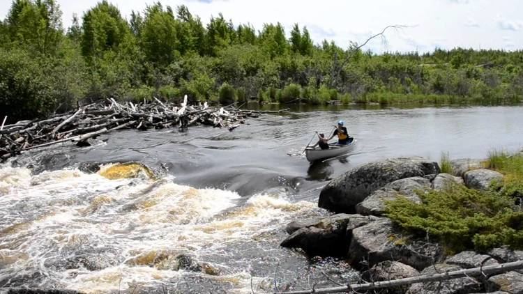 | ||
Emma janes rapids manigotagan river
The Manigotagan River is a protected area located in southeastern Manitoba, Canada. The river flows into the eastern side of Lake Winnipeg and it is a rare remote river of southern Canada. The last southern herd of woodland caribou in Canada can be found near this river and in Nopiming Provincial Park. Logging roads and over development can potentially threaten the important habitat and ecology of this area. The river was recently protected as an important ecological area, the Manigotagan River Park Reserve 51°00′50″N 96°02′39″W, popular for canoeing, and close to the many remote and pristine rivers along the east side of Lake Winnipeg. These eastern rivers in Manitoba are the last undeveloped rivers in Southern Canada.
Contents
- Emma janes rapids manigotagan river
- Map of Manigotagan River Division No 19 Unorganized MB Canada
- Flour rapids manigotagan river
- References
Map of Manigotagan River, Division No. 19, Unorganized, MB, Canada
In 2008, the Manitoba Eco-Network's mapping centre launched a new GIS map of the river, along with a website. It is a unique map and website combination that details all the features along the river, and it is a first of its kind in Canada for a river map.