
Elevation 8,611 m Highest point K2 | Area 77,154 km² | |
 | ||
Countries ListPakistanChinaAfghanistanIndiaTajikistan Passes Khunjerab Pass, Karakoram Pass, Hispar Pass, Mintaka Pass, Kilik Pass, Bilafond La, Sasser Pass, Sia La Mountains | ||
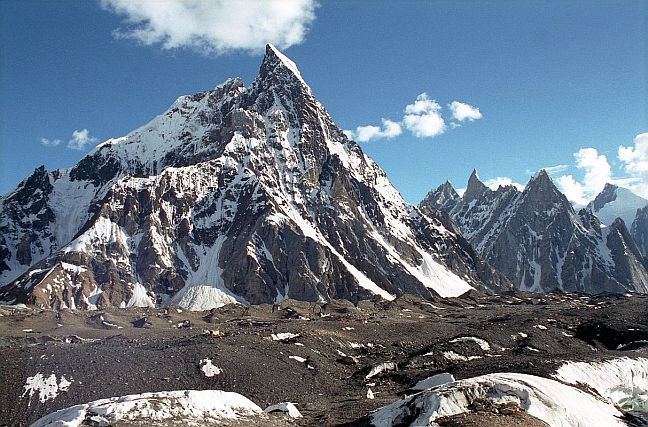
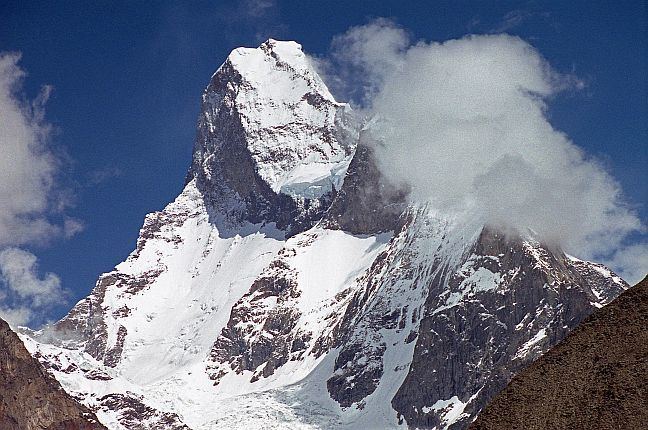
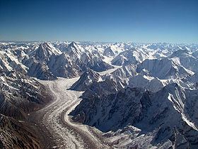
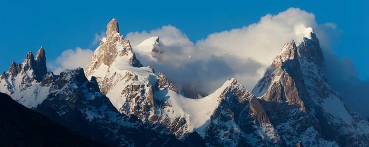
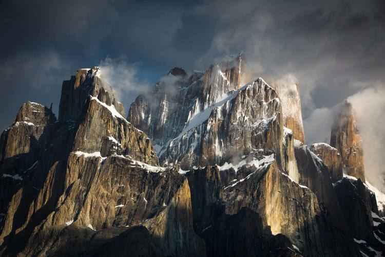
The Karakoram, or Karakorum is a large mountain range spanning the borders of Pakistan, India, and China, with the northwest extremity of the range extending to Afghanistan and Tajikistan. It is located in the regions of Gilgit–Baltistan (Pakistan), Ladakh (India), and southern Xinjiang (China), and reaches the Wakhan Corridor (Afghanistan). A part of the complex of ranges from the Hindu Kush to the Himalayan Range, it is one of the Greater Ranges of Asia. The Karakoram is home to the four most closely located peaks over 8000m in height on earth: K2, the second highest peak in the world at 8,611 m (28,251 ft), Gasherbrum I, Broad Peak and Gasherbrum II.
Contents
- Name
- Exploration
- Geology and glaciers
- The Karakoram during the Ice Age
- Highest peaks
- K names
- Subranges
- Passes
- References
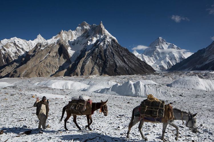
The range is about 500 km (311 mi) in length, and is the most heavily glaciated part of the world outside the polar regions. The Siachen Glacier at 76 kilometres (47 mi) and the Biafo Glacier at 63 kilometres (39 mi) rank as the world's second and third longest glaciers outside the polar regions.
The Karakoram is bounded on the northeast by the edge of the Tibetan Plateau, and on the north by the Pamir Mountains. The southern boundary of the Karakoram is formed, west to east, by the Gilgit, Indus, and Shyok Rivers, which separate the range from the northwestern end of the Himalaya range proper as these rivers converge southwestward towards the plains of Pakistan.
The Tashkurghan National Nature Reserve and the Pamir Wetlands National Nature Reserve in the Karalorun and Pamir mountains have been nominated for inclusion in UNESCO in 2010 by the National Commission of the People's Republic of China for UNESCO and has tentatively been added to the list.
Name
Karakoram is a Turkic term meaning black gravel. The name was first applied by local traders to the Karakoram Pass. Early European travellers, including William Moorcroft and George Hayward, started using the term for the range of mountains west of the pass, although they also used the term Muztagh (meaning, "Ice Mountain") for the range now known as Karakoram. Later terminology was influenced by the Survey of India, whose surveyor Thomas Montgomerie in the 1850s gave the labels K1 to K6 (K for Karakoram) to six high mountains visible from his station at Mount Haramukh in Kashmir.
Exploration
Due to its altitude and ruggedness, the Karakoram is much less inhabited than parts of the Himalayas further east. European explorers first visited early in the 19th century, followed by British surveyors starting in 1856.
The Muztagh Pass was crossed in 1887 by the expedition of Colonel Francis Younghusband and the valleys above the Hunza River were explored by General Sir George K. Cockerill in 1892. Explorations in the 1910s and 1920s established most of the geography of the region.
The name Karakoram was used in the early 20th century, for example by Kenneth Mason, for the range now known as the Baltoro Muztagh. The term is now used to refer to the entire range from the Batura Muztagh above Hunza in the west to the Saser Muztagh in the bend of the Shyok River in the east.
Floral surveys were carried out in the Shyok River catchment and from Panamik to Turtuk village by Chandra Prakash Kala during 1999 and 2000.
Geology and glaciers
The Karakoram is in one of the world's most geologically active areas, at the plate boundary between the Indo-Australian plate and the Eurasian plate. A significant part, 28-50% of the Karakoram Range is glaciated, compared to the Himalaya (8-12%) and Alps (2.2%). Mountain glaciers may serve as an indicator of climate change, advancing and receding with long-term changes in temperature and precipitation. Karakoram glaciers are mostly stagnating or enlarging, because, unlike in the Himalayas, many Karakoram glaciers are covered in a layer of rubble which insulates the ice from the warmth of the sun. Where there is no such insulation, the rate of retreat is high.
The Karakoram during the Ice Age
In the last ice age, a connected series of glaciers stretched from western Tibet to Nanga Parbat, and from the Tarim basin to the Gilgit District. To the south, the Indus glacier was the main valley glacier, which flowed 120 kilometres (75 mi) down from Nanga Parbat massif to 870 metres (2,850 ft) elevation. In the north, the Karakoram glaciers joined those from the Kunlun Mountains and flowed down to 2,000 metres (6,600 ft) in the Tarim basin.
While the current valley glaciers in the Karakoram reach a maximum length of 76 kilometres (47 mi), several of the ice-age valley glacier branches and main valley glaciers, had lengths up to 700 kilometres (430 mi). During the Ice age, the glacier snowline was about 1,300 metres (4,300 ft) lower than today.
Highest peaks
The highest peaks of the Karakoram are:
The majority of the highest peaks are in the Gilgit–Baltistan region of Pakistan. Baltistan has more than 100 mountain peaks exceeding 6,100 metres (20,000 ft) height from sea level.
K-names
Subranges
The naming and division of the various subranges of the Karakoram is not universally agreed upon. However, the following is a list of the most important subranges, following Jerzy Wala. The ranges are listed roughly west to east.
Passes
From west to east
The Khunjerab Pass is the only motorable pass across the range. The Shimshal Pass (which does not cross an international border) is the only other pass still in regular use.