
Elevation 5,589 m (18,337 ft) | ||
 | ||
Range Eastern Karakoram Range | ||
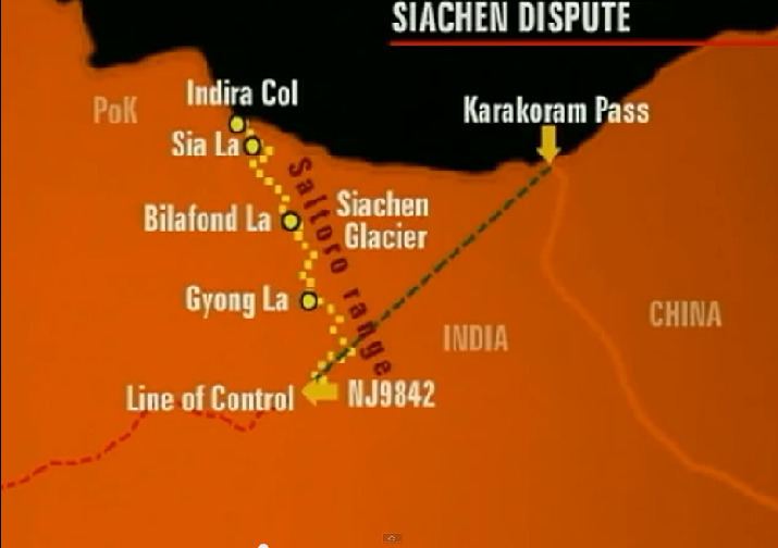
Sia La is a mountain pass situated on Saltoro Ridge, some 60 km (37 mi) north-northwest of map point NJ9842 which defined the end of the 1972 Line of Control between India and Pakistan as part of the Simla Agreement. Sia La sits near the China border and immediately northwest of the upper part of the vast Siachen Glacier, connecting that glacier to the Pakistani-controlled Kondus Glacier and valley to the west.
Geopolitical issues
Sia La, as well as nearby passes Bilafond La and Gyong La, saw military action starting in 1984 during Operation Meghdoot, the first military action of the Siachen conflict, itself being part of larger conflict, the Kashmir conflict. All three passes are currently held by India; Pakistan controls areas just to the west.
References
Sia La Wikipedia(Text) CC BY-SA