
Elevation 7,795 m | State/Province Gilgit District | |
 | ||
Mountains Passu Sar, Ladyfinger Peak, Hunza Peak, Sangemarmar Sar, Bojohagur Duanasir Similar Batura Sar, Diran, Gasherbrum III, Malubiting, Kanjut Sar | ||
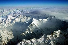
The Batura Muztagh mountains are a sub-range of the Karakoram mountain range. They are located west of the Hunza Valley in the Gilgit District of the Gilgit-Baltistan province in northern Pakistan.
Contents
Map of Batura Muztagh
They are the westernmost sub-range of the Karakoram, running from Chalt village in Bar Valley in the east to Kampir Dior in the Kurumbar Valley in the west, and they separate the Pamir and Hindu Kush ranges from the Karakoram range.
Books, pamphlets, and maps about Batura Muztagh
References
Batura Muztagh Wikipedia(Text) CC BY-SA