
Elevation 5,450 m | Range Karakoram | |
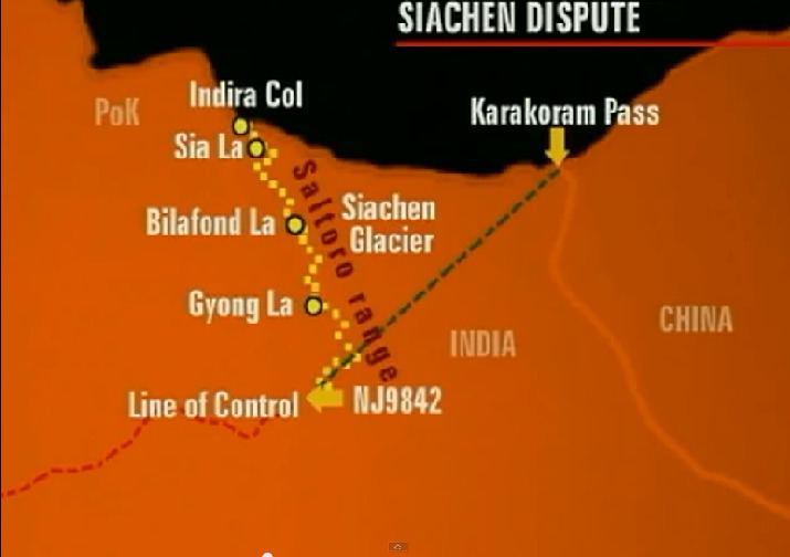 | ||
Bilafond La (meaning "Pass of the Butterflies" in Balti language, also known as the Saltoro Pass, is a mountain pass situated on Saltoro Ridge, sitting immediately west of the vast Siachen Glacier, some 40 km (25 mi) directly north of map point NJ 980420 which defined the end of the 1972 Line of Control between Pakistan and India as part of the Simla Agreement. Bilafond La (Pass of the Butterflies) is on the ancient Silk Route linking undivided India and China.
Contents
Map of Bilafond La
Bilafond La was a prominent feature during the 1984 start of military action in the Siachen Conflict between India and Pakistan. The Indian Army captured the pass in 1984 along with Sia La to the north and, in 1987, Gyong La to the south. India currently maintains a fortified military base at Bilafond La.
Geopolitical issues
Bilafond Pass, as well as nearby passes Sia La and Gyong La, were scenes of military activity starting in 1984 during Operation Meghdoot, part of the Siachen Conflict, itself being part of the larger Kashmir Conflict. Due to the strategic location of the pass west of the Siachen Glacier and near the current Actual Ground Position Line between India and Pakistan, the Indian Army maintains a presence to defend it.